Snow events in the winter can arrive in the Mid Atlantic region in many ways. While Low Pressure is often called a storm, not all are the same.
Here is a looks at the basic typical ways we can get snow. There are others, and no two events are exactly alike. This just helps to generalize and classify them.
Faith in the Flakes
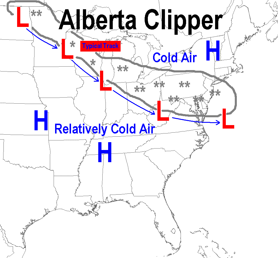
An Alberta Clipper is a fast moving system that originates around Alberta Canada. These have also been called Saskatchewan Screamers, also based on the region in Canada where they originate.
They arrive in arctic patterns and often move through very fast, with only a few hours of snowfall.
The track plays a big role for us east of the mountains.
If the center of Low Pressure (L) passes directly over Baltimore or to the north, much of the snow will sublimate and erode away. Any stickage would be west and Frederick and north of I-70 or the PA line.
If Low Pressure passes south of Baltimore, these events can bring a ‘typical’ 1 to 3 inches of snow to metro areas. The higher mountains can get in on more.
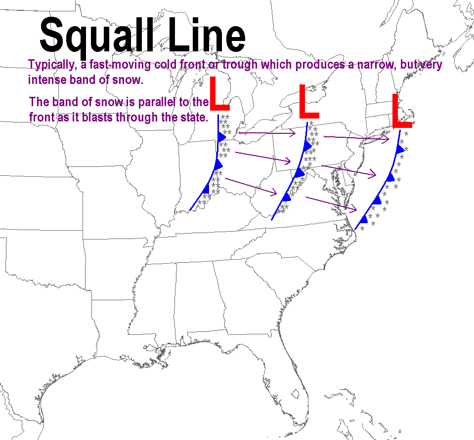
A squall line is also a fast moving snow event. These also behave much like the ‘clippers’ with location of the Low Pressure. But these can also be along an arctic front or caused by Vort Mazes, peak spin in the jet stream.
Like an intense line of thunderstorms, they may last a few minutes, but less than 1/2 hour.
A squall can produce near blizzard conditions for brief period. That means snowfall rates of 1″/Hr with winds gusting over 35 mph.
Miller Type Storms
Coastal Storms or Nor’Easters
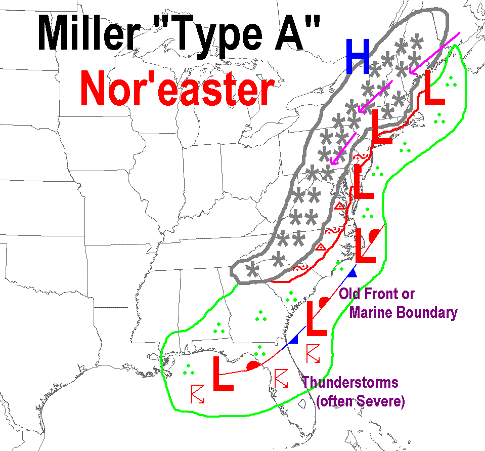
Miller A Storms are the winter events that often come from The Gulf of Mexico. These can take on new form as a coastal Nor’Easter.
The track is important as these can bring in warmer air from the Atlantic, resulting in that dreaded mix or rain on Delmarva and by the Chesapeake Bay.
Along I-95 and within about 10-20 miles can be the dividing line of snow and rain. This is explained in the Maryland Snow page.
These are one of the two Big Snow types of storms. Not all, but some can be the ones that produce double digit snowfall totals, if the conditions are right.
These can produce 10+” inches in the colder inland suburbs of central Maryland/southern PA, 1/2 that amount or less in the cities, and even less or all rain near Annapolis, southern Maryland, and the Eastern Shore.
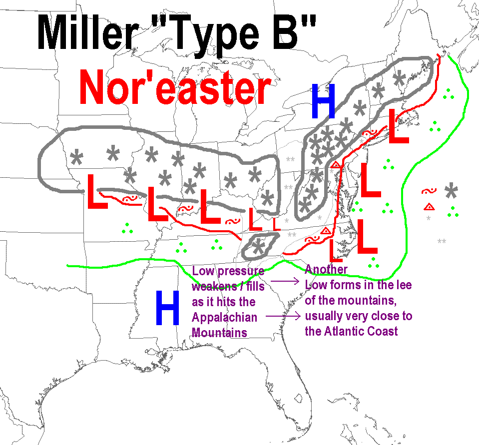
The Miller B Storm complex can be the most complicated.
These events start with a Low Pressure in the Mid-West to Ohio Valley. Then they transfer energy to a new Low forming along the Mid Atlantic coast.
During this transition, one of two results are common:
Stay in the ‘zone’ and a long duration snow or ice event can last a few days.
Get Dry Slotted. This is when dry air from the original Low expands when moving over the mountains. That can cut off precipitation and BUST a forecast if it does not fill back in.
Often this all depends on the Strength of the original Low and the location of the new coastal Low.
These can be among the heaviest snow producers if conditions are just right. If you stay ‘in the zone’ snow can last for 2 days or longer.
All Winter Weather Resource Pages
Recent Articles
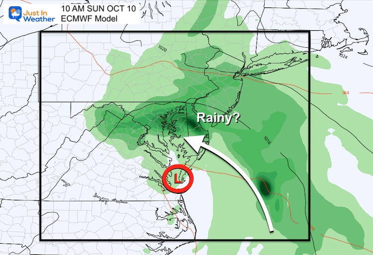
October 7 A Break Today But Weekend May Bring Rain From Coastal Storm
Thursday October 7 This morning we have already seen a
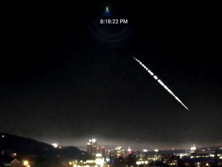
Fireball Video Over Pittsburgh Tuesday Evening October 5 2021
Wednesday October 6 2021 On Tuesday evening, a fireball was
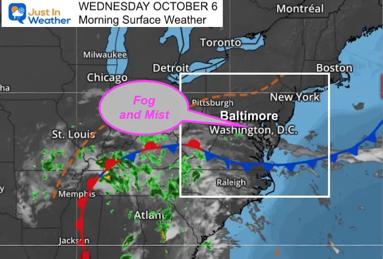
October 6 Weather Still Warm And Damp Tracking Narrow Band Of Rain
Wednesday October 6 This morning begins with fog and mist.
Please share your thoughts, best weather pics/video, or just keep in touch via social media
Facebook: Justin Berk, Meteorologist
Twitter: @JustinWeather
Instagram: justinweather
Winter Outlook Series


14 Local Maryland Pages (and York PA)
We have made a page for Maryland Weather which gives you the current conditions for 14 present area locations.

FITF Shop Open
My ‘bonus’ daughter Jaiden and wife showing off our popular Maryland Hoodies. Unisex and women’s items all produced in Maryland.
Click here to see this and many other new items.


Also see:
Maryland Weather Page
I wanted to keep it simple. Just the basics for a quick view at any time.

Just In Power Kids:
A portion of proceeds go to our programs Providing FREE holistic care for kids in cancer treatment and up to 5 years post treatment and caregivers.
![]()
New Caps and Hats

