Rain Timeline: Slow Arrival From South Today, Heavy Tomorrow
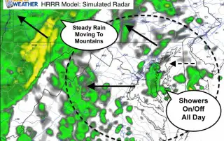
Today starts off chilly and will end wet, and heavier rain will fall Wednesday. I've been pointing out the adjustment of models to the east with rain in the increase.

Today starts off chilly and will end wet, and heavier rain will fall Wednesday. I've been pointing out the adjustment of models to the east with rain in the increase.
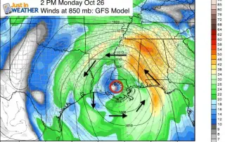
The core of the former epic Hurricane Patricia are now sitting over the warm water of the Gulf of Mexico. It is still close to shore, so strengthening is slow,
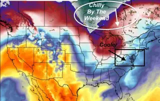
I was about to say this would be the last warm day this week, but it sounds familiar. Typical fall weather has brief warm ups followed by progressively cooler air.

We have a two more warm days ahead, but we are starting to think about it as borrowed time. Wednesday was our last day of the calendar year when Baltimore
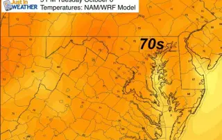
Monday was nearly perfect in Baltimore as the east coast storm began to break down and move away. I say nearly perfect because the Fall Bounce will make for difficultly
It has been pretty much a week of cool, damp weather. Now it is time for a change, and you may have noticed some breaks of sun on Sunday afternoon.
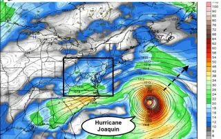
This is NOT Hurricane Joaquin hitting the Mid Atlantic. That storm is more than 1000 miles away and now on the move away from the Bahamas into the central Atlantic.

First of all, this is NOT Hurricane Joaquin hitting the Mid Atlantic. That storm is more than 1000 miles away and now on the move away from the Bahamas into

The forecast track for Hurricane Joaquin continues to push farther east. It still is a Cat 4 and has 130 mph winds, but we will NOT get a direct hit.

The latest update from the National Hurricane Center has Hurricane Joaquin gaining intensity and size as it sits over very deep, warm water. Top wind speeds are up to 125