July 8 Weather Update Afternoon Storms And Possible Tropical Storm This Week
Wednesday July 8 2020 We are in another hot and humid afternoon, but that does not always promise thunderstorms. The mechanism to produce storms is to our north, so the

Wednesday July 8 2020 We are in another hot and humid afternoon, but that does not always promise thunderstorms. The mechanism to produce storms is to our north, so the

Wednesday July 8 2020 We are stuck in this pattern with heat and uncomfortable humidity, which will be oppressive today. The boundary that has helped to trigger storms will be

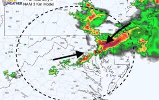
Tuesday July 7 2020 The storms yesterday lived up to expectations. Up to 6 inches fell in parts of Maryland just east of Baltimore. BWI officially had 1.40" of rain,
Monday July 6 2020 The atmosphere is primed to dump a lot of rain on some areas today. The high temperatures in the 90s and dew points in the mid
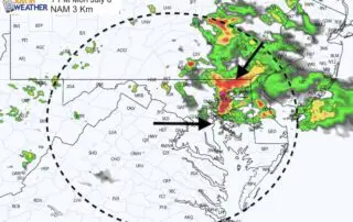
Monday July 6 2020 We are still in a pattern that will bring hot days and some strong storms with a risk some turn severe. The factors include temperatures in
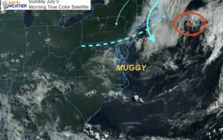
Sunday July 5 2020 Today is one of those days I can hear my brother say the weather is just wet you see or feel outside. That is most of

Saturday July 4 2020 A backdoor cold front moved through last night. Only a few showers passed by, but now the winds have shifted just enough to make a difference.
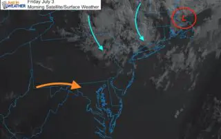
Friday July 3 2020 As we start the July 4 holiday weekend, the forecast of 90s maybe expected. I looked back at all of the 90 degree days at BWI,
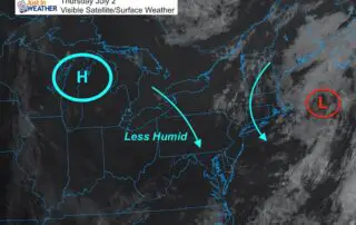
July 2 2020 The best thing I can show you this morning is the satellite image just after sunrise. This a large part of the eastern US cloud free. This
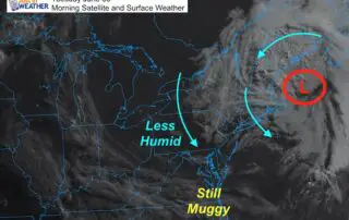
June 30 2020 A slight drop in humidity is the most noticeable weather item this morning. If you live in central Maryland to norther PA it feels nice. Farther south