Major Hurricane Laura Has Winds Of 115 mph Forecast To Hit As Cat 4
Tuesday August 26 2020 Hurricane Laura has taken full advantage of the conditions in the Gulf of Mexico to flare up overnight. Winds are now 115 mph, making this a
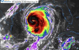
Tuesday August 26 2020 Hurricane Laura has taken full advantage of the conditions in the Gulf of Mexico to flare up overnight. Winds are now 115 mph, making this a
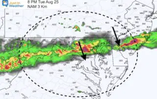
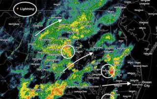
Tuesday August 25 2020 A cold front will bump into the hot and humid air we have in place today and this evening. A line of strong and severe thunderstorms
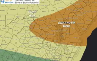
Tuesday August 25 2020 The headlines have been about the tropics, but today we have a local increased risk for severe storms. That timeline is below, plus a quick look

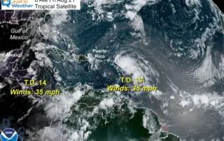
Saturday August 22 2020 It almost seems as if nothing in 2020 would be a surprise. Now we have two tropical storms that may possibly become hurricanes an forecast to
Friday August 21 2020 Something strange is afoot at the Circle K. Locally the humidity returns for us, brining back more heat and some showers and storms into the weekend.
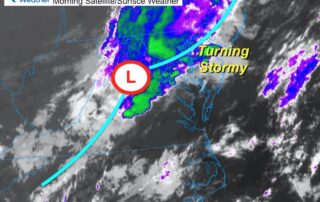

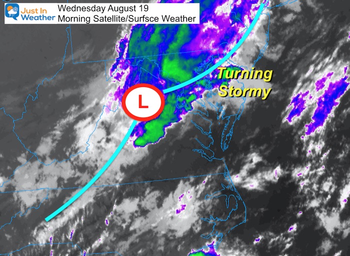
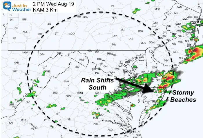
Wednesday August 19 2020 This morning began with rain and even some rumbles of thunders on Maryland's Eastern Shore. But we will get some clearing this afternoon. An area of
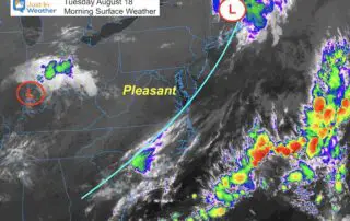
Tuesday August 18 2020 It appears we get a break from the active weather with comfortable temperatures, humidity, and limited showers. There still may be some popping up, but will
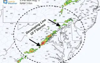
Monday August 17 2020 With the storm well off of the coast and the wind shift, the humidity is much lower and more comfortable this morning. But a cold front

Saturday August 8 2020 This morning report will be a little different and I hope you take a moment to see why. The storms have moved out, even from the
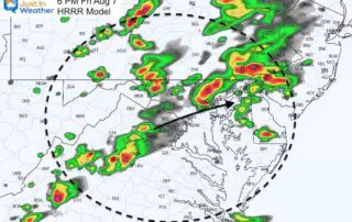
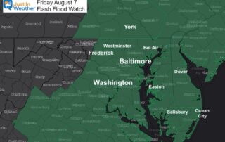
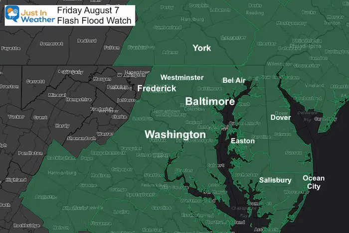
Friday August 7 2020 The Flash Flood Watch has been expanded into southern Pennsylvania. I mentioned in my morning report that this should happen as the front and development of