May 7 Rain Returns This Afternoon And Lingers This Weekend With A Chill
Friday May 7 The best way to sum up this weekend and the next week is chilly. We are entering a cool pattern where temperatures will be ‘at least’ 10
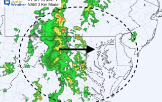
Friday May 7 The best way to sum up this weekend and the next week is chilly. We are entering a cool pattern where temperatures will be ‘at least’ 10
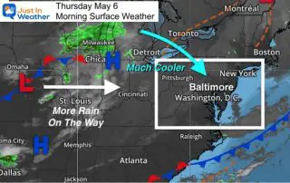
Thursday May 6 The weather pattern has flipped back to early spring conditions. Afternoon temperatures will be average 10 degrees below average and we may still see frost inland over
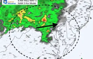
Wednesday May 5 2021 A new round of rain is already spreading in this morning. This is part of a cold front that will push this summer preview out of
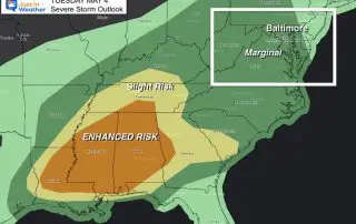
Tuesday May 4 2021 This morning you will notice the increase in humidity, perhaps even some thick fog. This is one of the results of the storms we had last
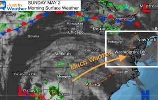
Sunday May 2 2021 Three years ago we started a three day record heat wave in our region. BWI recorded 90ºF + between May 2 and May 4 2018. We
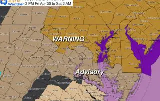
Friday April 30 2021 Maybe it’s April going out like a lion. The cold front responsible for the strong showers we had yesterday and overnight, is moving towards the coast.
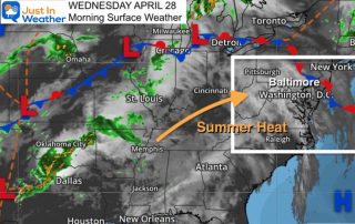
Wednesday April 28 2021 Summer heat continues today and it will be a little warmer. Baltimore hit 85ºF yesterday at BWI, the warmest since last September 9. Today should bump
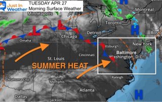
Tuesday April 27 2021 A complete phase change is taking place and you will surely notice it today. Last week we had snow showers. Now summer heat is building in
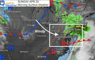
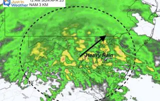
Sunday April 25 2021 This could have been one of the best outcomes for our weekend weather. The bulk of the rain fell overnight and ended this morning. Even if
Saturday April 24 2021 The sunny start this morning is a bit of a tease. A storm near the Gulf is on the way, and it will increase out clouds