Developing Heat Wave Starts With Air Quality Alert
Friday June 29 2018 We are about to experience something typical in summer but very rare this year: A Heat Wave. Calling for temperatures in the 90s for a few
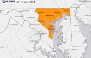
Friday June 29 2018 We are about to experience something typical in summer but very rare this year: A Heat Wave. Calling for temperatures in the 90s for a few
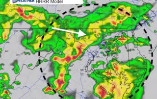
June 20 2018 The stalled front has lived up to expectations and powered storms this afternoon. The line of storms has turned severe in western Maryland. It dropped over 3
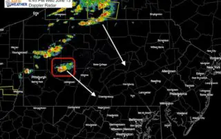
Wednesday June 13 2018 Storms have erupted along a line form western New York to western Pennsylvania. There was one cell with a tornado warning in Pennsylvania's Indiana and Armstrong
4 PM Sunday June 3 2018 The heavy rain with our coastal Low Pressure has produced up to 1.5 inches of rain in the past hour in central Maryland's Baltimore,
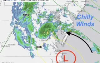
Sunday June 3 2018 The weather today is far from what we would expect for the first weekend of June. A new Low Pressure has formed as expected and will
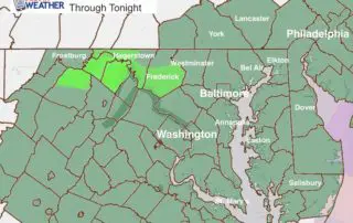
Saturday June 2 2018 A new Flash Flood Watch is in place for most of our area through tonight as another round of heavy rain and thunderstorms will develop. It's
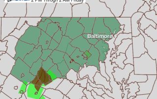
Thursday May 31 2018 We have a Flash Flood Watch in place this afternoon and this evening, and I will show the latest radar simulation update below. Many afternoon sports
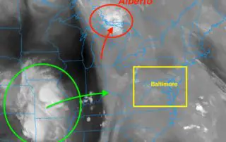
May 31 2018 We start the morning with more widespread fog which is just a sign of the moisture in the air. The remains of Subtropical Depression Alberto have pushed
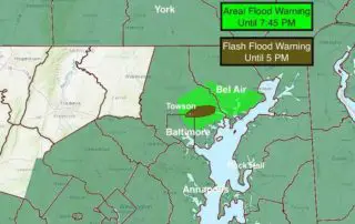
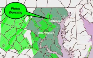
May 27 2018 Heavy rain has already erupted early this afternoon and prompted Flash Flooding in Baltimore and Hartford Counties. Doppler Radar is showing heavy rain moving over the same
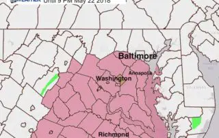
May 22 2018 A Severe Thunderstorm Watch is in effect until 9 PM for our region south of Baltimore and west of the Chesapeake Bay This includes Howard, Anne Arundel,