Wednesday June 13 2018
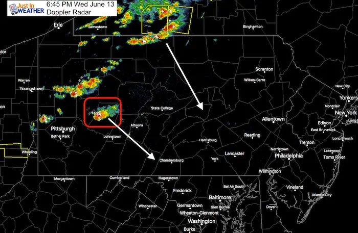
Storms have erupted along a line form western New York to western Pennsylvania. There was one cell with a tornado warning in Pennsylvania’s Indiana and Armstrong Counties that expired at 6:45 PM. I had a few questions about these severe storms cells and if the weather was heading our way tonight.
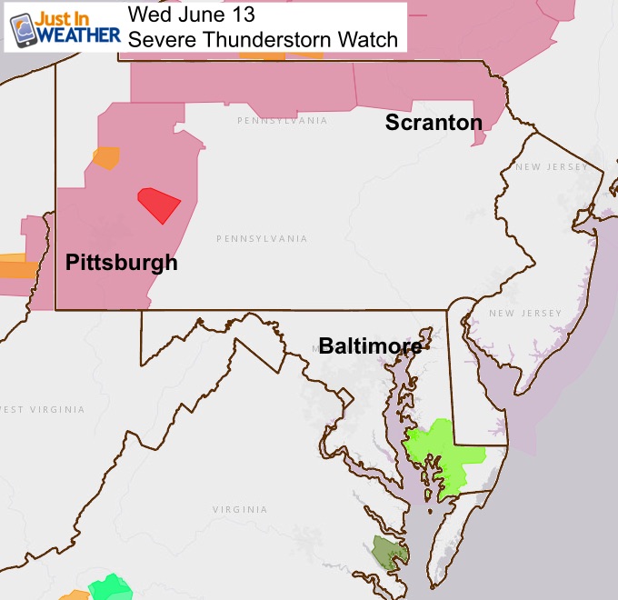
All of southwestern PA was under a Severe Thunderstorm Watch through the evening. Why is that important to metro York, Baltimore, and Washington? Because those storms are dropping to the southeast and will arrive just after midnight. However, I believe they will be in a weakened form, but could still produce some brief heavy rain and boomers on the north side of Baltimore.
Radar Loop (2 Hours ending 6:35 PM)
Radar Simulation —> slider
[metaslider id=63197]
Severe Thunderstorm Watch
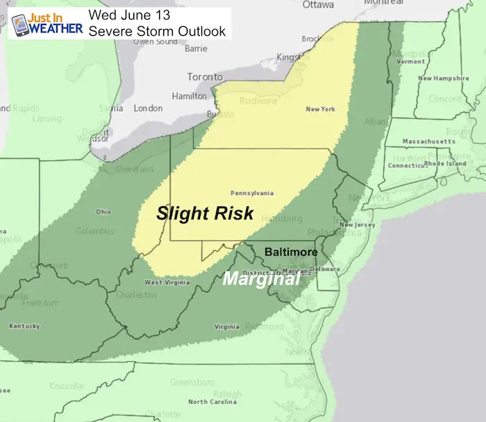
Note: This matches the Severe Storm Risk posted this morning
Please share your thoughts, best weather pics/video, or just keep in touch via social media
-
Facebook: Justin Berk, Meteorologist
-
Twitter: @JustinWeather
-
Instagram: justinweather
Keep In Touch Every Day
Click here to sign up for email alerts…. Just in case you don’t get the post on your social media feed
Shine On
Proceeds from all sales go to Just In Power Kids. Click the image to shop and show your support.

![]()
 Get the award winning Kid Weather App I made with my oldest son and support our love for science, weather, and technology. Our 3 year anniversary of the release and our contribution to STEM education is this November. It has been downloaded in 60 countries, and works in both temperature scales. With your support we can expand on the fun introduction to science and real weather.