Rain Timeline Today And Into The Weekend
Friday June 22 2018 We entered a new season and seem to be stuck with the same old weather. We did this with snow at the start of spring and
Friday June 22 2018 We entered a new season and seem to be stuck with the same old weather. We did this with snow at the start of spring and
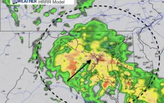
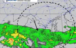
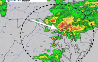
June 20 2018 The stalled front has lived up to expectations and powered storms this afternoon. The line of storms has turned severe in western Maryland. It dropped over 3
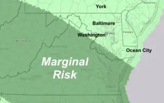
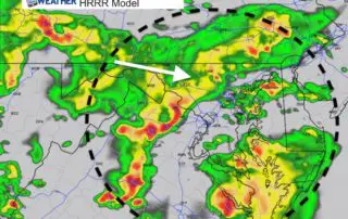
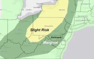
Wednesday June 20 2018 We still have some heat and humidity in place to spark showers and storms this afternoon. The weather will remain active through the weekend as we

Tuesday June 19 2018 The storm that blew through Monday afternoon was responsible for many downed trees and knocking out power to over 20,000 people at one point. This cell
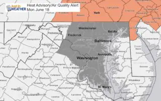
Monday June 18 2018 A rarity with our weather this year has been heat, and there are still no prolonged heat waves in sight. But we will be getting the
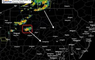
Wednesday June 13 2018 Storms have erupted along a line form western New York to western Pennsylvania. There was one cell with a tornado warning in Pennsylvania's Indiana and Armstrong
June 13 2018 The weather map is already active this morning and rain will be passing through our north side early, then spread across the rest of the area through
Monday June 11 2018 A cold front is already moving into southern Maryland. The rain is lagging behind, but will also push south today. It is mid June and temps
Sunday June 10 2018 The morning sky is filled with clouds and the air is heavy with humidity. But the source of energy for the next round of rain is
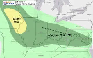
Saturday June 9 2018 The energy for today's weather is located in the southern Great Lakes and the upper level flow is pointing in our direction. Storms will be developing