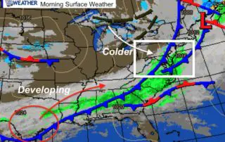
February 20 Weather Colder And Tracking Snow For North Carolina
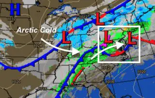
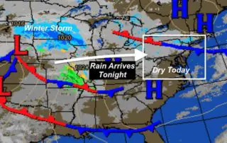
Thursday February 20 2020 The weather map this morning looks like I expected to see often the winter. We have colder air in place and a developing winter storm. But
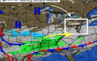
Thursday February 20 2020 The weather map this morning looks like I expected to see often the winter. We have colder air in place and a developing winter storm. But
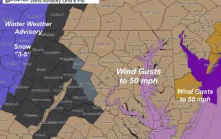
Wednesday February 19 2020 Rain showers crossing the Eastern Shore this morning are part of the latest cold front. This will bring us two more cold days this week. But
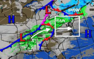
Tuesday February 18 2020 The weather pattern this morning is bringing snow to central Pennsylvania and New York. But that is north of our region. We will have some sprinkles
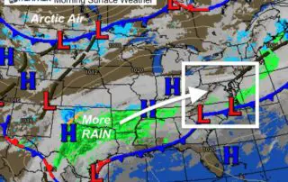
Monday February 17 2020 This is not your parents' Presidents Day weather. This week is well known for some of our largest snowstorms. February 15-18 we set the record snowfall
Thursday February 13 2020 We have more rain with us this morning. It may come as no surprise that Baltimore is 1.18 inches of rain 'above average' this year. We
Wednesday February 12 2020 We have more rain on the way, but for a change of pace it will arrive in the evening. So this morning and most of the
Tuesday February 11 2020 Rain, fog, mist, and spray will great you on your commute this morning. The temperatures start this morning where they should be in the afternoon, and
Monday February 10 2020 Here we go again with another wet weather pattern and no cold air in sight, yet. Rain has already started this morning and will be with
Sunday February 9 2020 Where is the cold air? Well, today will be seasonably cold, but following the Full Snow Moon, there is no snow in sight. Ironically, up to
Friday February 7 2020 A wild swing of weather this morning is underway. A Dense Fog Advisory is in place until 8 AM. However, as rain moves in this will