Flood Watch And Falling Temperatures With Heavy Rain Today
Sunday June 3 2018 The weather today is far from what we would expect for the first weekend of June. A new Low Pressure has formed as expected and will
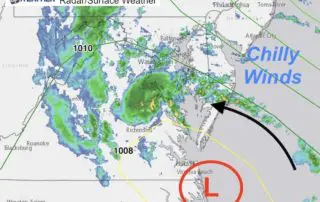
Sunday June 3 2018 The weather today is far from what we would expect for the first weekend of June. A new Low Pressure has formed as expected and will
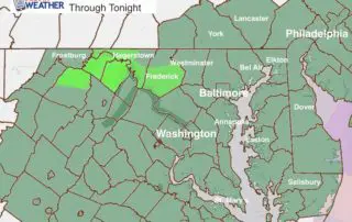
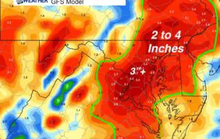
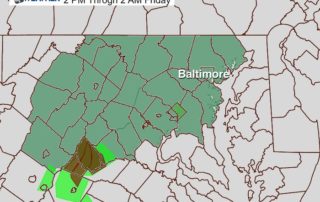
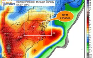
Saturday June 2 2018 A new Flash Flood Watch is in place for most of our area through tonight as another round of heavy rain and thunderstorms will develop. It's
June 1 2018 Today is the start of meteorological summer and hurricane season. But, once again we have low visibility across our area that is the focus. That is just
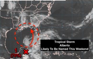
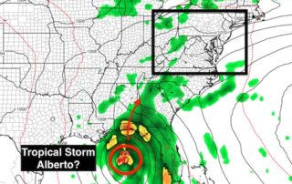
May 31 2018 We start the morning with more widespread fog which is just a sign of the moisture in the air. The remains of Subtropical Depression Alberto have pushed
Tuesday May 29 2018 More rain is on the way this week. This morning the visibility is the main issue. Fog and some mist will be a dominant part of
Friday May 25 2018 H is good, L is bad. That is the simple approach to weather a friend of mine had years ago. Well, the big H is on
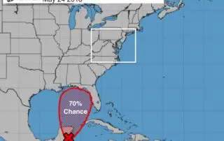
Thursday May 24 2018 Nearly perfect weather today and tomorrow as High Pressure keeps the sky mostly clear and humidity low. As we enter the weekend, we need to watch
Wednesday May 23 2018 The Ain issue this morning is low visibility, and that is not for all of us. This morning map shows the worst fog northeast of Baltimore
May 22 2018 One round of rain this morning was quite heavy in spots. Not good for those trying to view the Blue Angels practice flights and not good for
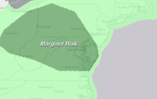
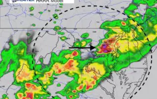
May 22 2018 We have a marginal risk of severe storms. This means there will be widespread showers and some thunderstorms with a select few that could reach severe limits.