Wednesday September 1 Noon Update
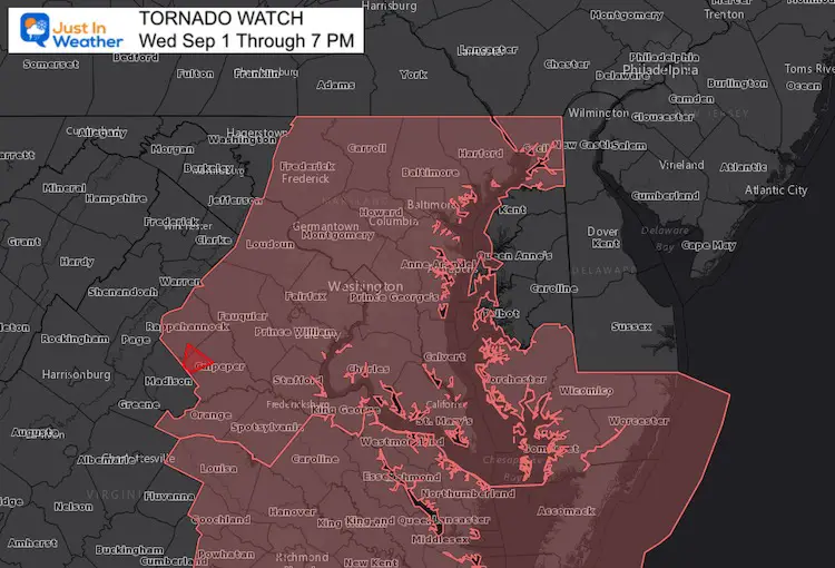
A Tornado Watch has been issued for our region this afternoon and evening. This is in response to the remains of former Hurricane Ida passing through. Surface winds have weakened, but plenty of spin aloft will help any storm cells turn severe.
If any tornados are identified, then a warning will be issued for where it should track.
Tornado Watch
Heavy rain has been steady all morning in the areas expected inland. Along the big cities and Chesapeake Bay, this may nit have seemed like much too far, but that fits expectations as well.
If you are in an area where the sun may have popped out, that will only add fuel to severe storms on the way.
This afternoon and evening is when severe weather will become widespread. This update has a new simulation to aid in the timeline.
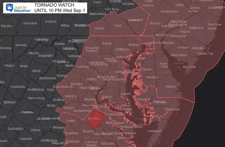
UPDATED 12:45 PM
EXPANDED to Southern PA and Delmarva until 10 PM
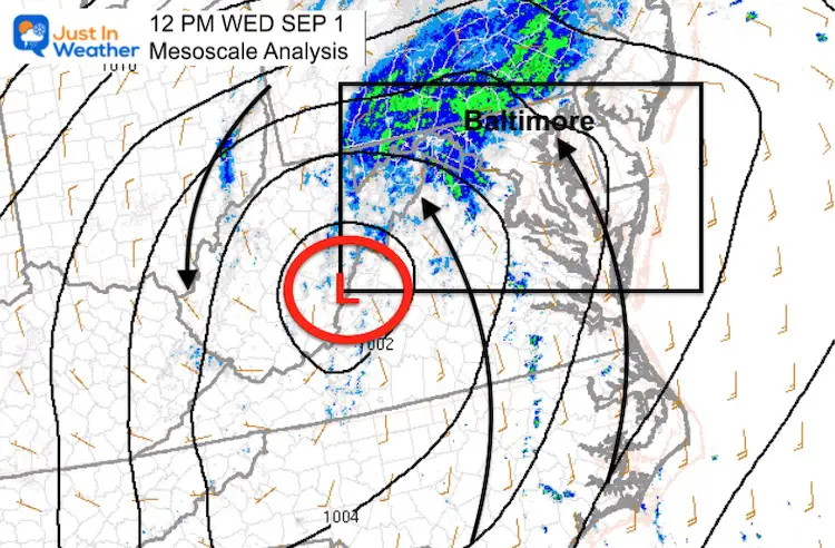
Mesoscale Analysis
Low Pressure that was once Hurricane Ida is along the WV and VA border.
The winds at the surface are a shell of the original storm, but at cloud level there is a lot of spin. That is why storms are likely to develop severe levels.
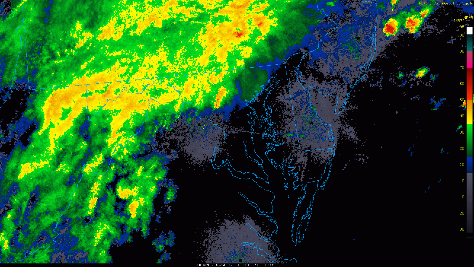
Radar Loop
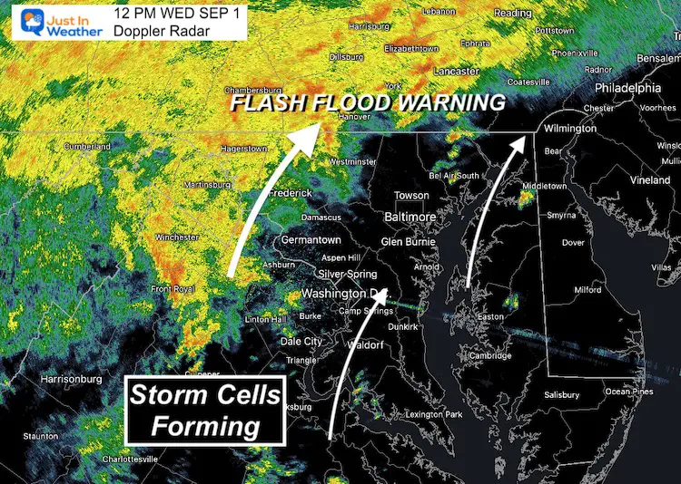
Steady rain has been inland, but here we see the first of expected lines of severe storms filling in across eastern Virginia.
Places that have beeb dry so far, may be at greater risk for storms to turn severe.
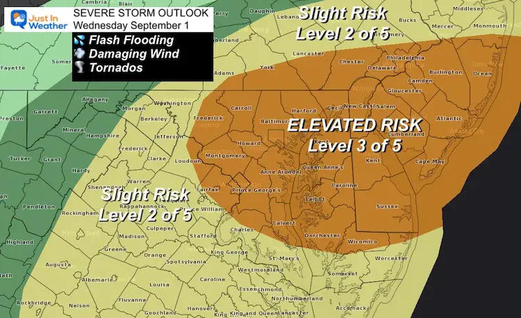
Severe Storm Risk
This forecast still holds and includes those areas that have been dry much of the morning.
Compare Live Radar To The Simulation below
Radar Snapshot
More activity shown here than the model forecast first image below. Note that for overachieving.
Radar Simulation —-> slider
Reminder that this product has under estimated storm coverage and timing.
The first image for 12 PM already showed less coverage than the radar snapshot above.
Use this as a guide, plus:
- More storms may verify
- Timing could be 1 to 2 hours earlier.


Live Radar Widget
Top Notes:
- Flash Flooding
- Rainfall rates can be over 1 inch per hour
- Higher rainfall north and west of the Low AND with severe storms cells.
- Watches may means it may happen.
- A ‘WARNING’ will be issued only when it is spotted and plotted through a town.
14 Local Maryland Pages (and York PA)
We have made a page for Maryland Weather which gives you the current conditions for 14 present area locations.
Maryland Trek Gear

Maryland Trek 8 Says THANK YOU!
Running Total Raised $116,438
During 329 Miles From Wisp To Ocean City
To Honor Kids In Cancer Treatment and Support FREE Programs At Just In Power Kids
![]()

Please share your thoughts, best weather pics/video, or just keep in touch via social media