Friday August 27 2021
Storms erupted during Friday afternoon. This followed the trend all summer with weather events over achieving short range modeling. At least we have been able to identify it and expect it.
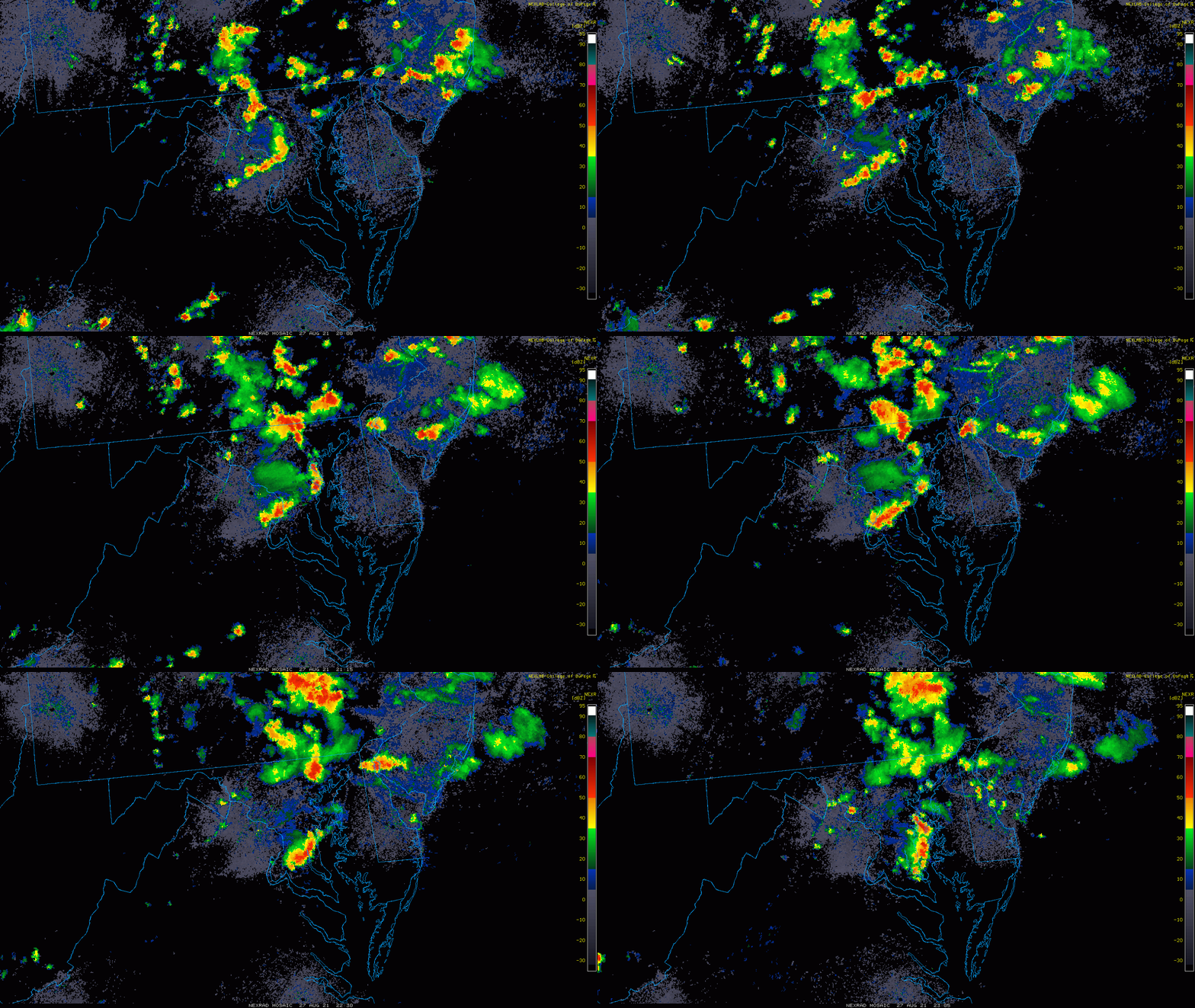
This radar loop from 4 PM to 7 PM shows the lines of storms, and individual cells merging around the larger mesoscale circulation. This is in part why there was added intensity.
Radar Loop
Pockets of storms can be seen here. The northern cluster between Carroll County MD and York County PA was particularly active with lightning.
WE can see the southern part merging with another cell to enhance over Harford County MD
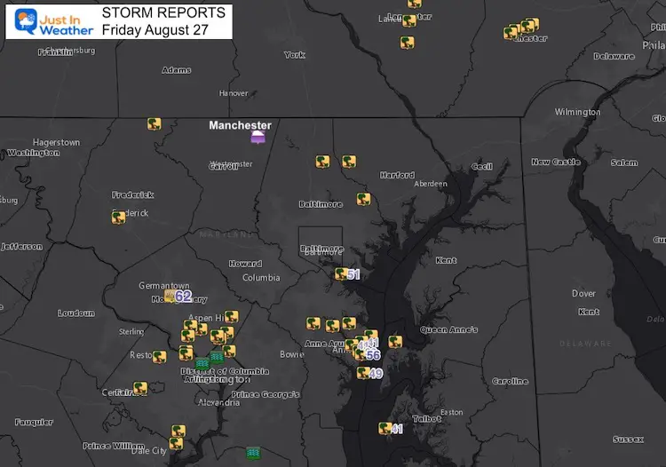
The line that developed in Anne Arundel County produced the most wind damage reports (shown below).
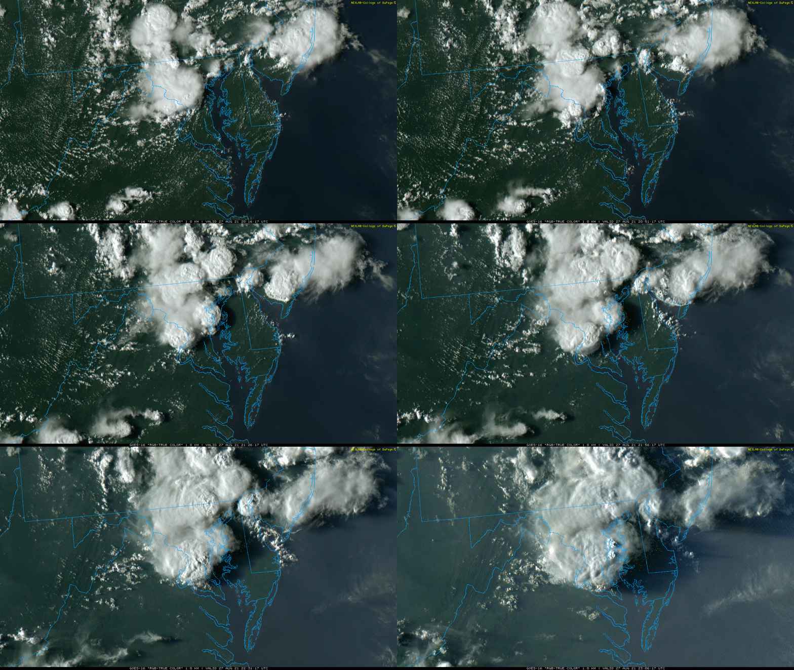
Satellite Loop 4 PM to 7 PM
This is fascinating. Watch closely and you will see multiple cells pop up at the same time. The convective temperature and atmospheric trigger was ignited.
Storm Damage
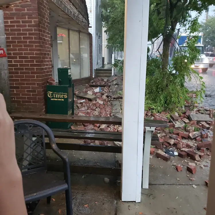
Lightning struck a building on Marin Street in Manchester MD. This is located in Northern Carroll County, next to Dutch Corner Restaurant. My friend Susan Rill shared this, and thankfully no one was hurt. Main St was closed.
Storm Report Map
Here is the plot of storm damage
Storm Reports From NOAA
|
1 NW GAITHERSBURG |
MONTGOMERY |
MD |
|
|
2 E POTOMAC |
MONTGOMERY |
MD |
TREE DOWN ON GAINSBOROUGH ROAD NEAR DEMOCRACY BOULEVARD. (LWX) |
|
1 N SILVER SPRING |
MONTGOMERY |
MD |
TREE DOWN ON THE 2000 BLOCK OF CLARK PLACE (LWX) |
|
2 NW BALLENGER CREEK |
FREDERICK |
MD |
TREE AND WIRES DOWN ON JEFFERSON PIKE NEAR WYE CREEK DRIVE. (LWX) |
|
1 S TAKOMA PARK |
MONTGOMERY |
MD |
MULTIPLE TREES DOWN ON ELM STREET IN TAKOMA PARK. (LWX) |
|
2 SSW STEWARTSVILLE |
BEDFORD |
VA |
TREE DOWN ON A POWER LINE AT THE INTERSECTION OF VIRGINIA RIDGE ROAD AND HARDY ROAD. (RNK) |
|
1 ESE EMMITSBURG |
FREDERICK |
MD |
TREE DOWN ON US-15 (LWX) |
|
4 S STEWARTSVILLE |
FRANKLIN |
VA |
TREES DOWN NEAR THE INTERSECTION OF EDWARDSVILLE ROAD AND HARDY ROAD. (RNK) |
|
MILLERSVILLE |
ANNE ARUNDEL |
MD |
TREES AND WIRES DOWN IN MILLERSVILLE. (LWX) |
|
2 ENE LORTON |
FAIRFAX |
VA |
TREE AND POWER POLE DOWN ON GILMORE DRIVE. (LWX) |
|
FAIRFAX |
FAIRFAX |
VA |
TREE AND POWER POLE DOWN ON GILMORE DRIVE. (LWX) |
|
BELVEDERE HEIGHTS |
ANNE ARUNDEL |
MD |
TREE DOWN IN BELVEDERE PARK. (LWX) |
|
3 SE CAPE ST. CLAIRE |
ANNE ARUNDEL |
MD |
TREE DOWN ON WESTBOUND US-50 AND US-301 (LWX) |
|
2 ESE OCCOQUAN |
FAIRFAX |
VA |
TREE DOWN ON ROUTE 4301 NEAR CARDIFF STREET. (LWX) |
|
2 SSE WILLOW STREET |
LANCASTER |
PA |
TREE ON WIRES. (CTP) |
|
7 N COCKEYSVILLE |
BALTIMORE |
MD |
TREE DOWN ON FALLS ROAD NEAR MONKTON ROAD. (LWX) |
|
2 SW JARRETTSVILLE |
HARFORD |
MD |
TREE DOWN ON FALLSTON ROAD NEAR FOX MEADOW COURT. (LWX) |
|
1 NW KINGSVILLE |
BALTIMORE |
MD |
POWERLINE WIRES DOWN ON THE 12000 BLOCK OF STONEY BATTER ROAD (LWX) |
|
STEVENSVILLE |
QUEEN ANNE’S |
MD |
TREE FEEL INTO A RESIDENCE ON CLOVERFIELDS DR. NO INJURIES. (PHI) |
14 Local Maryland Pages (and York PA)
We have made a page for Maryland Weather which gives you the current conditions for 14 present area locations.
Maryland Trek Gear
Maryland Trek 8 Says THANK YOU!
Running Total Raised $116,098
During 329 Miles From Wisp To Ocean City
To Honor Kids In Cancer Treatment and Support FREE Programs At Just In Power Kids
Please share your thoughts, best weather pics/video, or just keep in touch via social media

