Friday August 27 2021
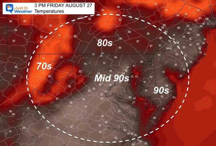
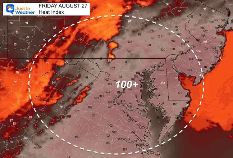
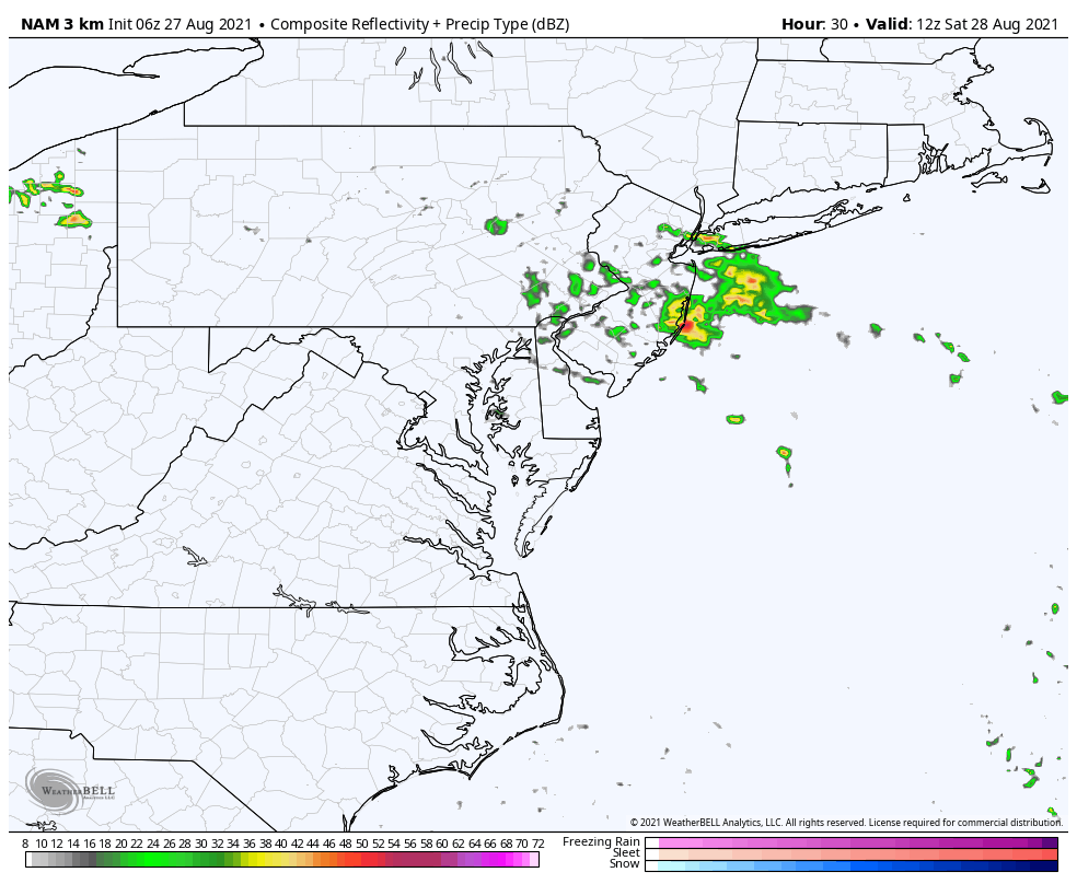
Temperatures should peak today with heat index values near or above 100ºF, then feeding into strong or severe storms this afternoon and tonight.
This weekend the risk of scattered storms will continue. The hit and miss may hit any time, especially in the afternoon and evening.
Tropical Storm Ida is expected to hit the Louisiana coastline as a major Category 3 hurricane.
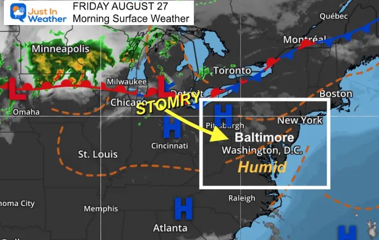
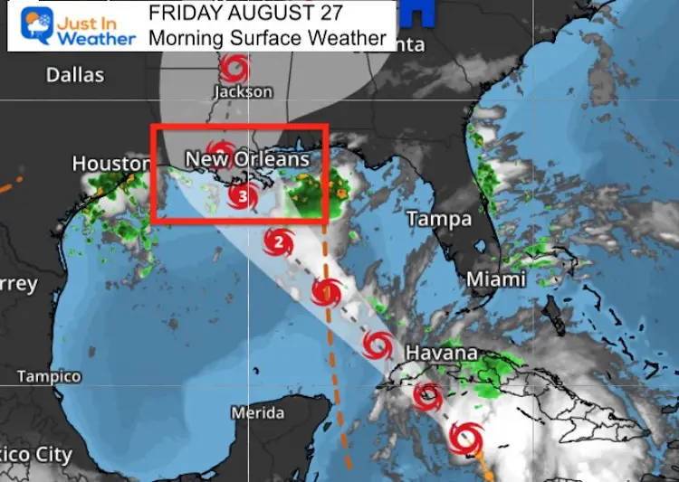
Morning Surface Weather
High heat will feed into slow moving strong storms this afternoon. Locally heavy downpours may produce a quick 1 inch or rain or higher.
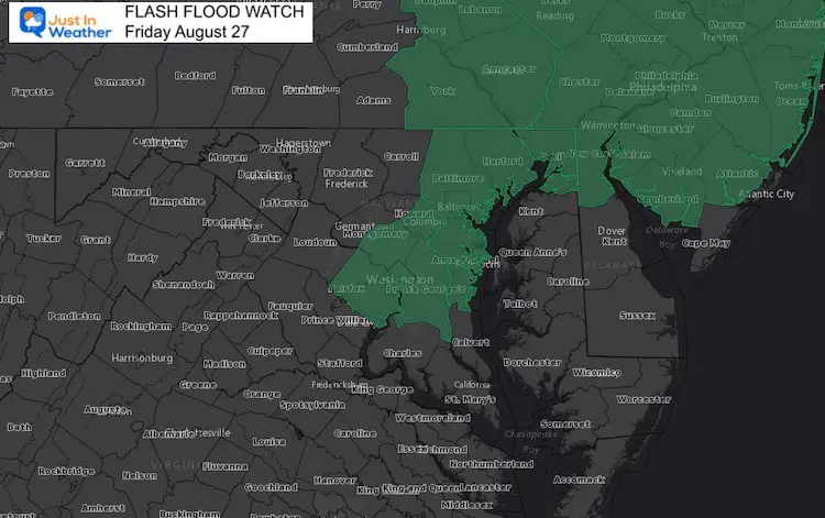
Flash Flood Watch
Radar Simulation —> slider


Weather Almanac: Climate Data
TODAY August 26
Normal Low in Baltimore: 64ºF
Record 53ºF in 1885
Normal High in Baltimore: 84ºF
Record 102º F 1948
Temperatures
This Afternoon
Heat Index
Weekend Rain
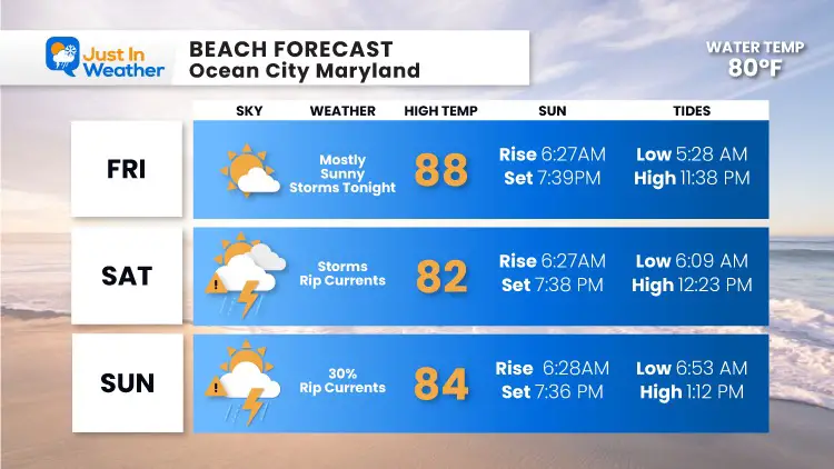
Off the coast will be a circulation along the stalled boundary. We need to watch this for location and influence on bringing rain/storms inland.
Along the coast, it will keep an onshore wind and rip currents at the beaches.
Beach Forecast
Tropical Outlook
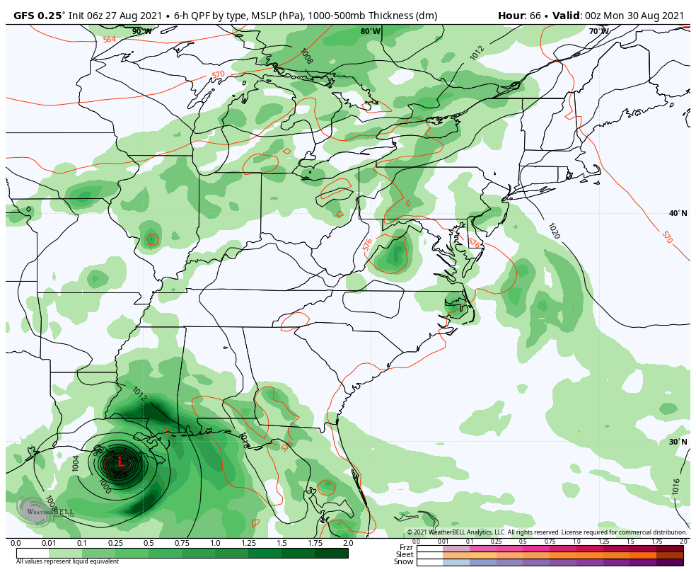
Tropical Storm Ida now has winds of 45 mph. The track takes it into the central Gulf of Mexico over very warm water. It will most likely develop into a major hurricane before making landfall near New Orleans Sunday or early Monday.
Movement: NW at 15 mph
Pressure: 1001 mb/ 29.56″
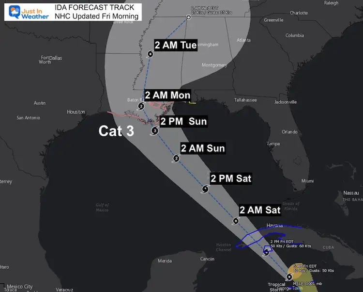
Forecast Track/Cone
The National Hurricane Center Track shows the path of landfall on the coast of Louisiana as a Category 3 Major Hurricane. The timing shows Sunday, but there is still some wiggle room among models.
I will have a more detailed update on the storm specifics later this morning.
US Watches
A Storm Surge Watch is in effect for…
* Sabine Pass to Alabama/Florida border
* Vermilion Bay, Lake Borgne, Lake Pontchartrain, Lake Maurepas, and
Mobile Bay
A Hurricane Watch is in effect for…
* Cameron, Louisiana to the Mississippi/Alabama border
* Lake Pontchartrain, Lake Maurepas, and Metropolitan New Orleans
Next Week: Impact for us
The spread of rain, which may be heavy, will reach our region in the middle of next week.
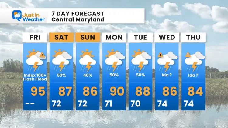
7 Day Forecast
14 Local Maryland Pages (and York PA)
We have made a page for Maryland Weather which gives you the current conditions for 14 present area locations.
Maryland Trek Gear

Maryland Trek 8 Says THANK YOU!
Running Total Raised $116,098
During 329 Miles From Wisp To Ocean City
To Honor Kids In Cancer Treatment and Support FREE Programs At Just In Power Kids
![]()

Please share your thoughts, best weather pics/video, or just keep in touch via social media