Thursday July 1 2021
We are ending this heat wave, but it is still quite humid this morning. A strong cold front will ignite thunderstorms that may turn severe, with the greater chance on Delmarva later this afternoon. This is all about the timing of the day, and the line of storms will reach that are at peak heating today.
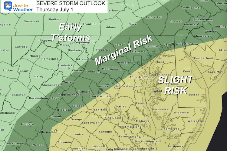
Severe Storm Risk
There will be storms, but not all will turn severe. The few that do may bring:
- Wind gusts to 60 mph
- Large hail
- Isolated Tornadoes
Any storm may produce dangerous lightning or Flash Flooding.
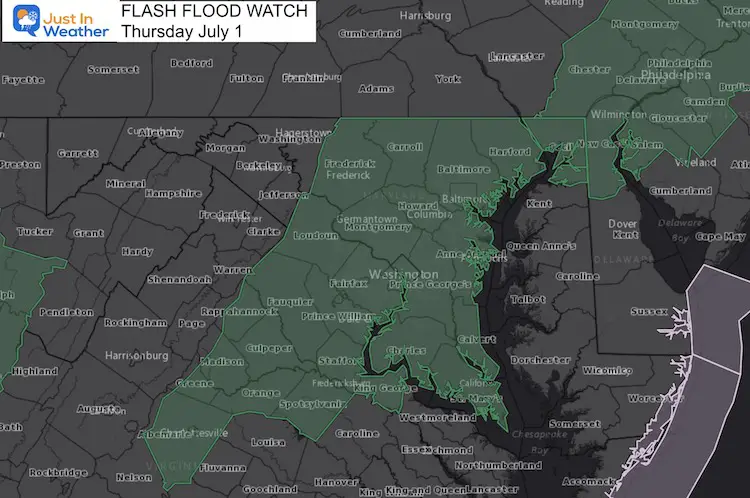
Flash Flood Watch
Behind the line of storms, there will be an extended period of rain. Some may be heavy. Give the heat wave and dry ground, downpours may have trouble draining.
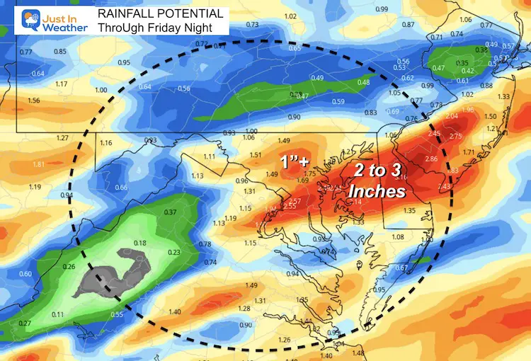
Rainfall Potential
Central Maryland to parts of Delmarva may receive between 1 and 3 inches of rain.
UPDATE AT 8:15 AM

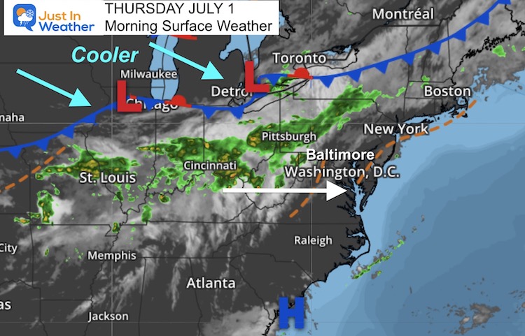
Morning Surface Weather
There will be showers this morning west and north of Baltimore.
Rain and storms become more widespread between noon and this evening.
The strongest storms will be on Delmarva after 3 PM.
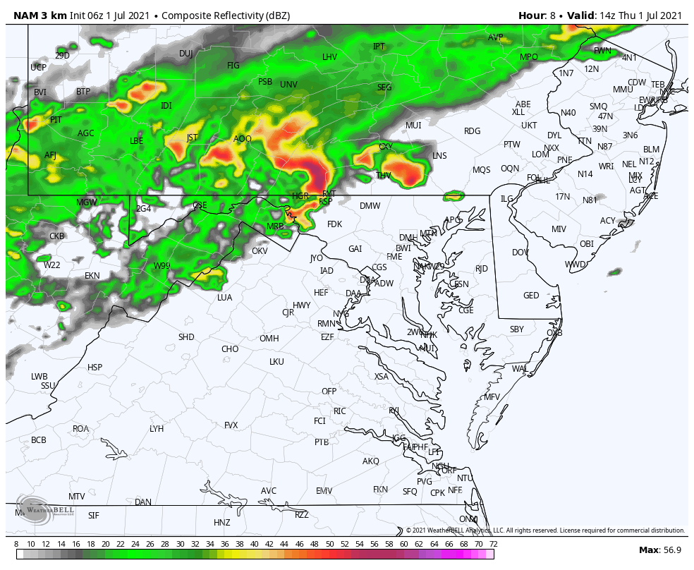
Radar Simulation and Live Radar
I have been saying with each event recently that computer model guidance has been poor. Today is one of those days, so expect more activity than what this maps show. That is why I added the live radar below the forecast animation below.
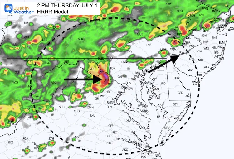
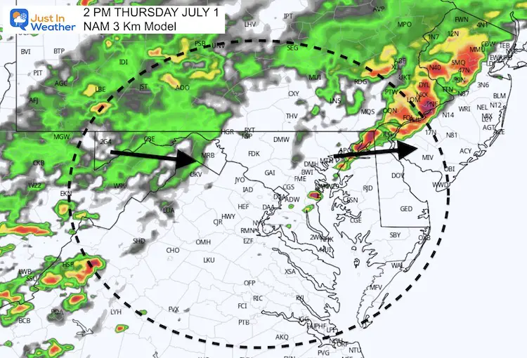
2 PM Snapshot
Comparing the HRRR to NAM, we already see different solutions.
This is part of the problem trying to pin down timing of storms that have not even formed yet.
NAM 3 Km Animation
10 AM to Midnight
Live Radar and Lightning
Weather Almanac:
Climate Data July 1
Normal Low in Baltimore: 65ºF
Record 50ºF in 1988
Normal High in Baltimore: 86ºF
Record 103 F 1901
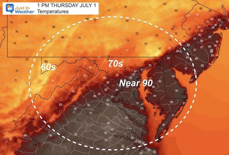
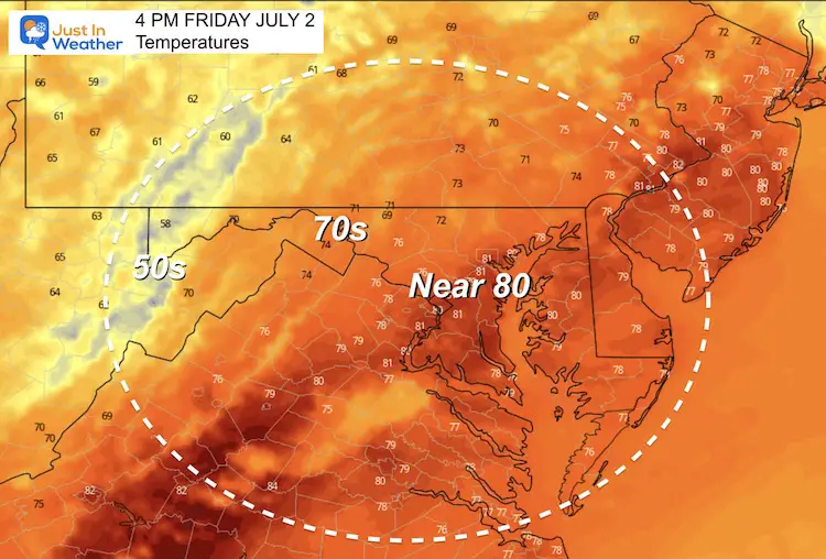
Afternoon Temperature Forecast
Friday Afternoon
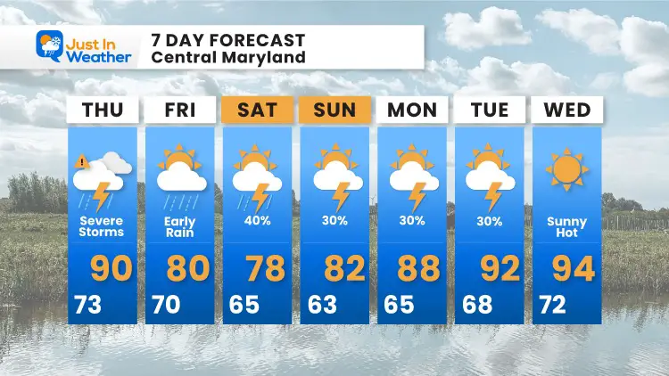
7 Day Forecast
The Independence Holiday Weekend will be cooler.
The rain on the graphic is NOT a washout, but there will be a slight chance for showers or storms each afternoon.
Next week, the heat will return.
In Case You Missed It:
Amazing Video of Baltimore Lightning and Storm Photos
Earthquake in Woodlawn, MD on Friday
Sunshine State Of Mind
I am done with the cold and snow (for the season). I am embracing my wife’s mantra of Sunshine State of Mind.
This was designed by Shannon Berk and we will be wearing it through spring and to the beach.
Double Benefit: Proceeds will be split between our nonprofit Just In Power Kids and the development of my new weather website. That has been scheduled to be ready to launch in May.

14 Local Maryland Pages (and York PA)
We have made a page for Maryland Weather which gives you the current conditions for 14 present area locations.

Please share your thoughts, best weather pics/video, or just keep in touch via social media