Monday June 28 2021
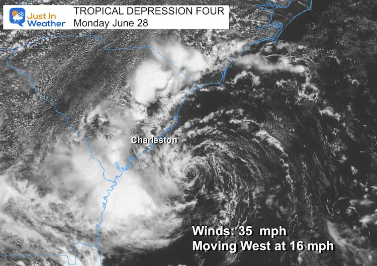
At 11 AM this morning, the National Hurricane Center identified the circulation off of the Southeast US coast as a Tropical Depression. Winds were 35 mph and it was heading to the west at 16 mph.
Tropical Storm Warnings have been issued for South Carolina. Rip Currents may be felt to the beaches up to Ocean City and Delaware through Tuesday.
It was located around 110 miles ESE of Charleston, SC. So on the current speed, it should make landfall this evening. That means it is running out of time and room to develop.

The threshold for this to become a Tropical Storm would be when sustained winds reach 40 mph. If that happens, the next name on the list is Danny.
That still might happen, and could repeat what happened with Claudette being named just as it was making landfall in Louisiana last week.
Next updates will be at 2 PM and 5 PM.
Satellite Loop
The circulation is tight and confined, with limited cloud cover. Basically this is an exposed low and more of a wind and wave maker.
Wider View
This is NOT OUR STORM in the Mid Atlantic. However, there could be some rip currents propagating up the coast over the next two days.

National Hurricane Center Track
Here we see the anticipation for this to be named (Danny is next on the list) before landfall. The track heads across north Georgia and into Tennessee as a depression. This may dirty the High Pressure and add more humidity and thunderstorms to the mix through mid week.

SUMMARY OF WATCHES AND WARNINGS IN EFFECT:
A Tropical Storm Warning is in effect for…
* Edisto Beach to South Santee River South Carolina
A Tropical Storm Warning means that tropical storm conditions are
expected somewhere within the warning area, in this case within the
next 12 hours.
Storm Surge
Rainfall may be 1 to 3 inches in spots, but the high water could be more impactful farther up the coast.

Storm Tracking Widget
Sunshine State Of Mind
I am done with the cold and snow (for the season). I am embracing my wife’s mantra of Sunshine State of Mind.
This was designed by Shannon Berk and we will be wearing it through spring and to the beach.
Double Benefit: Proceeds will be split between our nonprofit Just In Power Kids and the development of my new weather website. That has been scheduled to be ready to launch in May.
14 Local Maryland Pages (and York PA)
We have made a page for Maryland Weather which gives you the current conditions for 14 present area locations.
Please share your thoughts, best weather pics/video, or just keep in touch via social media


