Tuesday May 18 2021
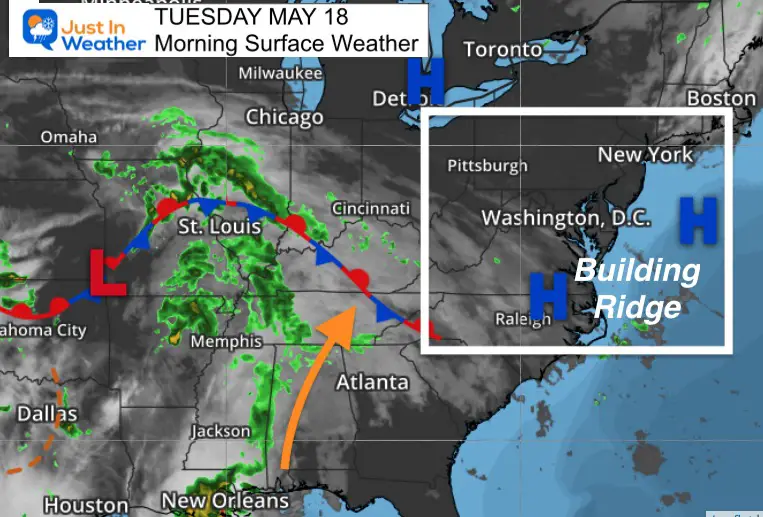
We are turning the corner to a warmer weather pattern that should bring in a taste of summer heat this week. High Pressure and a building ridge in the eastern US will shift the winds to allow this.
What has been showing up on the modeling is a shift in the center of that dome, possibly brining in the wind off the ocean Friday. That would allow some cooler ocean air to mix in.
Morning Surface Weather
High Pressure is taking a hold in the eastern US, which direct rain around it to our west.
Weather Almanac: Climate Data For Baltimore
Normal Low in Baltimore: 53ºF; Record 35ºF in 1973
Normal High in Baltimore: 74ºF, Record 97ºF 1962
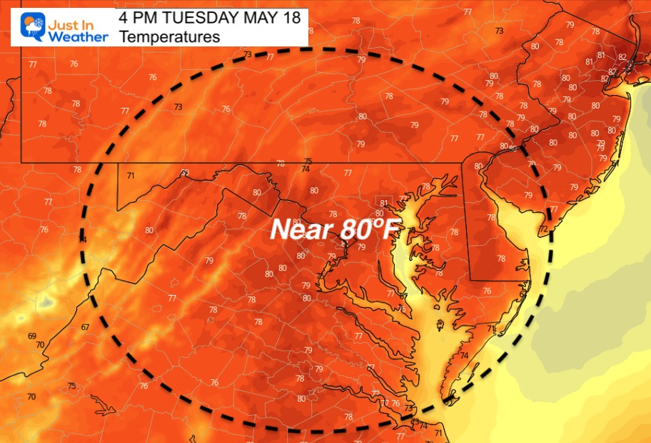
Temperature Forecast
Temps jump back above average today, with many places reaching the 80s. Still cooler by the water and in the mountains.
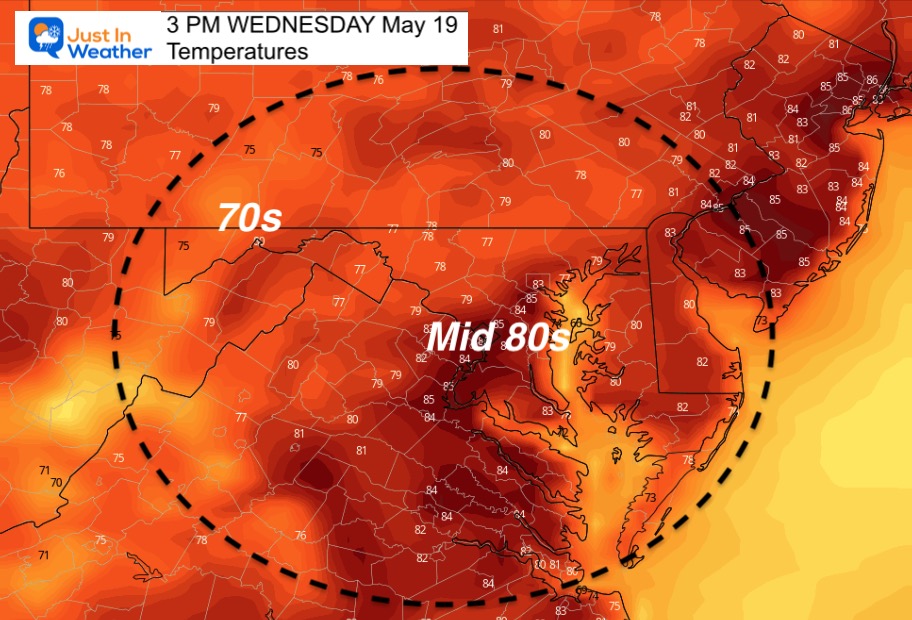
Wednesday Temperatures
Morning
A signal of the changing tone will be mild mornings… And the urban heat island keeping metro areas in the 60s

Afternoon
I have noticed these products running a little cooler than what has been verified. I expect more areas in the 80s than shown here.
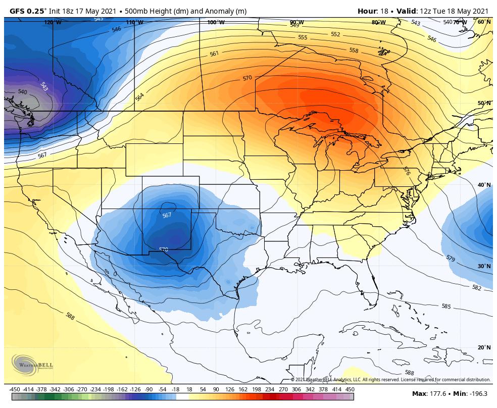
Jet Stream Animation
The upper level winds shown here around 18,000 Ft will be shifting the flow through Friday. This will allow much warmer air to pump into the eastern US, while the west coast cools a bit. However, the surface winds may put a wrinkle into Friday’s numbers….
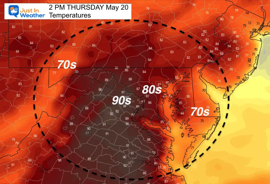
Thursday
If Baltimore hits 90ºF this week, this could be the day to do it… Again, observations have been running warmer than forecast maps.
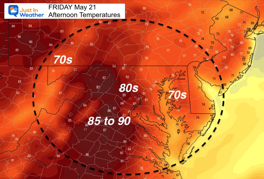
Friday
This was the say I had expected 90ºF, but new data is suggesting a slight wind shift from the east. That would depend on where the center of the High Pressure ‘dome’ is located.
Winds

Temperatures
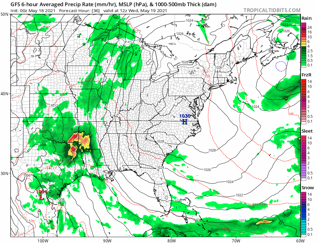
Rain Animation
The ridge ‘may’ break down by the end of the week. I want to point out that this is from the GFS Model, showing afternoon showers and T’storms with the heat Friday to Sunday. However the European ECWMF Model keeps the ridge intact through next weekend. That hold the heat and limit storms for us.
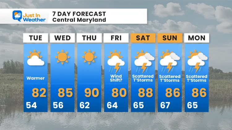
7 Day Forecast
I have made an adjustment to ‘Friday’. This is going to be a thorn in my side this week. We can easily end up either near 90ºF or in the 70s all based on the wind direction.
Sunshine State Of Mind
I am done with the cold and snow (for the season). I am embracing my wife’s mantra of Sunshine State of Mind.
This was designed by Shannon Berk and we will be wearing it through spring and to the beach.
Double Benefit: Proceeds will be split between our nonprofit Just In Power Kids and the development of my new weather website. That has been scheduled to be ready to launch in May.

14 Local Maryland Pages (and York PA)
We have made a page for Maryland Weather which gives you the current conditions for 14 present area locations.

Please share your thoughts, best weather pics/video, or just keep in touch via social media