Tuesday May 11
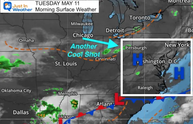
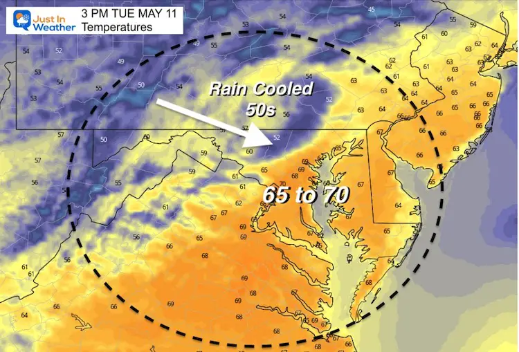
Here we go again. It definitely does not feel like mid May, but what it has felt like will continue. Another push of cooler air will develop a band of rain showers this afternoon.
The rain chance is 60%, which means some areas will get little or miss out, but we will get the winds picking up and temps dropping down.
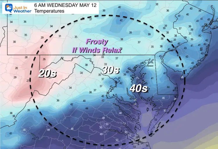
Wednesday morning will show temperatures in the 30s for the inland suburbs. Frost will develop if the wind can relax. Even colder 20s expected in the mountains can damage early crops.
Rocket Launch? Tonight will be the 5th attempt at Wallops Island, and the line of rain/wind will be reaching them around that time of 8:05 PM. But I will have tracking here later.
Morning Surface Weather
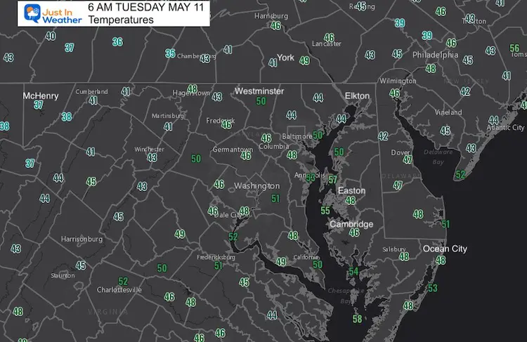
Morning Temperatures
Rain Simulation—->
12 PM to 9 PM
I need to point out that this model has trended to be lagging by an hour or so. This band of rain could reach you a little earlier than shown here.
Rocket Launch at Wallops Island: This front looks like it will arrive close to 8 PM
Weather Almanac: Climate Data For Baltimore
Normal Low in Baltimore: 50ºF; Record 32ºF in 1966
Normal High in Baltimore: 73ºF, Record 94ºF 1896
Temperatures Afternoon
Wednesday Morning
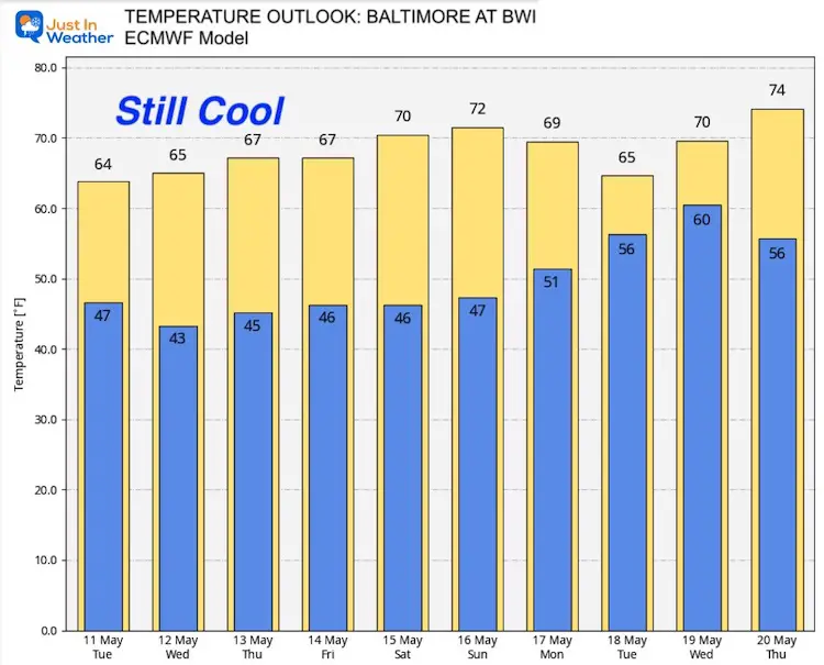
Temperature Outlook
We may get urban areas back to 70ºF this weekend. That will come with some scattered afternoon showers.
Sunshine State Of Mind
I am done with the cold and snow (for the season). I am embracing my wife’s mantra of Sunshine State of Mind. This was designed by Shannon Berk and we will be wearing it through spring and to the beach.
Double Benefit: Proceeds will be split between our nonprofit Just In Power Kids and the development of my new weather website. That has been scheduled to be ready to launch in May.
14 Local Maryland Pages (and York PA)
We have made a page for Maryland Weather which gives you the current conditions for 14 present area locations.
Please share your thoughts, best weather pics/video, or just keep in touch via social media


