Monday May 3 2021
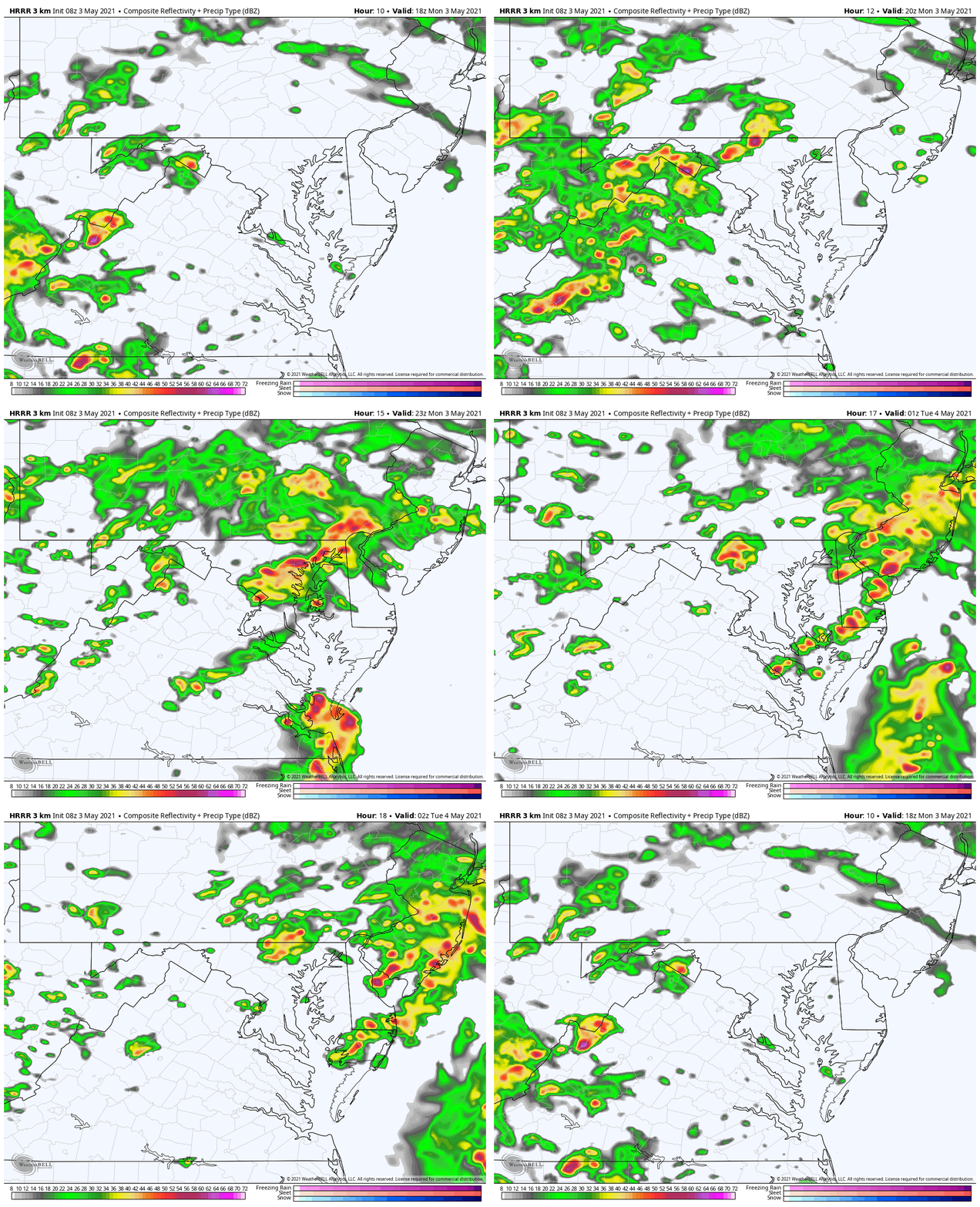
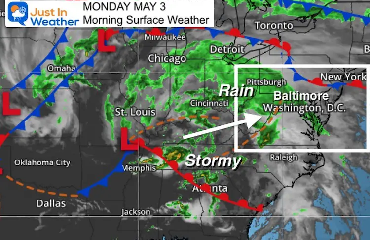
The timing of the weather worked out pretty well. After a nice weekend, the needed rain (it’s been pretty dry) is moving in this morning. It will be hard to broad brush this as it will be broken up today.
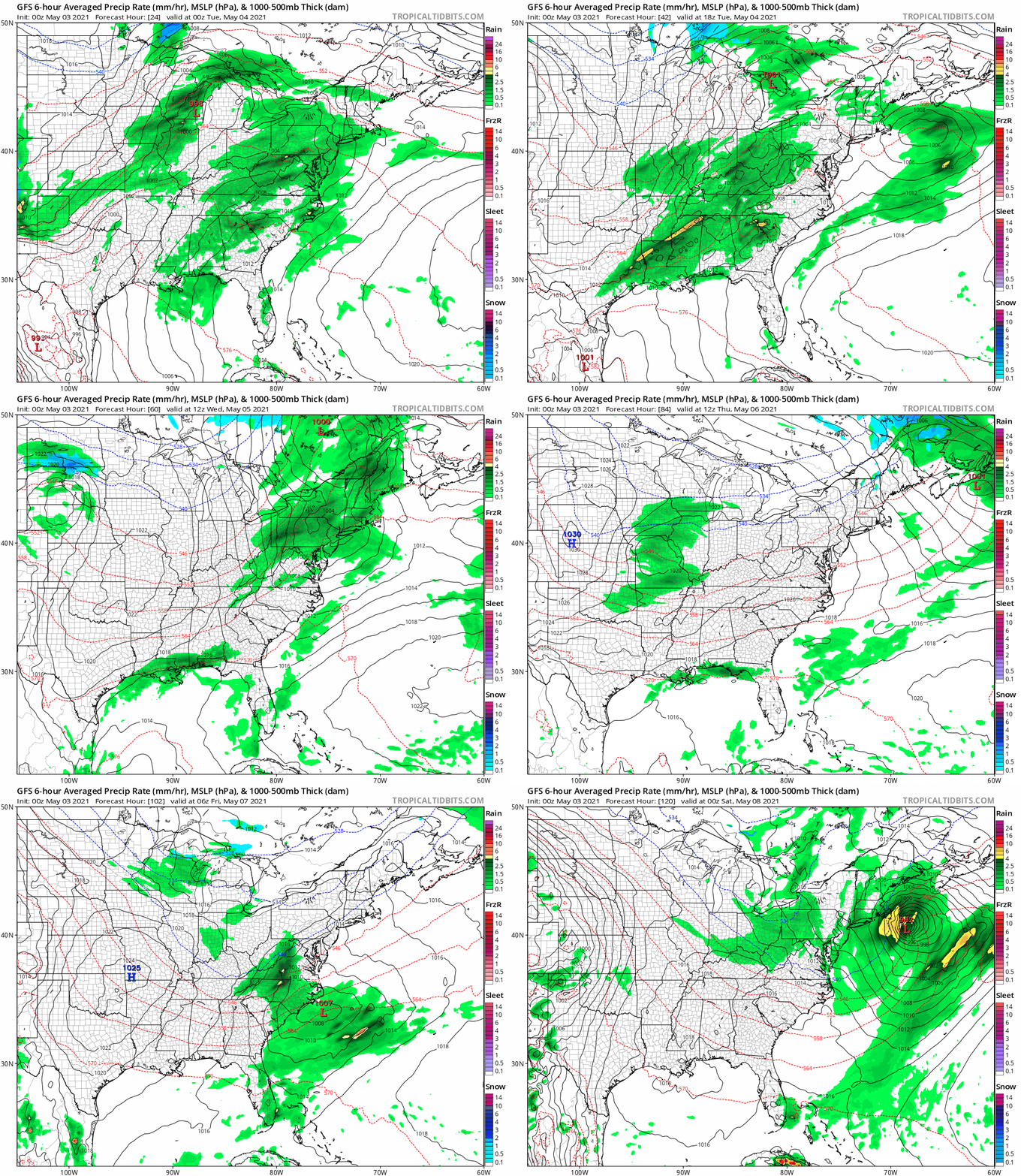
This morning we get a band of rain, then a break with thunderstorms this afternoon with pocket that may be very strong to severe. The start of the week will be warm and humid, then turning much cooler. More rain likely tomorrow, and a coastal storm on Friday.
Rain Animation: 2 PM to Midnight
Metro Storms Likely Between 4 PM and 9 PM
Highlights: Rain Timeline Snapshots
—> slider
Morning rain, then a break. Showers, storms, and some pockets of severe cells possible this afternoon into tonight.
Wet Week? Rain Animation Through Friday
Weather Almanac: Climate Data For Baltimore
Normal Low in Baltimore: 48ºF; Record 34ºF in 2005
Normal High in Baltimore: 70ºF, Record 92ºF 2018
Temperature Forecast
Monday

Tuesday
Morning

Afternoon
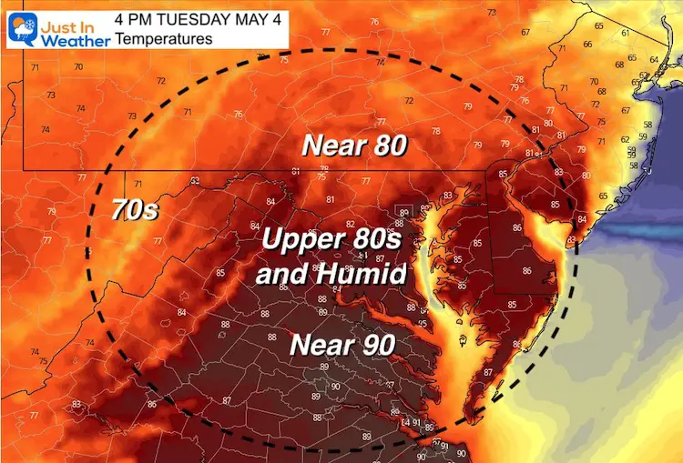
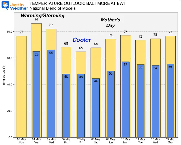
Temperature Outlook
The warm temps start the week, along with more humidity and the wet weather.
The cool down arrives by Thursday… But looking for a bounce back to the 70s by Mother’s Day.
Sunshine State Of Mind
I am done with the cold and snow (for the season). I am embracing my wife’s mantra of Sunshine State of Mind.
This was designed by Shannon Berk and we will be wearing it through spring and to the beach.
Double Benefit: Proceeds will be split between our nonprofit Just In Power Kids and the development of my new weather website. That has been scheduled to be ready to launch in May.
14 Local Maryland Pages (and York PA)
We have made a page for Maryland Weather which gives you the current conditions for 14 present area locations.
Please share your thoughts, best weather pics/video, or just keep in touch via social media
Facebook: Justin Berk, Meteorologist
Twitter: @JustinWeather
Instagram: justinweather

