Sunday February 21 2021
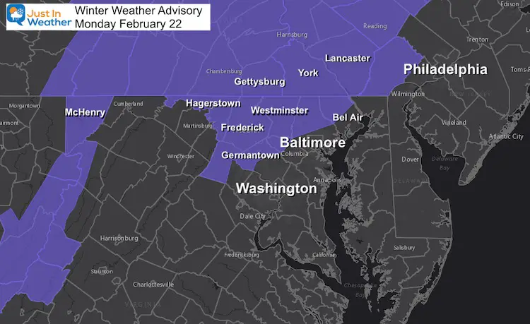
A Winter Weather Advisory has been issued for the northern and mountain counties of Maryland into southern Pennsylvania. This was expected as we discussed in my prior report. It is beginning Monday morning just after sunrise for most, and ending as rain in the afternoon. In fact some have rain and possibly thunder on the southern edges as it crosses Delmarva.
The main concern here is the timing. I continue to watch this, and the window is a little earlier between 8 AM and 10 AM for the first flakes. This will come on fast in the snow zone, but may be just as or after kids are getting to school. This will end before the end of the school day, most likely as rain with temps in the mid 30s.
Winter Weather Advisory
The National Weather Service issued this for areas inland (north and west of I-95). This does not include the big cities or coastal Bay areas.
The general idea is for a 1 to 3 inch snowfall.
There will be snow to start for others, just expected to be less impact on roads and faster change to mix or rain.
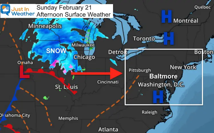
Sunday Afternoon Weather Map
This storm is racing eastward and will cover 1000 miles in the next 12 to 18 hours. It is just about to reach Chicago and it will arrive here shortly after sunrise Monday.
Monday Forecast Maps
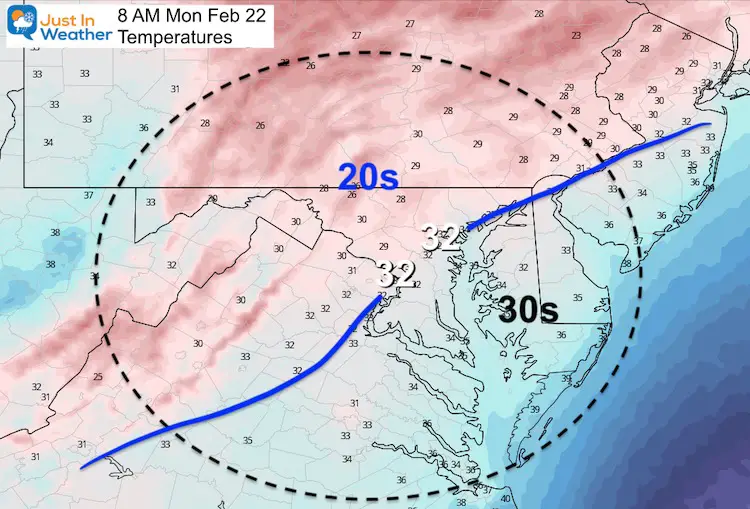
Morning Temperatures
The freezing line may cut through Baltimore, but primary interest is inland where it should be in the upper 20s. After this cold weekend, and a morning event, there will be stickage.
Metro areas may start with snow, but a slushy coating or wet roads are expected between Baltimore, Annapolis, and Washington.
Radar Simulation —-> slider
This is the NAM 3 Km Model… Just one solution but I must give it credit for doing a good job with the sleet aspect last week. Here we can see the mixing (or snow above freezing) in pink.
The snow may be heavy for a few hours between 10 AM and 1 PM. This may allow some colder spots and higher elevations to reach the upper end of snow potential.
Delmarva: Heavy rain and possibly thunder with the strong line crossing in the afternoon.
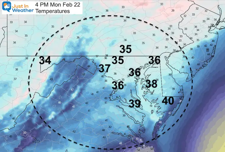
Afternoon Temperatures
The entire region will get above freezing. This is why the snow should end with rain, and any stickage will be thawing.
How Much Snow?
UPDATE: Click To See
Generally 1 to 3 inches in the Advisory area, but I think some spots could top 4” with the snow burst and colder temps.
There could be a coating to 1 inch in Baltimore.
I will post my call map this evening. To be honest, I am covered in paint now,. My wife and I have been priming and painting kitchen cabinets. I broke away for this report, but I want to give proper attention for a snow map.
Please check back later for more and I will include other model maps to compare.
#FITF
Last Storm Recap: Feb 18 to 19
If you missed it, please see my Storm Recap and Grade My Forecast.
Please share your thoughts, best weather pics/video, or just keep in touch via social media
Facebook: Justin Berk, Meteorologist
Twitter: @JustinWeather
Instagram: justinweather
14 Local Maryland Pages (and York PA)
We have made a page for Maryland Weather which gives you the current conditions for 14 present area locations.
Winter Outlook Series
FITF Shop Open
My ‘bonus’ daughter Jaiden and wife showing off our popular Maryland Hoodies. Unisex and women’s items all produced in Maryland.
Click here to see this and many other new items.


