February 2 2021
This winter storm just barely had our region in the grip, but we are still under the influence. Snow bands continue, and the radar displays the ‘haves’ and have nots’. That makes this forecast rely on watching the radar. If you get under the bands, they can still drop additional dusting to 1 inch or so.
Metro Baltimore and the western suburbs got in on some of that early this morning. Additional 2 to 4 inches (new snow) was reported in Howard and Carroll Coounties.
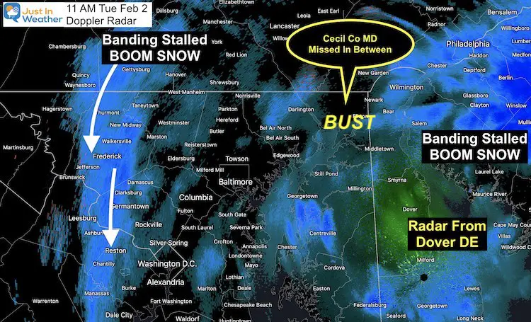
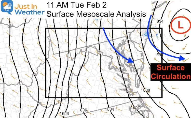
When this storm wraps up, most will verify with the forecast. Some have had a BOOM, while others have had a BUST. The radar at 11 AM highlighted that perfectly!
Doppler Radar
BOOM! There has been a persistent band of snow over Fredrick County. They already hit the jackpot yesterday, but it keeps coming today. The final snow totals may surpass the forecast. So far reports 10″ to 20″+
BUST! Cecil County, Maryland. This region has been caught between the Frederick band and the core snow to their east in Philadelphia. I expected this to win the snow based on how close they are to the storm center. So far most have between 2 to 5 inches. I have an explanation.
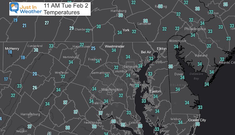
Temperatures
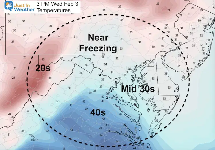
Where roads are treated, they are getting some assistance to be wet. Please note that we will drop below 32ºF tonight and refreeze.
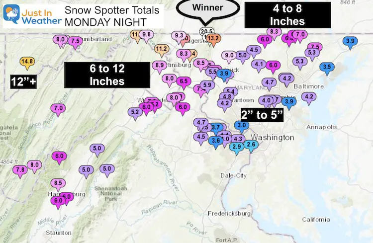
How Much Snow So Far?
These reports from NWS Spotters was LAST NIGTH. It does not include what fell at night or today. Some of these reports were actually in the afternoon. So being old they are too low.
Northern Frederick County: 20″ in Sabillasville broke 20 inches!!!
Back to the current weather…
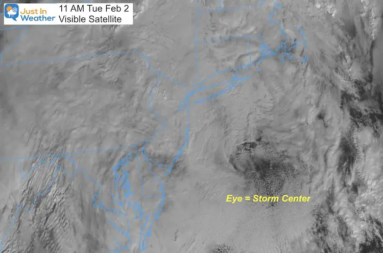
Visible Satellite
Notice the ‘Eye’ with the center of the storm about 250 miles east of Atlantic City, NJ
Storm Analysis At 11 AM
The Surface Low Was analyzed off of the New Jersey coast where that eye was located.
The wind circulation was annotated in blue. The really strong winds have been shifted east, closer to the center. But it is turning gusty.
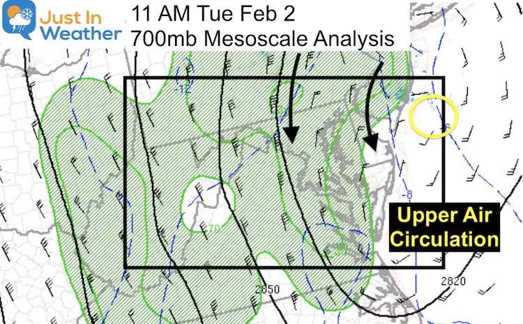
700 MB Analysis
I showed this map layer yesterday as we were turning back over.
This is around 10,000 Feet aloft and shows the circulation in the cloud layer a little closer to the NJ coast. This is what has been dictating the snow bands. The lines of snow have been like waves pushed out and rotating around.
The problem is that is has been nearly stuck. In it and you keep getting it. Missing it, and it seems like the storm was a total Bust. It wasn’t, but for you it may seem like it.
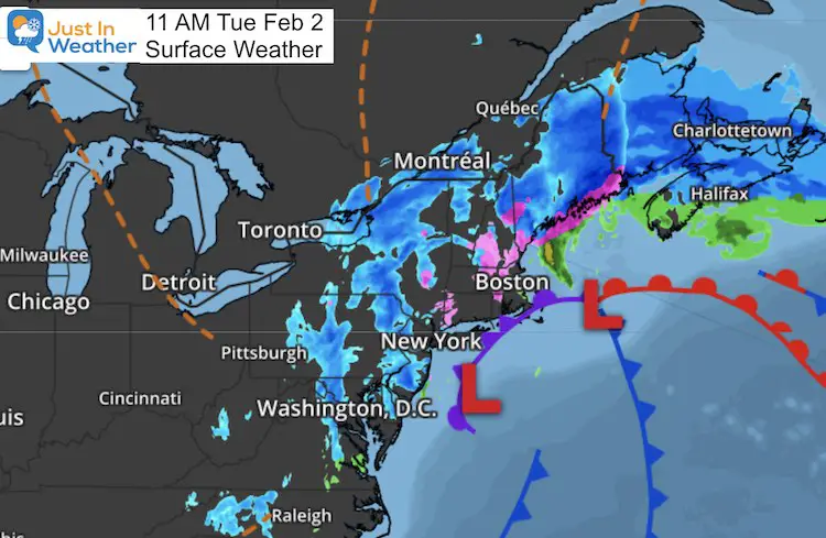
Weather Map
Some of these bands of snow are over 100 miles long.
We will continue to watch them, but they should shift east as the storm drifts that way. This may push the snow to new areas…
Temperature Forecast
Wednesday Morning: Refreezing in most areas…
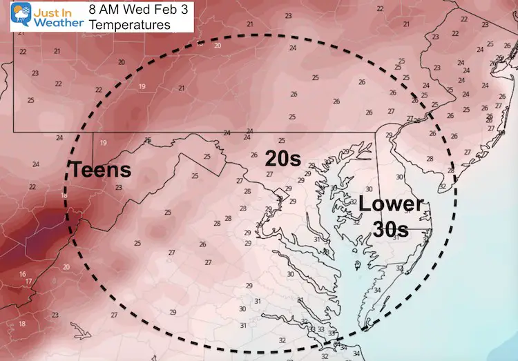
Wednesday Afternoon
Many areas get just above 32ºF to allow for anther thaw
Looking Ahead:
We still may remain under the influence of this storm with snow showers into Wednesday.
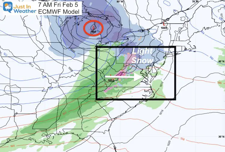
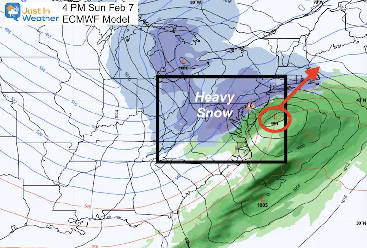
An active weather pattern will continue with two more hits of snow: Friday (light) and Sunday (a bigger storm), then The Polar Vortex comes into play.
Friday:
This will be a storm passing through the Great Lakes. It should bring milder air in, but on the leading edge we can get light snow in the morning.
Sunday:
This looks like a Miller A or Gulf to Coastal Storm. It’s a one-part event.
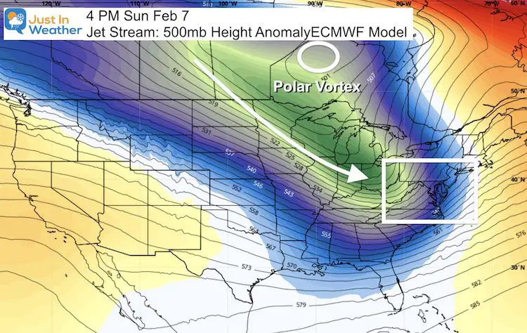
Polar Vortex
This core circulation will remain in Canada, but send a surge of very cold air to follow that storm into next week.
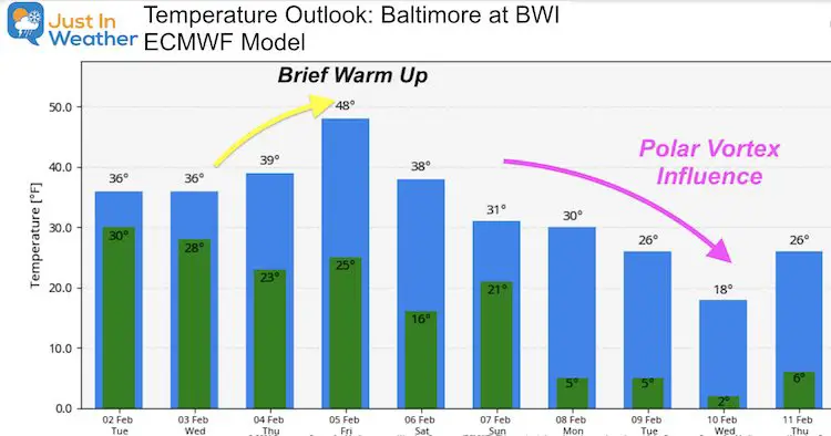
Temperature Outlook
A brief warm up after the Friday morning snow, then the Polar Plunge next week could bring highs only in the teens to lower 20s. I’ve seen this product go crazy then pull back a little with long range temps. So this is subject to change a little.
Maryland Weather Page
I wanted to keep it simple. Just the basics for a quick view at any time.

Please share your thoughts, best weather pics/video, or just keep in touch via social media
Facebook: Justin Berk, Meteorologist
Twitter: @JustinWeather
Instagram: justinweather
Winter Weather Resource Pages
Click Here For My Complete Winter Resource Info
Winter Outlook Series


14 Local Maryland Pages (and York PA)
We have made a page for Maryland Weather which gives you the current conditions for 14 present area locations.

FITF Shop Open
My ‘bonus’ daughter Jaiden and wife showing off our popular Maryland Hoodies. Unisex and women’s items all produced in Maryland.
Click here to see this and many other new items.


Also see:
Just In Power Kids:
A portion of proceeds go to our programs Providing FREE holistic care for kids in cancer treatment and up to 5 years post treatment and caregivers.
![]()
New Caps and Hats

