Tuesday January 12 2021
The Polar Vortex Disruption and Sudden Stratospheric Disruption have been popular topics in the past week. This is all in anticipation of winter finally making a return and take a strong hold. The process is happening now, and cold will come at us in pieces as the ‘sister vortices’ will be scattered all around the Northern Hemisphere.
Where is our cold air and snow?
I get it! We are almost halfway through winter, and it is not here yet. Also, not much mention of a big storm in sight. But I am here for you fellow snow lovers. What is happening is still on target with my Winter Outlook, and I will show it to you.
Also: This weekend we will have a few impulses trying to bring in snow showers. This is the beginning of our typical winter anyway. The snowiest month in our region is February and there is nothing to suggest otherwise now.
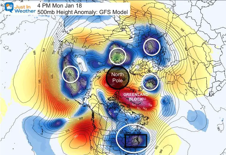
First, here is a look at next Monday, showing split of cold air around the globe. The North Pole is in the middle of this view.
While one piece of cold air will be in the eastern US, there is a concentrated push over Europe and Asia. Yes, the bulk of the cold air will go to the other side of the Northern Hemisphere. But, these waves have to rotate around the glove, and should swing our way.
We will get back to this later. But I wanted to address a few things first:
1. It is going to get colder!
2. The initial push may not seem impressive, and is less profound that first shown. I am aware! But, this may still bring some snow.
3. This is all still playing out with what I stated in my Winter Outlook back in November 2020.
Here are some of my quotes from that article:
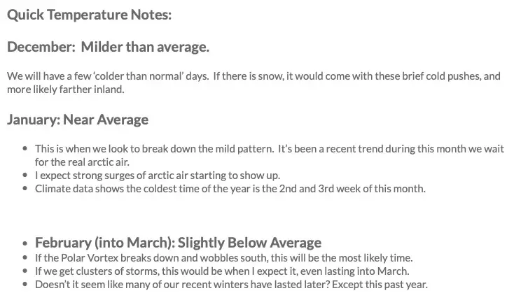
“I see this winter likely to get off to a slow start, but then bring bursts of storms and a stronger finish”
This was my temperature outlook summary. You click the image and see the full report again. I stated I was ‘Bullish’ for part of it. We are coming up on that part in the second half of this month and January:
Again, this cold push this weekend is the FIRST of the break down of the pattern as expected. I have been outspoken about low confidence in long range modeling, but we still use it for a gauge.
So, Where Is Our Cold?
Let’s start with the cold front Friday:
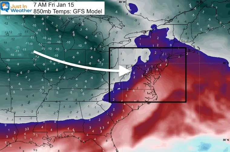
The cold air is best shown aloft at the 850mb Level (around 5,000 Ft) in ºC.
This map shows Friday morning, with the colder air just west of the mountains and through the north central US.
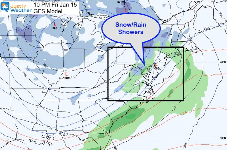
It will be Friday night when we might get some rain showers mixing with snow flakes. Don’t expect much from this.
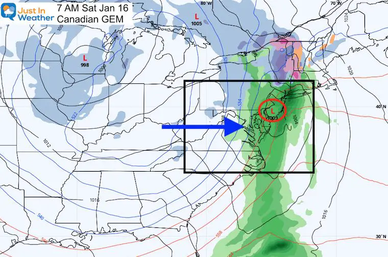
Saturday: The First Cold Push
Morning:
Here the Canadian Model lingers the front with a wave of Low Pressure. I tend to give this GEM Model more credit in arctic dominated patterns.. Should this verify, it would bring marginal rain/snow conditions. The European ECMWF Model also shows rain, and delays the surface cold air longer. However, the cold air will have already moved in aloft, allowing for a wintry mix to fall, even if it can’t stick at the surface.
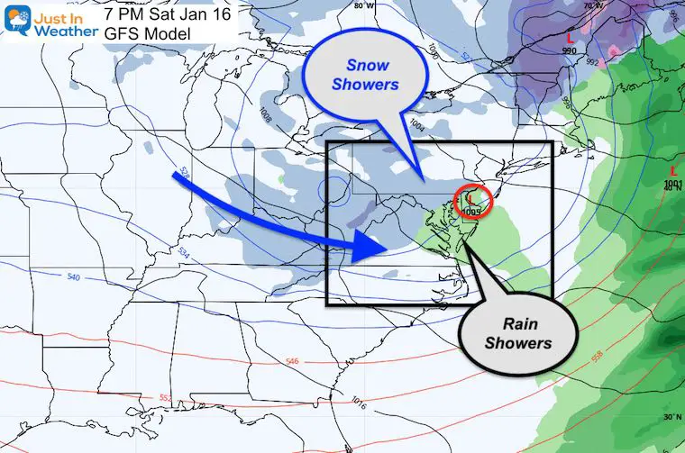
Saturday Evening: Weak disturbance snow showers?
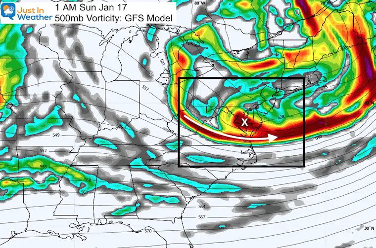
Overnight Vorticity:
This is the upper level support for more flurries or snow showers from the Great Lakes Saturday night into Sunday morning.
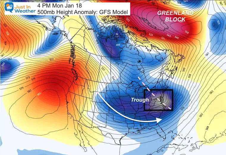
Monday: This map is a closer view of the Polar Image at the top.
Here we see the Deep Trough settling in to the eastern US.
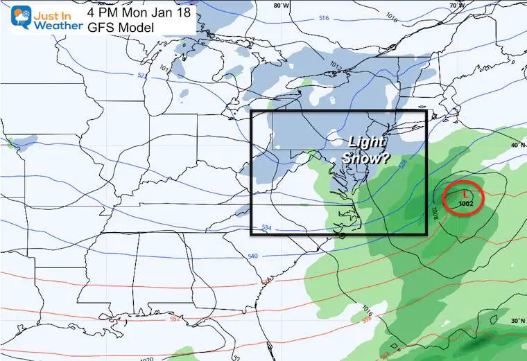
Monday Snow?
The GFS is trying to develop Low Pressure near the coast, close enough to put us in the sphere of influence and drop an area of light snow.
There isn’t much support otherwise brining this energy together. But, as I have said before: I think these little nuisances are worth watching as I think one may end up surprising us as opposed to the long range storm outlooks that keep falling apart.
Not seeing a storm on the horizon is not a lost cause. Why? Because long range modeling has been poor guidance. We should be able to squeeze some snow out of the next few weeks. Have Faith in the Flakes. I do.
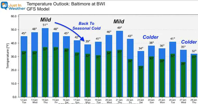
Temperature Outlook
This weekend is the first of several cold pushes on the way. I know these looks less impressive than initially suggested, but we will be breaking into a winter pattern for the second half of the month.
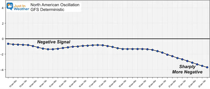
The North Atlantic Oscillation:
The DEEPER NEGATIVE at the end of the month is a very encouraging sign.
Please share your thoughts, best weather pics/video, or just keep in touch via social media
Facebook: Justin Berk, Meteorologist
Twitter: @JustinWeather
Instagram: justinweather
Email Updates
Please make sure you sign up (above or click here to sign up for email alerts…. ) for my newsletter. This way you will get an email to make sure you are notified of each post.
14 Local Maryland Pages (and York PA)
We have made a page for Maryland Weather which gives you the current conditions for 14 present area locations.
FITF Shop Open
My ‘bonus’ daughter Jaiden and wife showing off our popular Maryland Hoodies. Unisex and women’s items all produced in Maryland.
Click here to see this and many other new items.
Also see:
Also See:
December Climate, Sun Data, Solstice, ISS Flyovers, Moon, Planets, and The Great Conjunction
Maryland Weather Page
I wanted to keep it simple. Just the basics for a quick view at any time.

