Friday December 25 2020
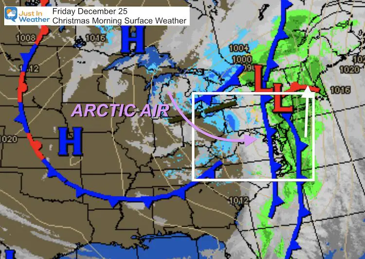
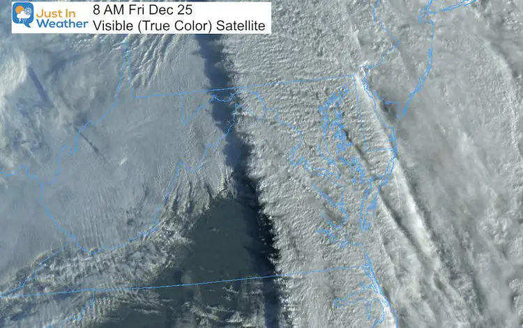
This may end up as a gift for most of us today. The colder air is moving in as expected this morning, and the upper level energy continues to support snow showers with possible heavier squalls. This will be ambience flakes, but may coat the ground in spots. Temperatures will continue to drop and allow for some stickage this afternoon and evening.
Strong Winds
Baltimore recorded a 42 mph wind gust. There were stronger surges. It appears most of the region kept their power, but how about the decorations? Did they survive?
Today, winds will be from the west and northwest. The gust will most likely be in the 30 mph range, but could be higher in snow squalls making the snow appear heavier.
Christmas Morning Set Up
Forecast Snapshot: Central Maryland

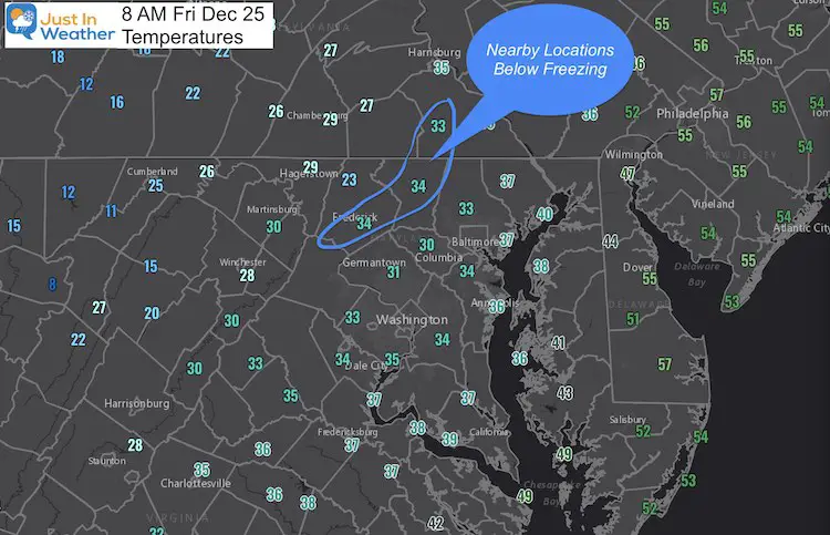
8 AM Temperatures
- The freezing temps made it to the suburbs just west of Baltimore.
- There is a nuisance with Frederick, Westminster, and York showing just about freezing, but all surrounding sites were closer to 30ºF at 8 AM. I mention this because of the potential freeze if you have any travel.
- Notice the 20s just west of Frederick. That’s the cold air working to move in all day.
Key Times —> slider
Remaining nearly steady or dropping.
Snow Showers and Squalls
- This and all models are NOT PERFECT.
- I’d watch for verification a little earlier and possibly a little farther north than shown here.
- There appears a distinct east-west band that could produce the best chance for minor accumulation mid afternoon into the evening.
—> slider
Live Radar Widget
*This is not color coded for winter precip.
14 Local Maryland Pages (and York PA)
We have made a page for Maryland Weather which gives you the current conditions for 14 present area locations.
FITF Shop Open
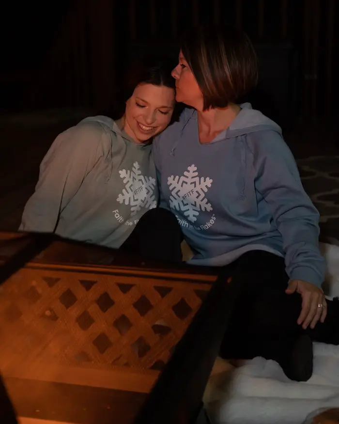
My ‘bonus’ daughter Jaiden and wife showing off our popular Maryland Hoodies. Unisex and women’s items all produced in Maryland.
Click here to see this and many other new items.
Also see:
Also See:
December Climate, Sun Data, Solstice, ISS Flyovers, Moon, Planets, and The Great Conjunction
Maryland Weather Page
I wanted to keep it simple. Just the basics for a quick view at any time.
Please share your thoughts, best weather pics/video, or just keep in touch via social media
Facebook: Justin Berk, Meteorologist
Twitter: @JustinWeather
Instagram: justinweather
Email Updates
Please make sure you sign up (above or click here to sign up for email alerts…. ) for my newsletter. This way you will get an email to make sure you are notified of each post.
Just In Power Kids:
A portion of proceeds go to our programs Providing FREE holistic care for kids in cancer treatment and up to 5 years post treatment and caregivers.

New Caps and Hats


