Friday December 18 2020
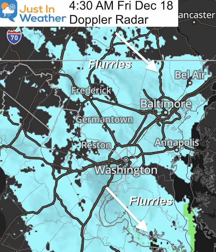
Flurries began to sneak in on radar last night and many woke up to the flakes this morning. This was in the forecast, but it might have been buried with all the post storm talk. No worries, as I write this they are already diminishing on radar.
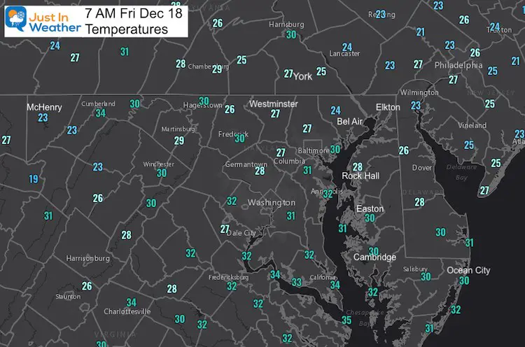
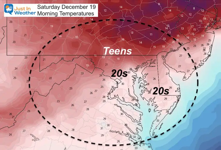
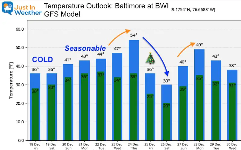
The arctic air remains with us through the weekend. Tomorrow morning should be the coldest of the season so far. Another round of flurries possible on Sunday.
I will also address the talk of snow on Christmas. I want to state that it is 1 WEEK AWAY. Yes, I began talking about the last storm in this time frame, so I think now it is OK. But it’s also worth highlighting trends and not specifics as computer guidance has been far from perfect. I made sure to account for that with my forecast last time.
Morning Set Up
Doppler Snapshot (Earlier)
There may be a light coating on your car, sidewalk, and some roads.
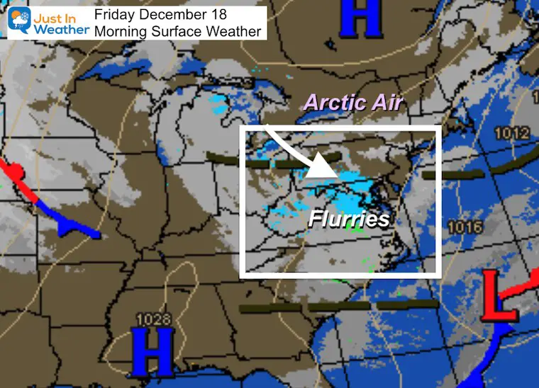
Morning Surface Weather
This cluster of flurries will diminish, but the arctic air remains in place through the weekend.
Temperatures
Forecast Snapshot

Saturday: Coldest Morning Of The Season (so far)
DID YOU GRADE MY FORECAST?
If not, see my report and log your grade in my poll for total results
Click here for the full snow report
Sunday
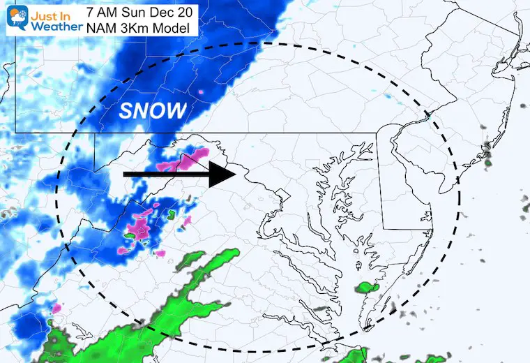
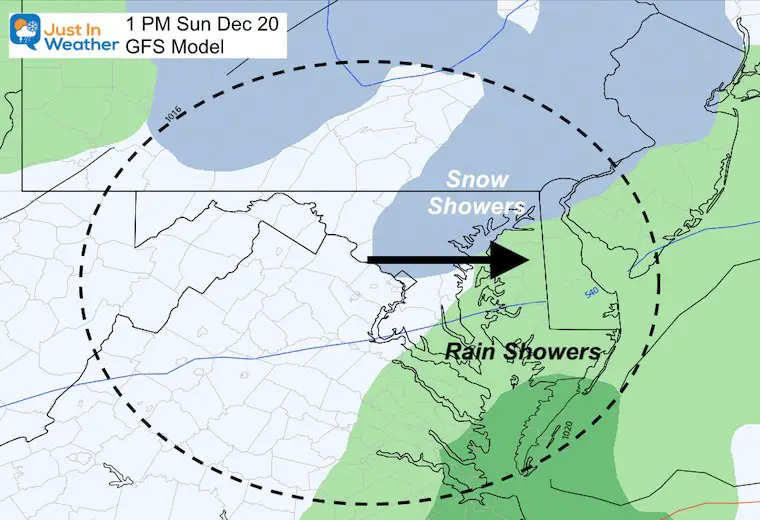
Another little system will be crossing the region. This will be moving from west to east, and as is often the case will get disrupted by the mountains.
This may look impressive early, but should break up to showers or less. The flakes are more likely in the same places that got snow in the last storm. Southward, sprinkles or rain showers.
Morning
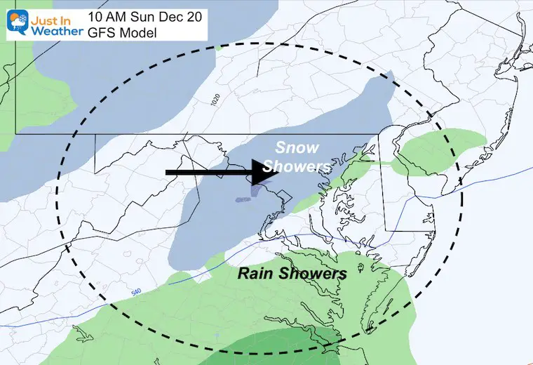
Afternoon
JUMPING TO NEXT WEEK: Christmas Storm
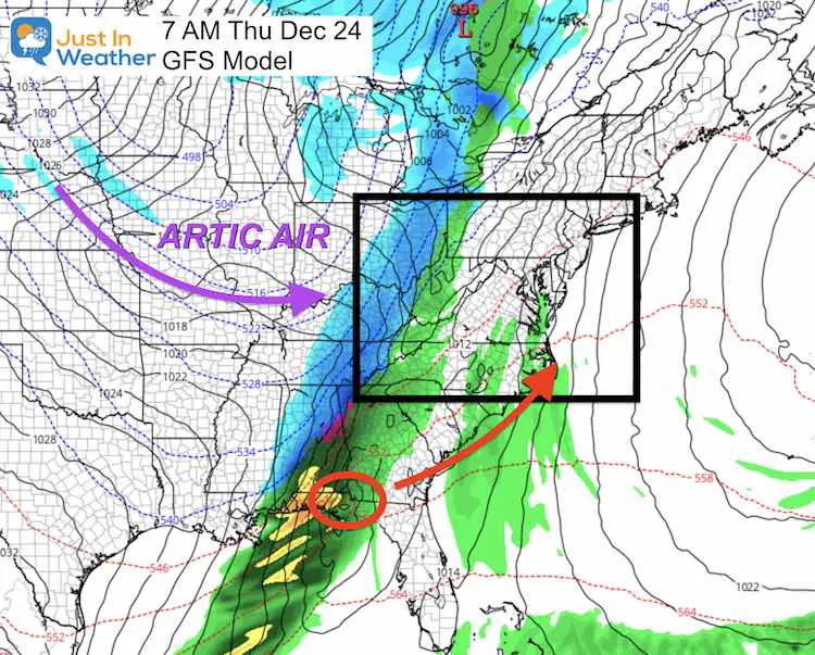
This looks like another Arctic Front swinging through. This forecast is for 7 Days Away. I expect an adjustment on timing, which will then force adjustment for the location of rain and snow. But here is why you are seeing that ‘Flake’ on your app forecast:
GFS Model
Christmas Eve
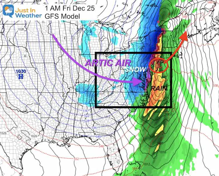
Look Familiar? Another area of Low Pressure coming out of Louisiana, along the Gulf Coast, and heading towards the east coast. This has been the pattern I identified in my winter outlook as it was common with the tropics. It looks like the atmosphere is primed to keep sending us more.
Christmas (After Midnight)
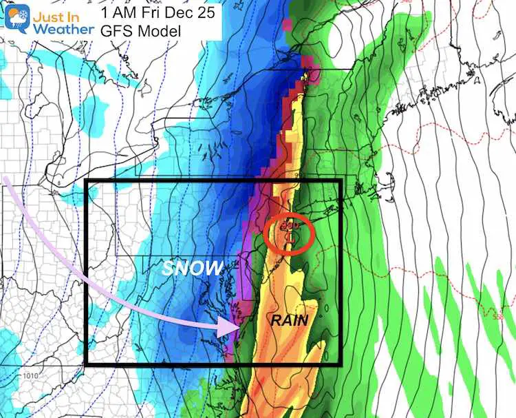
‘At this point’ The arctic Front is timing a transition around or after midnight to pull snow through the region.
Please note: This is 1 WEEK AWAY and subject to change…
Closer View
This reminds me of the snow we had on Christmas 2002. That was a burst with and arctic front after rain as well.
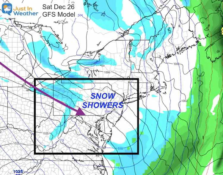
Christmas Weekend: Cold With Snow Showers
A cold set up brings Lake Effect Snow into the mountains and flurries or snow showers for us.
Temperature Outlook
FITF Shop Open
My ‘bonus’ daughter Jaiden and wife showing off our popular Maryland Hoodies. Unisex and womens items all produced in Maryland.
Click here to see this and many other new items.
14 Local Maryland Pages (and York PA)
We have made a page for Maryland Weather which gives you the current conditions for 14 present area locations.
Also see:
Also See:
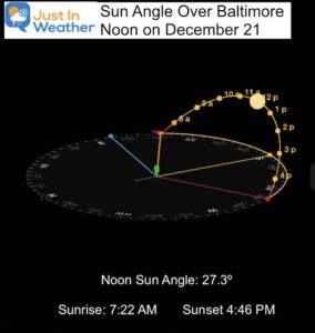
December Climate, Sun Data, Solstice, ISS Flyovers, Moon, Planets, and The Great Conjunction
14 Local Maryland Pages (and York PA)
We have made a page for Maryland Weather which gives you the current conditions for 14 present area locations.
Maryland Weather Page
I wanted to keep it simple. Just the basics for a quick view at any time.
Please share your thoughts, best weather pics/video, or just keep in touch via social media
-
Facebook: Justin Berk, Meteorologist
-
Twitter: @JustinWeather
-
Instagram: justinweather
Email Updates
Please make sure you sign up (above or click here to sign up for email alerts…. ) for my newsletter. This way you will get an email to make sure you are notified of each post.
Just In Power Kids:
A portion of proceeds go to our programs Providing FREE holistic care for kids in cancer treatment and up to 5 years post treatment and caregivers.

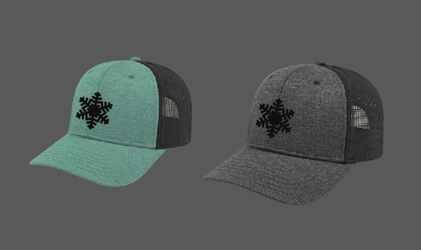
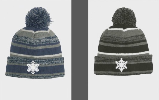
New Caps and Hats


