November 12 2020
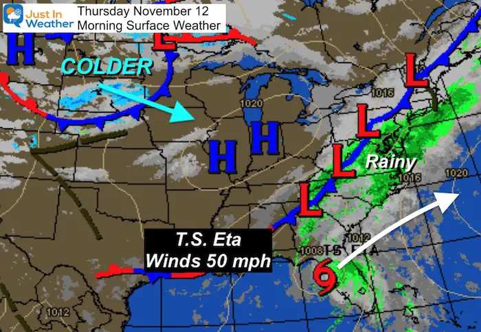
Rain continues this morning with more heavy bands passing through our southern sections. There have been Flood Advisories and Warnings, which continue.
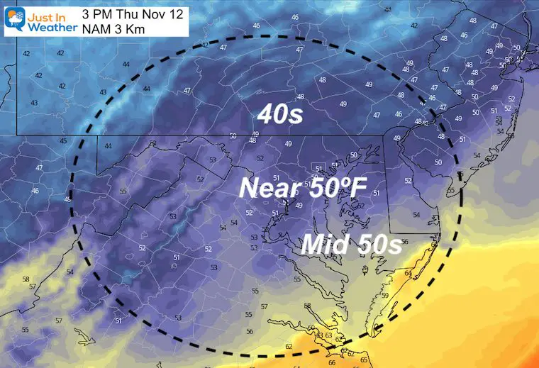
Temperatures start off mild in the 60s, but will turn colder by this afternoon.
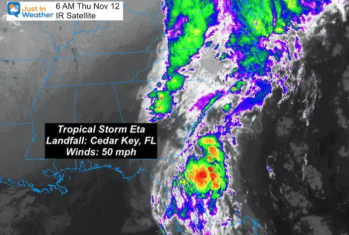
Tropical Storm Eta mad landfall by Cedar Key, Florida. That storm will delay this cold front movement, then pull it through. Our weekend looks better, but next week looks colder.
Thursday Morning Weather
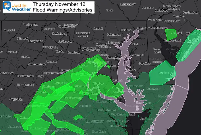
Flood Advisories and Warnings
Heaviest rain has fallen near Washington, south and east!
Tropical Storm Eta
Satellite shows most of the moisture thrown well ahead of the storm. This is what continues to feed into our cold front, and slow it down.
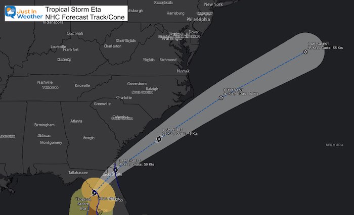
Forecast Track
The center of Eta will move well off of the US coast. This is a big player in the cold front we have, and will eventually pull it through for a nicer weekend.
Track The Rain
LIVE RADAR
Radar Simulation —> slider
This is for Thursday, but a few showers will linger into Friday morning.
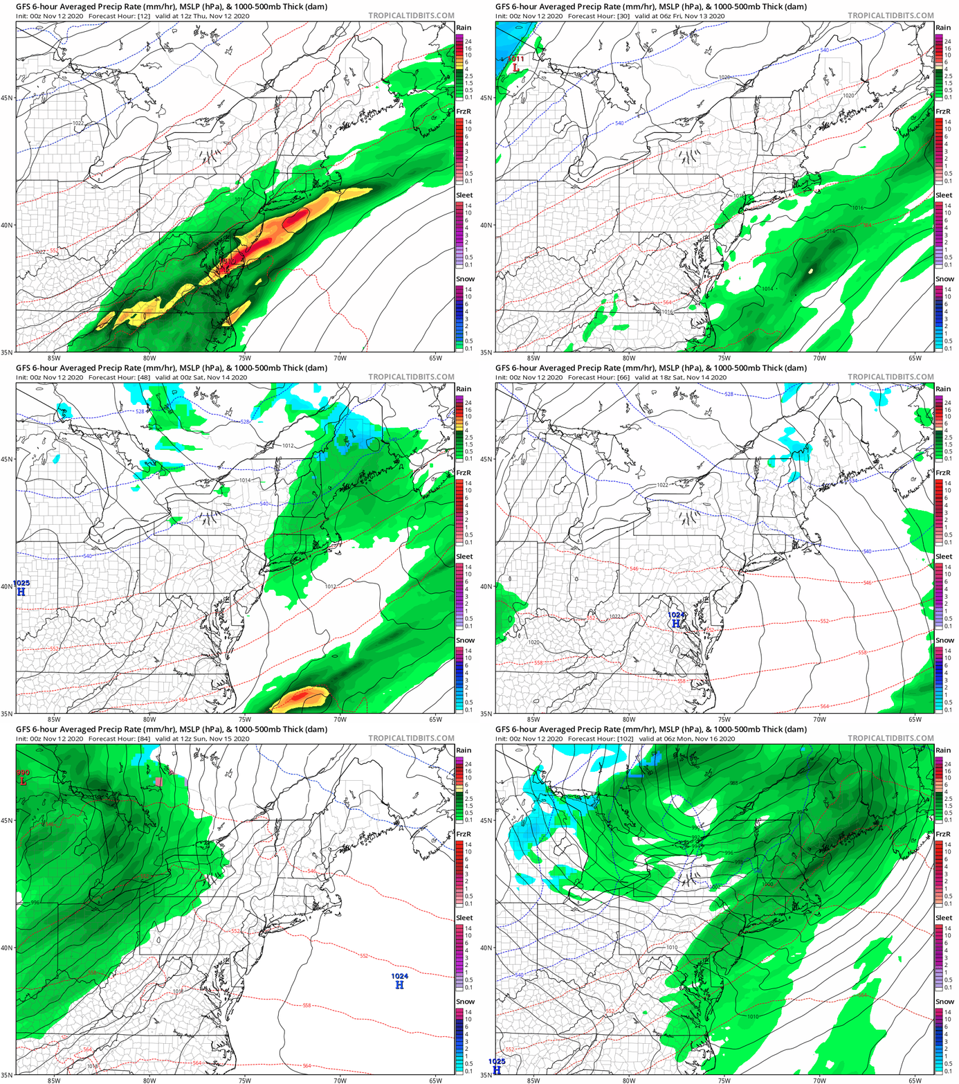
Rain Animation Forecast: Today Through Sunday Night
Sunday Snapshot
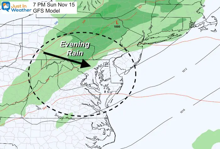
With Eta on the move, it will not feed into the next front. That frees us from added moisture then, and keeps us dry this weekend… until Sunday night.
Much colder air will follow that front next week!
Temperature Forecast
Friday
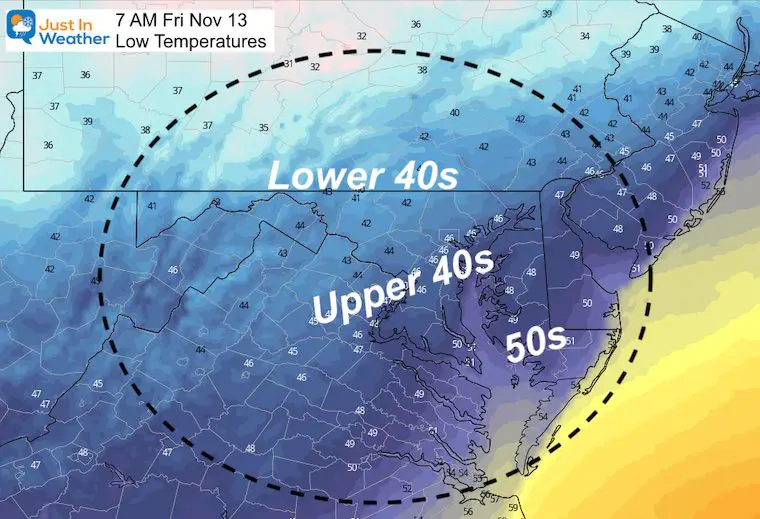
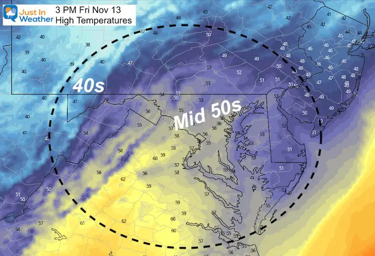
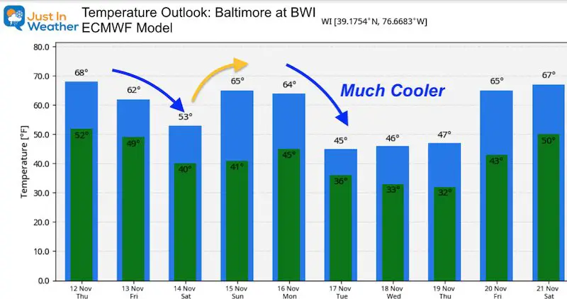
Temperature Outlook
The weekend will be dry, with a chilly Saturday and warmer Sunday. Then the next COLD shot will arrive next week.
14 Local Maryland Pages (and York PA)
We have made a page for Maryland Weather which gives you the current conditions for 14 present area locations.
Maryland Weather Page
I wanted to keep it simple. Just the basics for a quick view at any time.
Please share your thoughts, best weather pics/video, or just keep in touch via social media
-
Facebook: Justin Berk, Meteorologist
-
Twitter: @JustinWeather
-
Instagram: justinweather
Email Updates
Please make sure you sign up (above or click here to sign up for email alerts…. ) for my newsletter. This way you will get an email to make sure you are notified of each post.
Also See
Help Solve The Mystery
UFO, Meteor, Or Something Else Caught On Cam In Owings Mills MD This Week?
Explore More:
Autumnal Facts and Weather Stats
Record Low Tied at BWI and Frost Photos Sep 20
Typical First Frost and Freeze
Also See:
July 2020 The hottest on record. Will it hint at snow this winter?
Comet NEOWISE Viewing All July (photos/video)
Other Links:
Baltimore Weather At BWI May Not Be As Hot As Reported
Construction at the airport close to the weather station may be added artificial heat. Click here or the image for the details.
Just In Power Kids:
Proceeds go to our programs Providing FREE holistic care for kids in cancer treatment and up to 5 years post treatment and caregivers.


