Wednesday Afternoon October 7 2020
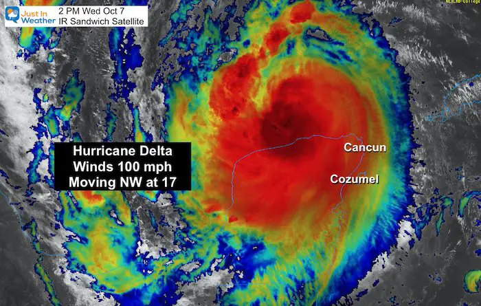
Hurricane Delta lost a little more speed as it interacted with Mexico’s Yucatan. This storm moved on target between Cozumel and Cancun, and area still dealing with a few other hits this year. They also had to deal with Gamma a few days ago, plus Laura and Marco.
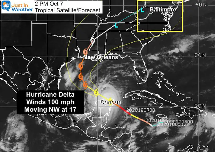
Now that this is over the open water again, it will regain strength. Winds are now 100 mph, but the satellite loop below shows it quickly reorganizing. I expect rapid intensification again as it moves toward the US for a second landfall on Friday in Louisiana.
Storm Surge and Hurricane Watches are in place. The track still brings rain our way later in the weekend.
Below you will find the latest images, info, storm recourse center, and forecast for rain into our region.
Hurricane Delta Afternoon Close Plot
Hurricane Delta Wednesday Afternoon Update
National Hurricane Center Update
SUMMARY OF 100 PM CDT...1800 UTC...INFORMATION
----------------------------------------------
LOCATION...21.8N 88.8W
ABOUT 115 MI...185 KM W OF CABO CATOCHE MEXICO
ABOUT 65 MI...110 KM ENE OF PROGRESO MEXICO
MAXIMUM SUSTAINED WINDS...100 MPH...155 KM/H
PRESENT MOVEMENT...NW OR 305 DEGREES AT 17 MPH...28 KM/H
MINIMUM CENTRAL PRESSURE...975 MB...28.80 INCHES
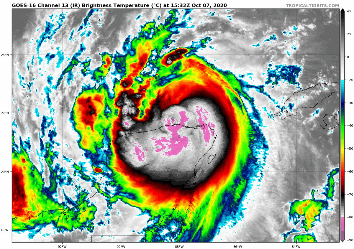
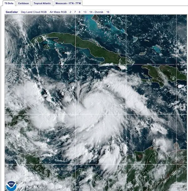
Satellite Loop
The highest cloud tops are in white and pink. Still a very ragged center with no eye present, but the center is defiantly reorganizing. Look out for rapid intensification again.
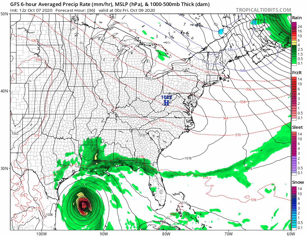
Computer Model Forecast Plots
The consensus is along the middle of the Louisiana coast, this is to the west of New Orleans, but may still carry the max impact with the stronger side to the east.

National Hurricane Center Forecast And Advisories
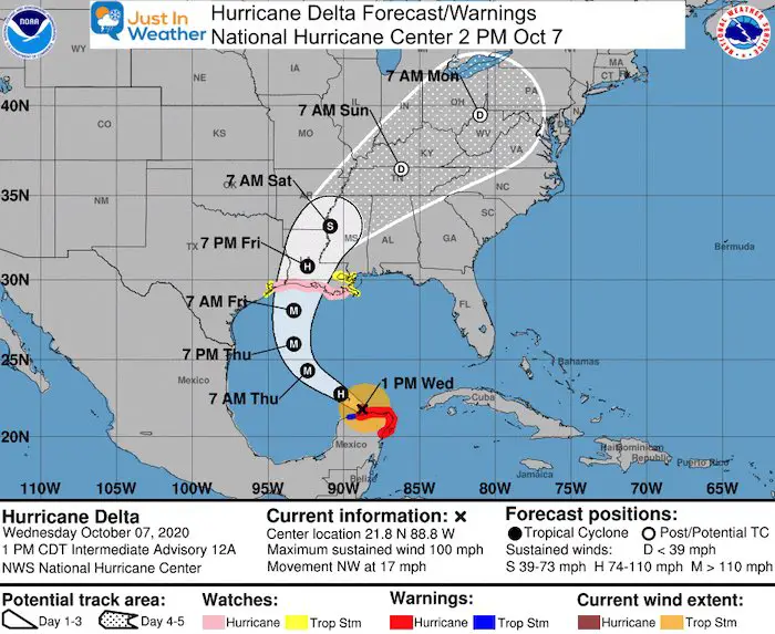
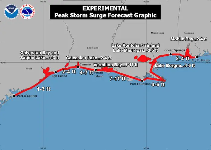
Warnings and Watches
A Storm Surge Watch is in effect for...
* High Island, Texas, to the Alabama/Florida border including
Calcasieu Lake, Vermilion Bay, Lake Pontchartrain, Lake Maurepas,
Lake Borgne and Mobile Bay
A Hurricane Warning is in effect for...
* Tulum to Dzilam Mexico
* Cozumel

A Hurricane Watch is in effect for...
* High Island Texas to Grand Isle Louisiana

A Tropical Storm Warning is in effect for...
* Dzilam to Progreso Mexico

A Tropical Storm Watch is in effect for...
* San Luis Pass to west of High Island Texas
* East of Grand Isle Louisiana to Bay St. Louis Mississippi,
including New Orleans
* Lake Pontchartrain and Lake Maurepas
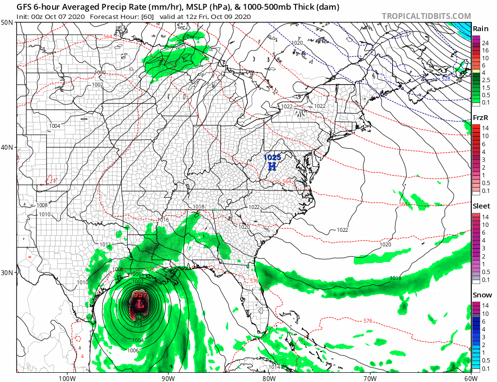
GFS Model Forecast Animation
Updated from this morning's model run.
Rain like to arrive on Sunday and may be heavier on Monday for the Mid Atlantic.
 This track would NOT bring surge or coastal flooding risk to our region. That will be absorbed by the Gulf Landfall.

Weather Widgets You Control
Wind and Pressure Levels
This is a forecast view. You can see the future cast using the button at the bottom of the map.
Waves
All GOES EAST Satellite ‘Floater’ views
Click here to see all new satellite loops
Also See:

Related Posts
2020 Tropical Storm and Hurricane Names and Naming History

Atlantic Tropical History: Maps of Origin Regions Every 10 Days


Please share your thoughts, best weather pics/video, or just keep in touch via social media
-
Facebook: Justin Berk, Meteorologist
-
Twitter: @JustinWeather
-
Instagram: justinweather
Email Updates
Please make sure you sign up (above or click here to sign up for email alerts…. ) for my newsletter. This way you will get an email to make sure you are notified of each post.
Maryland Trek Team Shirt
All proceeds will go to the Just In Power Kids programs

NEW INTERACTIVE WEATHER PAGES
Maryland Weather Page
I wanted to keep it simple. Just the basics for a quick view at any time.

14 Local Maryland Pages (and York PA)
We have made a page for Maryland Weather which gives you the current conditions for 14 present area locations. Many of these match up with the spots on our route. Please use this list below are reference. I will include them daily with my articles on the kids.
Other Links:
Was Your County Not Included?
Click this map for more on the regional forecast zones

Baltimore Weather At BWI May Not Be As Hot As Reported
Construction at the airport close to the weather station may be added artificial heat. Click here or the image for the details.

Just In Power Kids:
Proceeds go to our programs Providing FREE holistic care for kids in cancer treatment and up to 5 years post treatment and caregivers.
![]()
Shine On
Proceeds from all sales go to Just In Power Kids. Click the image to shop and show your support.
