Friday November 1 2019
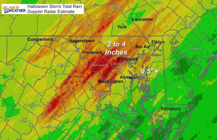
That Halloween storm lived up to expectations just after trick or treating for most. The winds did knock down trees and power in some areas. A tornado warning was issued on Kent Island overnight, but this morning will reveal if there was damage. The biggest impacts were lightning and flooding rain. Hardest hit areas were west of Baltimore with over 3 inches of rain in Eldersburg, but many streams were still in flood stage early this morning.
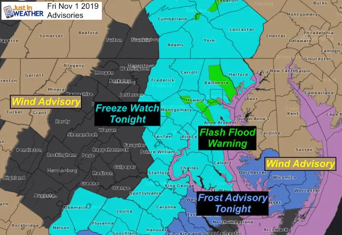
Warnings Watches and Advisories
- High winds still hitting the mountains and Delmarva
- Flash Flooding in waterways this morning.
- Freeze Watch overnight west of the Bay
- Frost Advisory on Delmarva/Lower Eastern Shore
Morning Weather
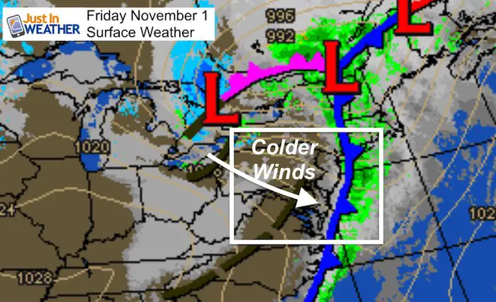
As the strong storm departs, gusty winds bring in the colder air for us. Winds will gust to 30 mph.
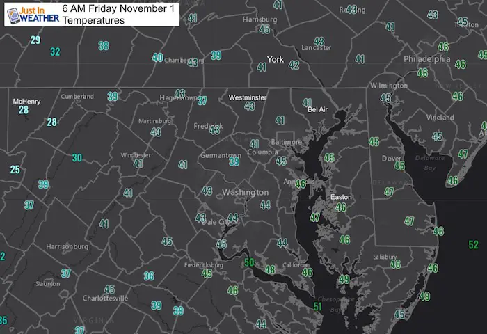
Morning Temperatures
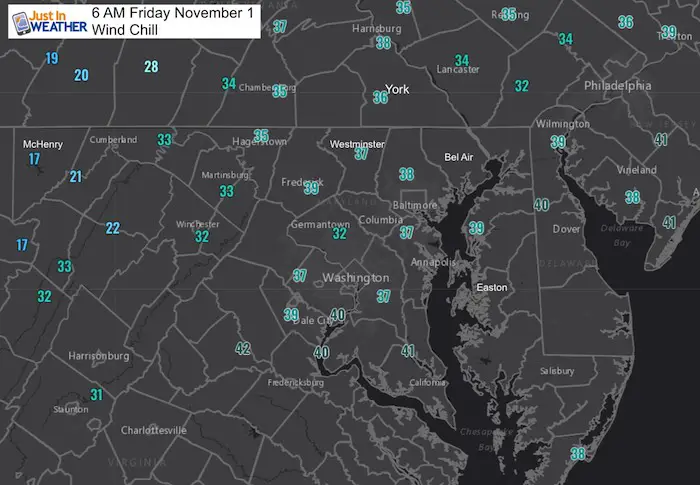
Morning Wind Chill
Local Weather Stats:
Friday November 1, 2019 in Baltimore
Average High: 62ºF
Record High: 86ºF in 1950
Average Low: 40ºF
Record Low: 29ºF in 1954
Sunrise: 7:34 AM
Sunset 6:05 PM
*Daylight = 2:16 shorter than yesterday
*Bay Water Temperature = 64ºF at Thomas Pt. Light House
Get Forecasts By Email
Just in case you don’t get all posts on your social media feed, stay up to date with the latest info…
Click here to sign up for email alerts…. Be the first to hear any new weather
Thank you to our Title Sponsor for Maryland Trek 6
Shining on with Smyth and their contribution, our team has raised over $95,000 for Just In Power Kids to provide free programs for kids in and post cancer treatment.

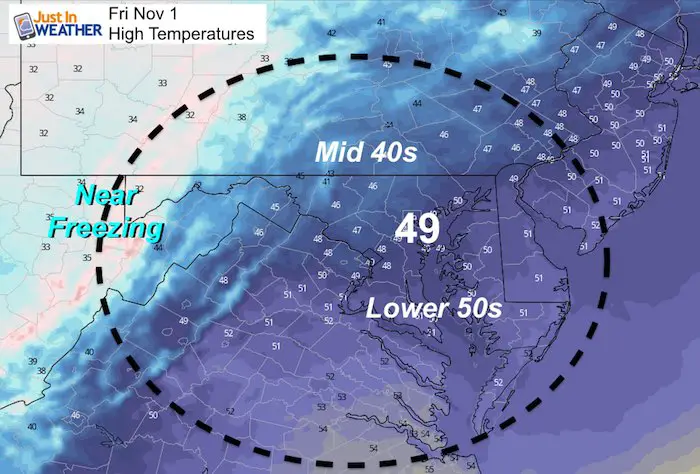
Friday Afternoon Temperatures
The NAM 3 Km Model is showing many staying in the upper 40s. Your phone app might show 50s, but the wind will keep us feeling chilly all day.
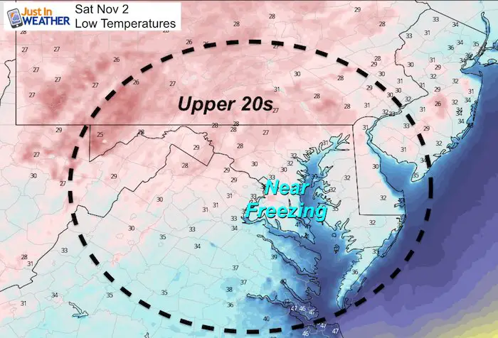
Saturday Morning Temperatures
A hard freeze likely inland. Temps will be near freezing in the cities and close to the Bay. Even interior Delmarva is likely to dip close to freezing.
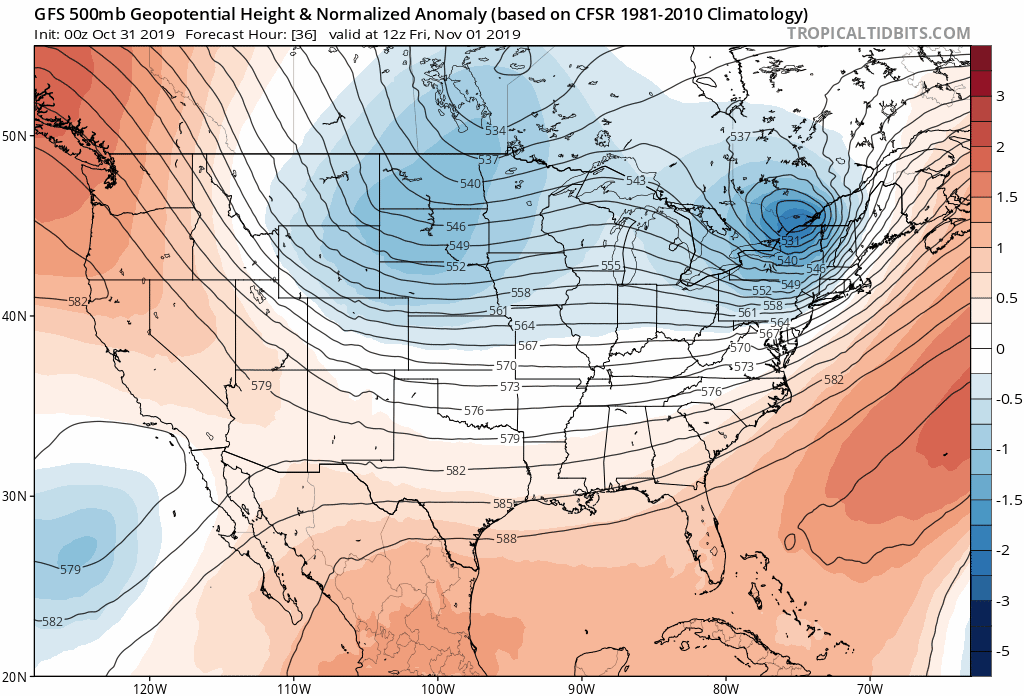
Outlook: Jet Stream
The cold pattern this weekend will ease a little next week, but turn colder next weekend
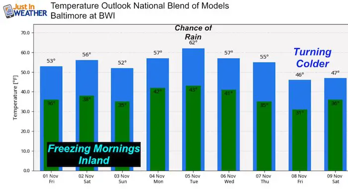
Temperature Outlook
The mild day next week will come with a chance for rain. Then a n even colder air mass will hit us next weekend.
Please share your thoughts, best weather pics/video, or just keep in touch via social media
-
Facebook: Justin Berk, Meteorologist
-
Twitter: @JustinWeather
-
Instagram: justinweather
ALL FITF Apparel Available


New Colors
We are giving 10% of each sale to Just In Power Kids: Providing FREE holistic care to pediatric oncology patients and FREE healthy meals to local hospitals.

Also See:
NOAA Winter Outlook Leaves Room For More Snow With Mild ‘Seasonal Average’ Temperatures

Many areas inland from the cities should drop into the 30s by tomorrow morning. This could do it.
See the maps for when we normally expect the first frost in this link.

Snowy Winters Following A Hot and Dry September

Baltimore Weather At BWI May Not Be As Hot As Reported
Construction at the airport close to the weather station may be added artificial heat. Click here or the image for the details.

Other Links:
Atmospheric Memory Shaped The US East Coast
Atmospheric Memory Of Hurricanes Over Thousands Of Years Shaped The Coast

Was Your County Not Included?
Click this map for more on the regional forecast zones

Maryland Trek Cycle Jerseys From Hill Killer
All proceeds will go to the Maryland Trek 6 total and Just In Power Kids programs

Just In Power Kids:
Proceeds go to our programs Providing FREE holistic care for kids in cancer treatment and up to 5 years post treatment and caregivers.
![]()
Shine On
Proceeds from all sales go to Just In Power Kids. Click the image to shop and show your support.
