Friday May 3 2019
Early this afternoon the one thing that stands out is the temperature map. If you are in an area that still has low clouds or event stubborn fog, that is slow to depart and keeping many in the 60s to event upper 50s across central and eastern sections. However, the wind shift and sun breaking out has pushed 70s and 80s west and south. The deciding line appears to be west of Westminster and Frederick, and south of Washington and Annapolis.
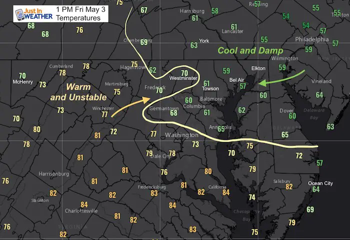
We need to watch the warmer air in the mountains for the source of developing storms. The edge of the warm air will be the edge of the marginal risk for storms to turn severe.

Afternoon Radar
Here we can see a flare up of storms in the mountains just over the West Virginia border. These will be riding the ridges to the east-northeast. But the timing is up for debate.

Radar Simulation —> slider
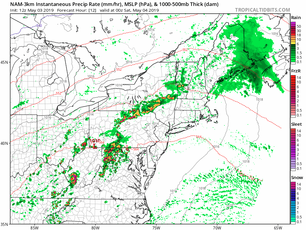
Here is a look at the NAM 3 Km Model simulation. This shows the storms beginning at 2 PM, an earlier forecast for just 15 minutes after the Doppler image above. It has under estimated this cluster… which is the focus for what will move our west this evening.
We need to watch the leading edge to possibly jump ahead of the timeline here by an hour or two. The bulk is likely to hit the western hills a few Horus before the risk to metro areas. But if we hold the easterly wind by the bay, a new cluster of showers could develop on the warm air boundary ahead of what this model displays here.
Please consider some margin or error with the projection here. There may be a few more storms, and the timing might arrive for you up to an hour earlier. My son has a baseball game tonight, and after two rainouts, we will be watching the radar closely.
[metaslider id=76299]
Rain notes:
- This evening: Showers and storms develop west and move into metro areas around and after sunset.
- Tonight: Rain, heavy at times.
- Saturday: Morning showers and fog. Afternoon should be dry, but storms will start to pop after 5 PM
- Saturday Night: Rain returns and may be heavy overnight
- Sunday: The morning looks wet. The latest guidance supports rain lingering off and on much of the day.
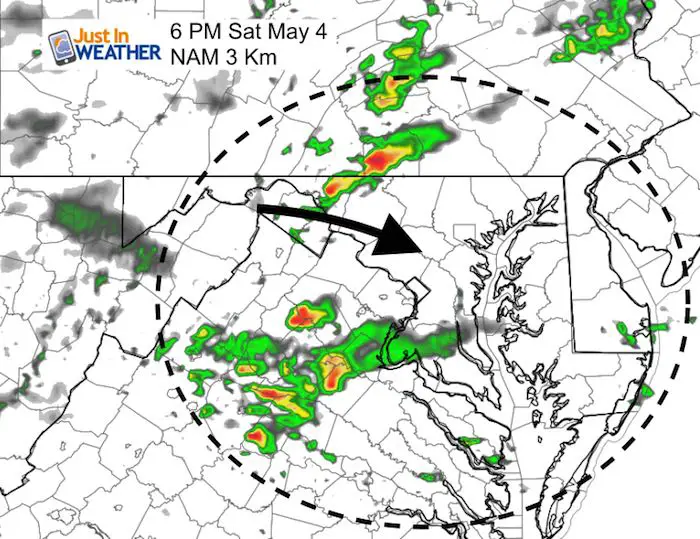
Saturday Afternoon/Evening Storms Rebuild
Rain Animation Through Sunday
Keep In Touch Every Day
Just in case you don’t get all posts on your social media feed, stay up to date with the latest info…
Click here to sign up for email alerts…. Be the first to hear any new weather.
Maryland Trek 6
Our look got an upgrade, but we have the same purpose. Please click the logo take a look at our new page.
- Consider joining our team for the week, a single day, or even as a sponsor.


New Partner
Buchanan Kia of Westminster is a supporter of Just In Power Kids and Maryland Trek 6 in August 2019.
Please share your thoughts, best weather pics/video, or just keep in touch via social media
-
Facebook: Justin Berk, Meteorologist
-
Twitter: @JustinWeather
-
Instagram: justinweather
Related Links:
Was Your County Not Included?
Click this map for more on the regional forecast zones
