Monday February 4 2019
Last night might have been the lowest score in the Super Bowl History, but at least we have come out of the lowest temperatures. We still have some cold air and freezing temps around. Combine that with fog and we have some advisories this morning. This once again my be confusing, but I can only pass along what your local National Weather Service Office issues and point out what is missing.
Temps will warm today and this week overall. Reminder that if you live by the water where there is ice, temperatures may be 10 to 20 degrees cool there.
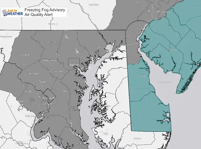
The Air Quality alert is due to light wind with warmer air aloft and cold ground/ice on the water. This allows pollution partials build up and what the air quality goes down.
Freezing Fog Advisory (Delaware ad New Jersey)
Air Quality Alert (West of the Chesapeake Bay/along I-95 to metro Philadelphia)
The Eastern Shore of Maryland often says they are ignored, and I understand. There is fog and Caroline County has a school delay, but no advisory. Please be careful driving as cold air with the fog may cause some spots to be icy.
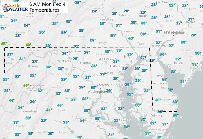
Morning Temperatures
Many areas in the 20s in areas where there is fog, but not an advisory… can lead to icy spots. Just drive with caution. Especially on bridges and overpasses.
Local Weather Stats For February 4, 2019 in Baltimore
Average High: 43ºF
Record High: 71ºF in 1991
Average Low: 25ºF
Record Low: 5ºF in 1918
*Record Snow: 7.2″ in 1995
Sunrise: 7:10 AM
Sunset 5:30 PM
*Daylight = 2:09 longer than yesterday
*Bay Water Temperature = 34ºF at Thomas Pt. Light House
Keep In Touch Every Day
Just in case you don’t get all posts on your social media feed, stay up to date with the latest info…
Click here to sign up for email alerts…. Be the first to hear any new weather.

New Partner
Buchanan Kia of Westminster is a supporter of Just In Power Kids and Maryland Trek 6 in August 2019.
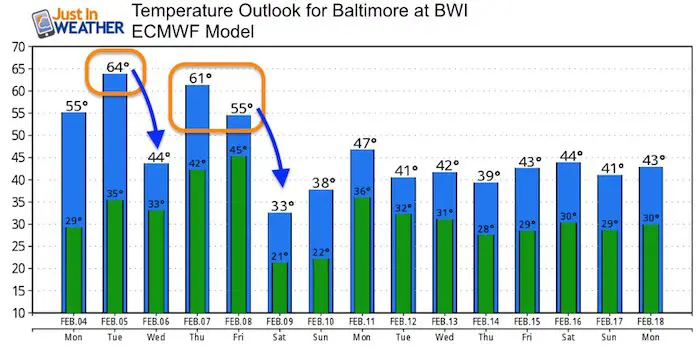
Temperatures This Week
Daily High Temperatures—> slider
[metaslider id=72557]
Weather Animation
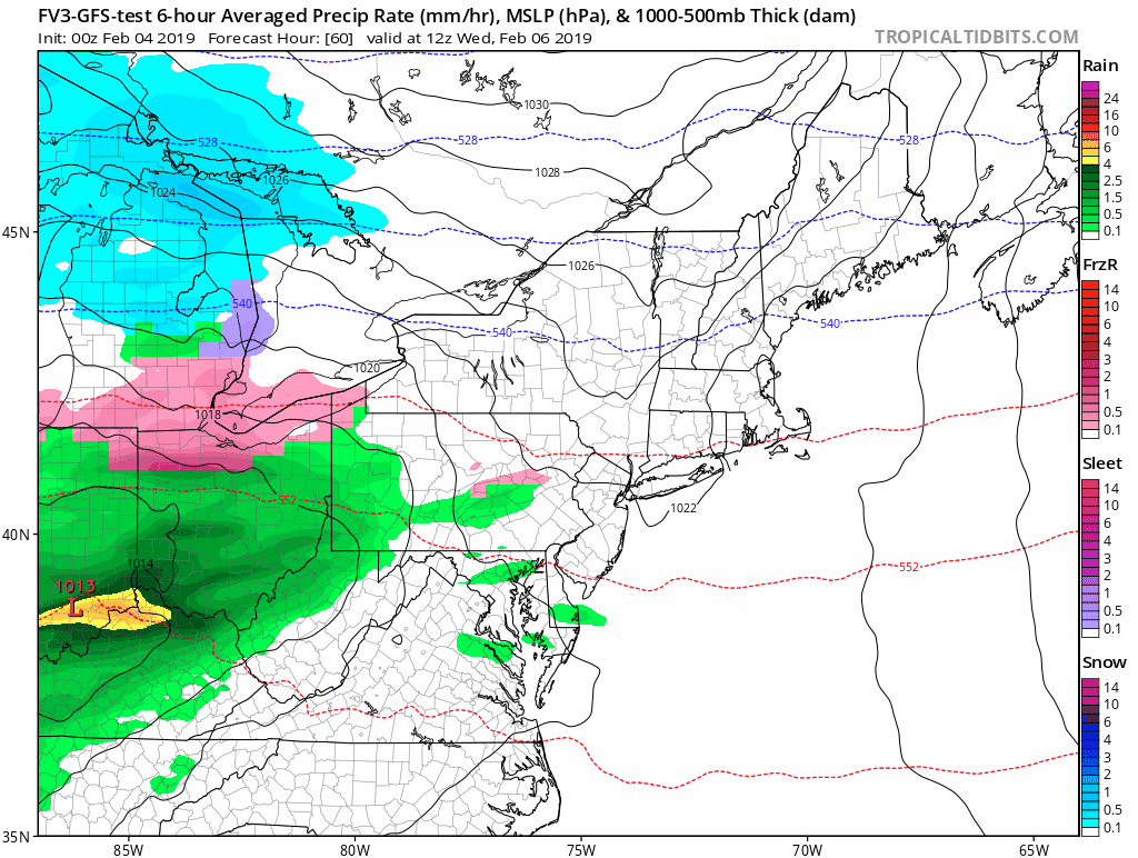
There will be some rain this week. The cool down will come with showers later Wednesday into Thursday morning. Then again on Friday to end the warm spell. The really warm air shown above for Thursday and Friday are all contingent on the front moving back north.
Outlook
After this warm week we should return to near ‘normal’ temperatures for the middle of February.

New Colors
We are giving 10% of each sale to Just In Power Kids: Providing FREE holistic care for pediatric oncology patients.

Please share your thoughts, best weather pics/video, or just keep in touch via social media
-
Facebook: Justin Berk, Meteorologist
-
Twitter: @JustinWeather
-
Instagram: justinweather
FITF and SnowStix

Related Links:
Winter Outlook
My Winter Outlook 2018-19: Multiple Nor’Easters and more snow

Interactive Snow Report
November 15 Snow Reports- Interactive Map Compared To My Forecast

Winter Snow And Top 5 Wet Years
Snowfall Seasons at Beginning and End of Top 5 Wet Years In Baltimore

Related Winter Outlooks
Solar Cycle: When Sun Spots Are Low We Get More Snow
El Nino Modoki May Enhance Snow Chances
Sweet Spot: Hitting 70ºF on Halloween is followed by more winter snow
Will A Wet Summer Bring A Snowy Winter?
NOAA Winter 2018-2019 Outlook Explained: This Actually Supports Snow
Winter Outlook From Two Different Farmers Almanacs
Maryland Winters: Snowfall Maps and Baltimore Snow History
