Wednesday January 23 2019
It is still cold this morning, but the storm on the way will be pushing in warmer air just in time for rain. Temperatures today will continue to warm up through midnight and even into Thursday morning. This will come with rain that will be so heavy Thursday morning, a Flood Watch has been issued for our central region. Included in this event might be a band of thunderstorms.
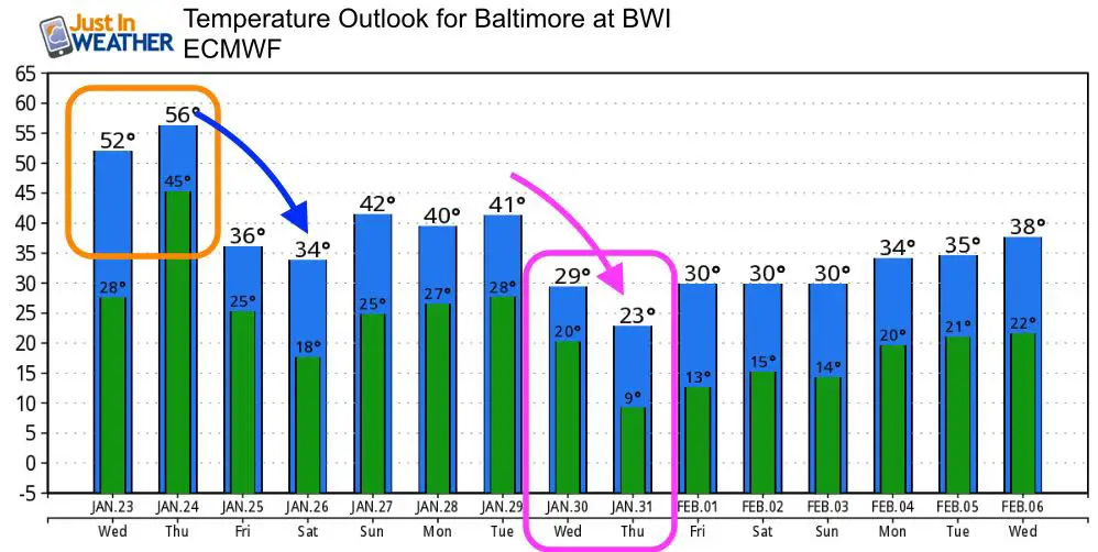
Below is a quick look at the temperatures and rain timeline. There may be some sleet at the start with some stray early showers, but the wintry weather will be north of Harrisburg. Once again, colder air will follow this storm. There are a few chances for snow next week, but I would hold off on declaring any events or labeling a storm at this time.
Anniversary: Today marks the largest snowstorm of all time in Baltimore. The calendar date had 25.5 inches of snow at BWI. I will have a look back posted during the day.
Flood Watch

Baltimore at 6 AM
- Temperature = 29ºF
- Wind Gusts: S 6
- Wind Chill = 23ºF
Local Weather Stats For January 23, 2019 in Baltimore
Average High: 41ºF
Record High: 73ºF in 1967
Average Low: 24ºF
Record Low: 0ºF in 1936
*Record Snow: 25.5* in 2016
Sunrise: 7:20 AM
Sunset 5:16 PM
*Daylight = 1:44 longer than yesterday
*Bay Water Temperature = 36ºF at Thomas Pt. Light House

New Partner
Buchanan Kia of Westminster is a supporter of Just In Power Kids and Maryland Trek 6 in August 2019.
Keep In Touch Every Day
Just in case you don’t get all posts on your social media feed, stay up to date with the latest info…
Click here to sign up for email alerts…. Be the first to hear any new weather.
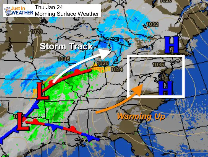
Morning Set Up
Weather Map
Temperatures

Afternoon


Midnight
Notice the warmer air


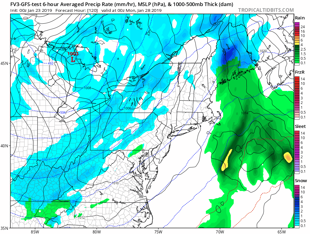
Radar Simulation Rain Timeline –> slider
The strong line with potential thunder has slowed a little. It may hold off until the end of the morning commute for Baltimore
[metaslider id=71698]
Rain Total Forecast

Outlook
The next two systems will come with colder air. We will watch for snow showers on Sunday and then perhaps a little more impact on Tuesday into Wednesday
Temperature Outlook
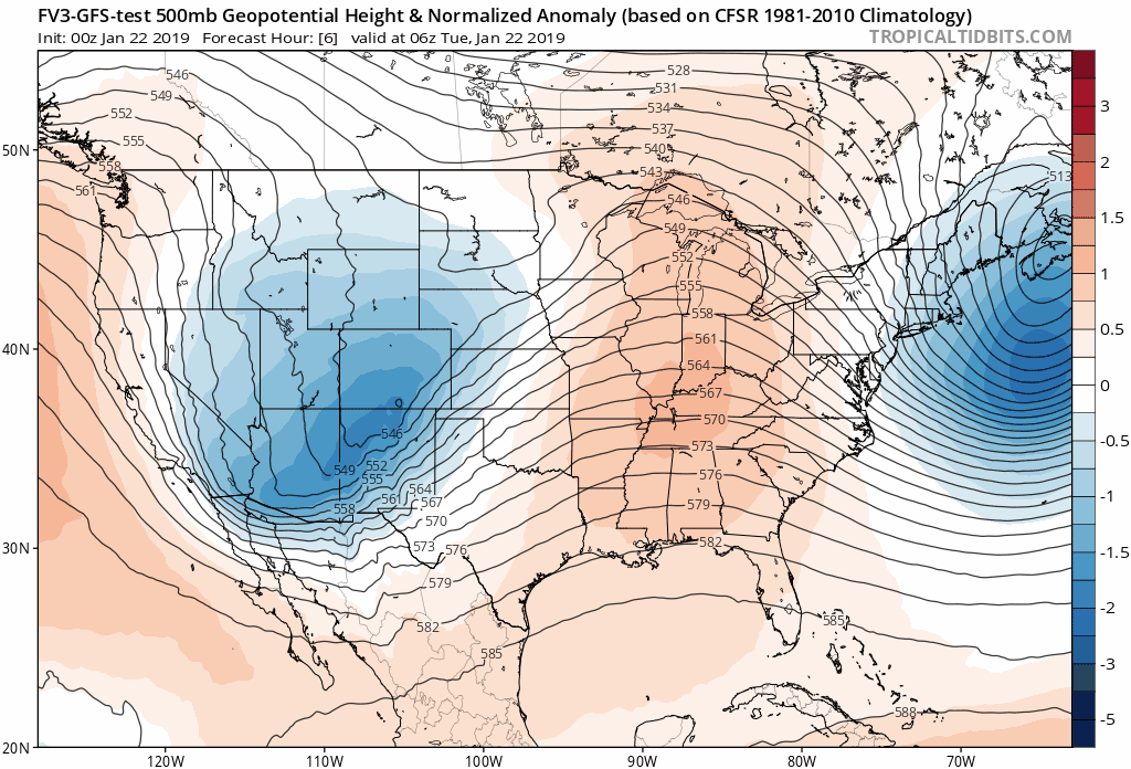
Outlook: Jet Stream
Winter is still here and has more to give us. Our luck is likely to change. FITF
We will be dominated by cold air (blue) pattens into February. There will be plenty of supply, but like above, no guarantee of storms at this time. I expect it will be active and worth watching for our winter prime time show.
SnowStix
We have added a bunch of new color options

We are giving 10% of each sale to Just In Power Kids: Providing FREE holistic care for pediatric oncology patients.
Please share your thoughts, best weather pics/video, or just keep in touch via social media
-
Facebook: Justin Berk, Meteorologist
-
Twitter: @JustinWeather
-
Instagram: justinweather
FITF and SnowStix

Related Links:
Winter Outlook
My Winter Outlook 2018-19: Multiple Nor’Easters and more snow

Interactive Snow Report
November 15 Snow Reports- Interactive Map Compared To My Forecast

Winter Snow And Top 5 Wet Years
Snowfall Seasons at Beginning and End of Top 5 Wet Years In Baltimore

Related Winter Outlooks
Solar Cycle: When Sun Spots Are Low We Get More Snow
El Nino Modoki May Enhance Snow Chances
Sweet Spot: Hitting 70ºF on Halloween is followed by more winter snow
Will A Wet Summer Bring A Snowy Winter?
NOAA Winter 2018-2019 Outlook Explained: This Actually Supports Snow
Winter Outlook From Two Different Farmers Almanacs
Maryland Winters: Snowfall Maps and Baltimore Snow History
