Saturday December 15 2018
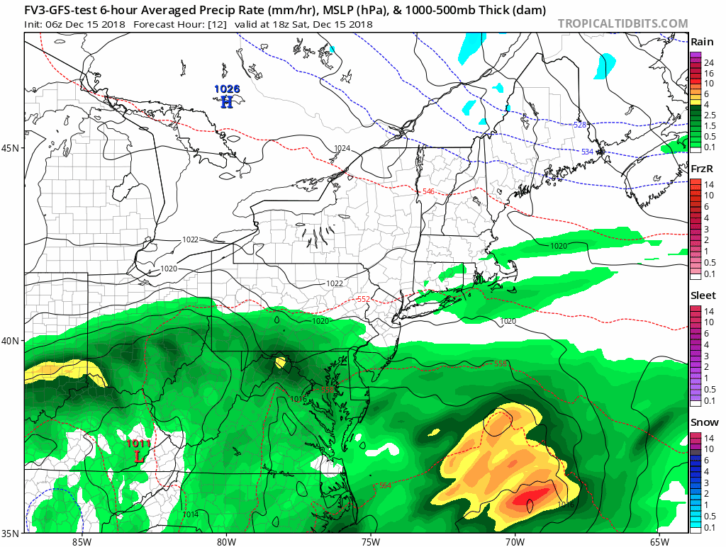
Seriously! How many times have we done this? A storm, on the weekend… Too many! Here we go again and the Flood Watch all weekend through Sunday morning. I truly believe should be expanded beyond Virginia and Maryland to include southern Pennsylvania and Delmarva. The entire region will have an additional 1 to 2 inches of rain and possibly some thunder. The rain will be heavy at times today and tonight.

Too Much Rain
On Friday, BWI recorded 0.22″ putting the yearly total now at 65.89″. We continue to add to the wettest year on record.
The soggy ground is why any rain could lead to flooding and even soften the soil for some trees to come down again.

Morning Set Up
The core Low Pressure is located in the southeast US. This surface map is having a hard time locating the primary Low, but you will see the upper level circulation easily in the satellite loop below. We still have areas of thick fog along with the rain as mild temperatures move in with a lot of moisture.

Satellite Loop
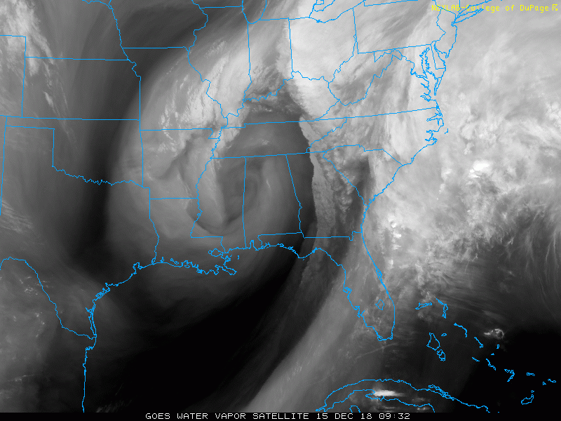
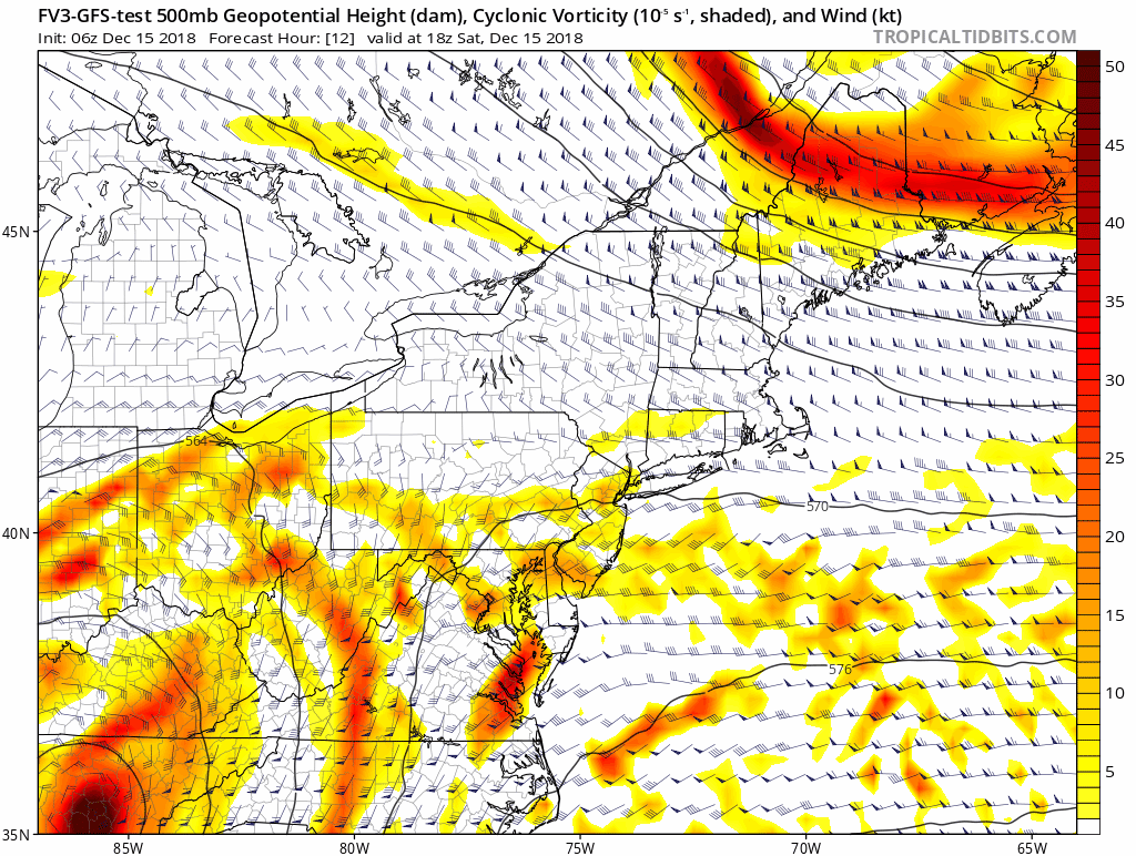
Tracking The Upper Low- Keeping Us Wet Through Sunday
Follow the circulation across southern Maryland and off of the coast. The dark bands that follow on Monday will be the colder air that I originally thought would bring us snow showers…. The set up now appears to stay to our north and miss most of us.
Thunder Possible

Storm Animation
The hourly sliders for today and tomorrow are below.
Today
Local Weather Stats For December 15 in Baltimore
Average High: 45ºF
Record High: 70ºF in 1971
Average Low: 28ºF
Record Low: 11ºF in 1960
*Record Snow: 5.7″ in 1905
Sunrise: 7:19 AM
Sunset 4:44 PM
*Daylight = 0:25 shorter than yesterday
*Bay Water Temperature = 40ºF at Thomas Pt. Light House
Rain Timeline Saturday —> slider
[metaslider id=69661]
High Temperatures

Rain Timeline Sunday —> slider
[metaslider id=69679]
Temperature Outlook

Snow Day Kit
Our ritual the night before a storm is finally in one kit. Maybe if more Maryland kids had this, the storm would reach us 🙂
- This includes a very soft raglan Tee printed inside out with #FITF AND the check list, #FITF spoon for under your pillow, ice cube tray with snowflake shapes, chalk, a #FITF wrist-band, a mini SnowStix, and a bag to carry it all in.
- Order by December 14 and it should arrive for the holiday.
- This will also help us give a free Snow Day Kit to each of the Just In Power Kids.

FITF and SnowStix Stores are now OPEN

Keep In Touch Every Day
Click here to sign up for email alerts…. Be the first to hear the big news over the weekend
Also- Just in case you don’t get the post on your social media feed
Please share your thoughts, best weather pics/video, or just keep in touch via social media
-
Facebook: Justin Berk, Meteorologist
-
Twitter: @JustinWeather
-
Instagram: justinweather
Keep In Touch Every Day
Click here to sign up for email alerts…. Just in case you don’t get the post on your social media feed
Related Links:
Winter Outlook
My Winter Outlook 2018-19: Multiple Nor’Easters and more snow

Interactive Snow Report
November 15 Snow Reports- Interactive Map Compared To My Forecast

Winter Snow And Top 5 Wet Years
Snowfall Seasons at Beginning and End of Top 5 Wet Years In Baltimore

Related Winter Outlooks
Solar Cycle: When Sun Spots Are Low We Get More Snow
El Nino Modoki May Enhance Snow Chances
Sweet Spot: Hitting 70ºF on Halloween is followed by more winter snow
Will A Wet Summer Bring A Snowy Winter?
NOAA Winter 2018-2019 Outlook Explained: This Actually Supports Snow
Winter Outlook From Two Different Farmers Almanacs
Maryland Winters: Snowfall Maps and Baltimore Snow History

Snowstix- We Need You To Measure Snow Too
We are giving 10% of each sale to Just In Power Kids: Providing FREE holistic care for pediatric oncology patients.
