 November 27 2018
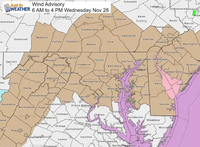
A windy Wednesday just flows off the tongue, if you can catch your breath. A Wind Advisory goes into effect at 6 AM and lasts through 4 PM on November 28 for most of our region. This is for winds that could gust to 45 mph (or higher). That can take down some tree branches or power lines. It may also move holiday decorations across the neighborhood.
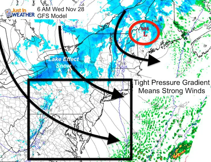
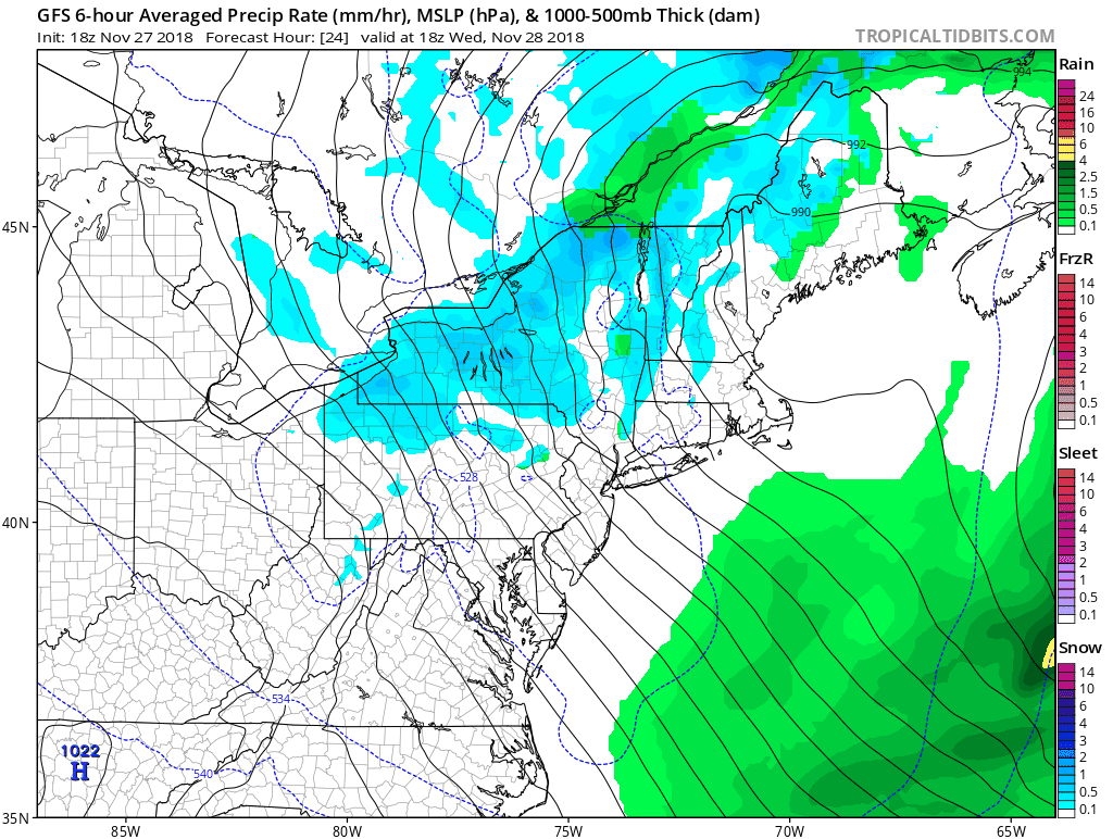
A strong storm in Maine will be cranking in mid-winter fashion. While it blows fresh snow on the New England ski resorts and Lake Effect will pound central New York, we just get the cold winds. The tight pressure gradient will result in increasing winds throughout the day.
Wind Timeline
There may be two impulses of wind. The top winds should be in the morning to mid day. But due to the dynamics of the storm, we could get a second surge of strong winds in the evening after the advisory expires. It will remain cold all day. So that despite the temperatures, it will feel like the 20s. Here are two views of the winds during the day. 1) Gusts; and 2) Wind Speed every other hour.
Wind Gusts —> slider
This model projection is still limited. There will be areas across a broader region that could gust higher than shown
[metaslider id=68945]
Wind Speed —> slider
Most of the day, wind speeds measured as a 1 minute average will range between 15 and 30 mph. The gusts will be the surges that push 45 mph.
[metaslider id=68954]
Looking Ahead
After the winds settle back, we will have a dry Thursday and most of Friday. Showers will return Friday afternoon/evening. Rain is likely on Saturday afternoon and night, ending Sunday morning.
Keep In Touch Every Day
Click here to sign up for email alerts…. Be the first to hear the big news over the weekend
Also- Just in case you don’t get the post on your social media feed
Please share your thoughts, best weather pics/video, or just keep in touch via social media
-
Facebook: Justin Berk, Meteorologist
-
Twitter: @JustinWeather
-
Instagram: justinweather
Keep In Touch Every Day
Click here to sign up for email alerts…. Just in case you don’t get the post on your social media feed
Related Links:
Winter Outlook
My Winter Outlook 2018-19: Multiple Nor’Easters and more snow

Interactive Snow Report
November 15 Snow Reports- Interactive Map Compared To My Forecast

Winter Snow And Top 5 Wet Years
Snowfall Seasons at Beginning and End of Top 5 Wet Years In Baltimore

Related Winter Outlooks
Solar Cycle: When Sun Spots Are Low We Get More Snow
El Nino Modoki May Enhance Snow Chances
Sweet Spot: Hitting 70ºF on Halloween is followed by more winter snow
Will A Wet Summer Bring A Snowy Winter?
NOAA Winter 2018-2019 Outlook Explained: This Actually Supports Snow
Winter Outlook From Two Different Farmers Almanacs
Maryland Winters: Snowfall Maps and Baltimore Snow History

FITF and SnowStix Stores are now OPEN

Snowstix- We Need You To Measure Snow Too
We are giving 10% of each sale to Just In Power Kids: Providing FREE holistic care for pediatric oncology patients.
