Tuesday November 27 2018
It is Giving Tuesday and the storm to our north is giving us plenty of wind and cold air. The snow is locked up to the north and some reaching western Maryland. After a few cold days, another storm reaches us making yet another wet weekend. The extended outlook does show the pattern change on target in early December after a mild start to the month.
Local Weather Stats For November 27 in Baltimore
Average High: 52ºF
Record High: 74ºF in 1896
Average Low: 33ºF
Record Low: 18ºF in 1991
*Record Snow: 3.5″ in 1978
Sunrise: 7:03 AM
Sunset 4:44 PM
*Daylight = 1:25 shorter than yesterday
*Bay Water Temperature = 47ºF at Thomas Pt. Light House
Record Rain Year Update:
The rain on Monday was 0.42″ at BWI. Considering the storm on the way this weekend and one month left in 2018, we may make a run for 70 inches.

Today is #givingTuesday but we always Give. A portion of all proceeds for FITF and SnowStix goes to our nonprofit Just In Power Kids- providing FREE holistic care for kids in and post cancer treatment.
The FITF Store Is Open With Gear And SnowStix
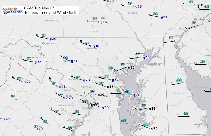
Morning Snapshot
The wind is the main weather story for the next two days. As of 6 AM, here are the regional observations.
Look at the (g) for Gusts in the 20 to 30 mph range.
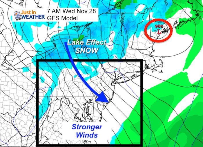
Weather Set Up
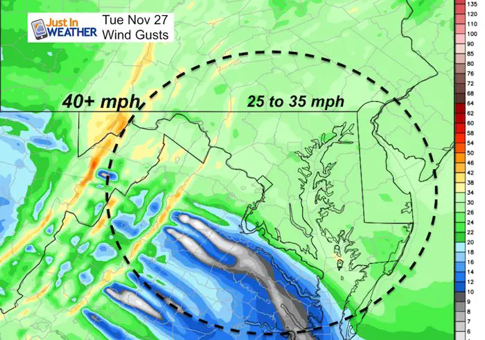
Low Pressure set up in New England will be crawling over the next 24 hours as it deepens. This will bring us gusty winds today and stronger winds Wednesday.
Today

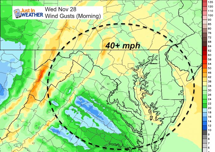
Wednesday
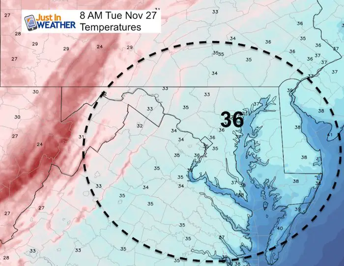
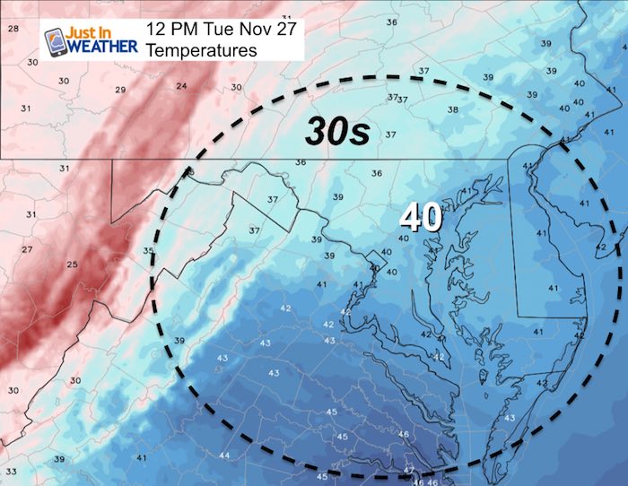
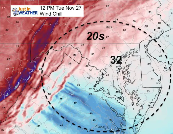
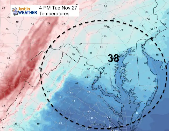
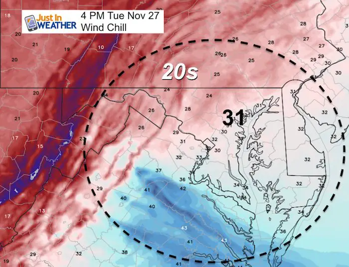
Temps And Wind Chill Today
Morning
 |
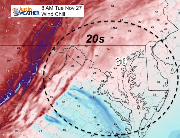 |
Noon
 |
 |
Afternoon
 |
 |
Wind Gusts
Gusty today, stronger tomorrow.
Looking Ahead
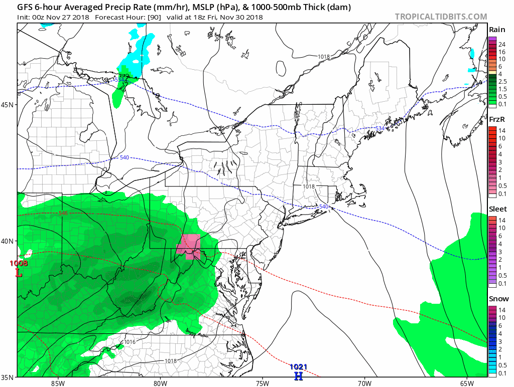
The next storm will bring showers Friday. At this point it looks like an afternoon arrival, so the risk of icing will be confined to the mountains. But heavy rain is expected on Saturday… especially in the afternoon (again).
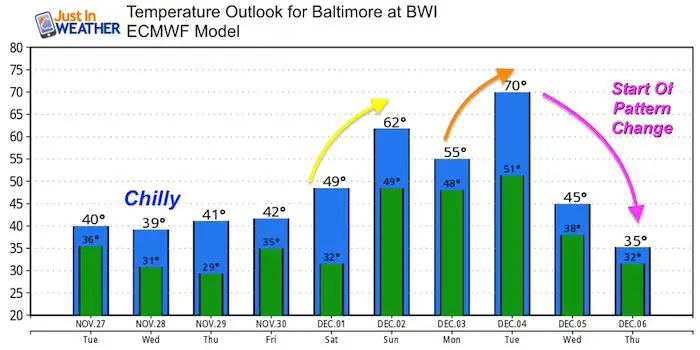
Temperature Outlook
After the weekend storm, warmer air will surge in… But don’t be lulled by the warm start to December. There will be a crash with the pattern change around December 5-8
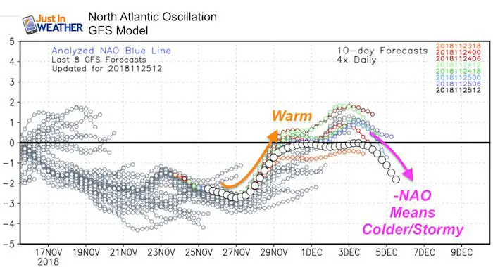
Pattern Outlook
The North Atlantic Oscillation (NAO) is the best predictor of cold and stormy patterns. It does NOT give specifics on storms, just the set up for the atmosphere to ‘turn’. This appears to show up between December 5th and 8th.
Keep In Touch Every Day
Click here to sign up for email alerts…. Be the first to hear the big news over the weekend
Also- Just in case you don’t get the post on your social media feed
Please share your thoughts, best weather pics/video, or just keep in touch via social media
-
Facebook: Justin Berk, Meteorologist
-
Twitter: @JustinWeather
-
Instagram: justinweather
Keep In Touch Every Day
Click here to sign up for email alerts…. Just in case you don’t get the post on your social media feed
Related Links:
Winter Outlook
My Winter Outlook 2018-19: Multiple Nor’Easters and more snow

Interactive Snow Report
November 15 Snow Reports- Interactive Map Compared To My Forecast

Winter Snow And Top 5 Wet Years
Snowfall Seasons at Beginning and End of Top 5 Wet Years In Baltimore

Related Winter Outlooks
Solar Cycle: When Sun Spots Are Low We Get More Snow
El Nino Modoki May Enhance Snow Chances
Sweet Spot: Hitting 70ºF on Halloween is followed by more winter snow
Will A Wet Summer Bring A Snowy Winter?
NOAA Winter 2018-2019 Outlook Explained: This Actually Supports Snow
Winter Outlook From Two Different Farmers Almanacs
Maryland Winters: Snowfall Maps and Baltimore Snow History

FITF and SnowStix Stores are now OPEN

Snowstix- We Need You To Measure Snow Too
We are giving 10% of each sale to Just In Power Kids: Providing FREE holistic care for pediatric oncology patients.
