Friday November 9 2018 2:20 PM
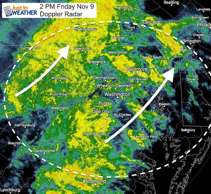
The moderate to heavy rain will be with us for the next few hours. The good thing is that it appears to be moving a little faster, so it might be out of here earlier this evening. But during this afternoon commute or plans for dinner or leaving town for the weekend will have to contend with what we know the rain will do: Slow down traffic. There is a chance for some area flooding in the downpours. Any risk of these turning severe might be on Delmarva where the temps are a bit warmer:
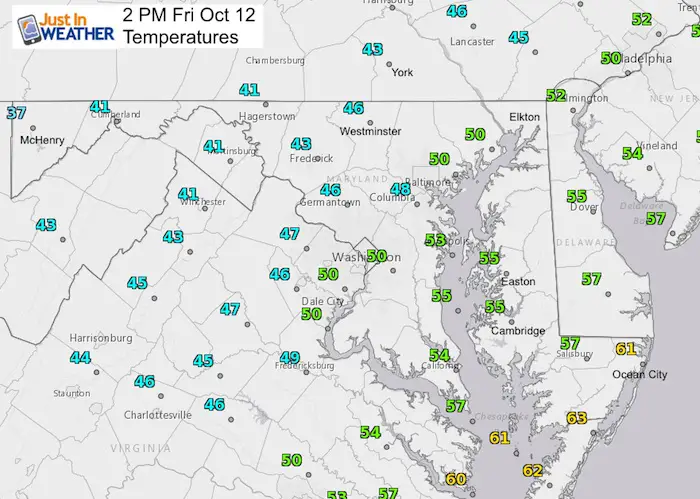
Temperatures at 2 PM
- 30s in western Maryland
- Mid 40s to mid 50s across central areas
- Ocean City in the lower 60s
Doppler Radar 2 Hour Loop
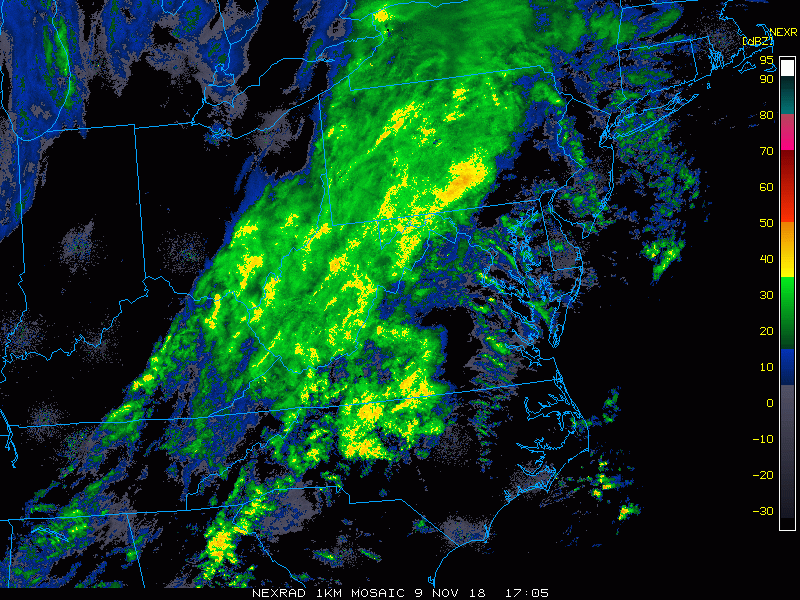
Doppler Radar Snapshot
Radar Simulation —> slider
Compare this first image to the Doppler Radar Snapshot above. The verified rainfall does look heavier that suggested by the model
[metaslider id=68080]
Note: Freeze Warnings have been posted for this weekend. More on that next
Cold Stuff
Normal First Frost/Freeze Dates
Winter Outlook
My Winter Outlook 2018-19: Multiple Nor’Easters and more snow

Related Winter Outlooks
Solar Cycle: When Sun Spots Are Low We Get More Snow
El Nino Modoki May Enhance Snow Chances
Sweet Spot: Hitting 70ºF on Halloween is followed by more winter snow
Will A Wet Summer Bring A Snowy Winter?
NOAA Winter 2018-2019 Outlook Explained: This Actually Supports Snow
Winter Outlook From Two Different Farmers Almanacs
FITF and SnowStix Stores are now OPEN

Snowstix- We Need You To Measure Snow Too
We are giving 10% of each sale to Just In Power Kids: Providing FREE holistic care for pediatric oncology patients.

Keep In Touch Every Day
Click here to sign up for email alerts…. Just in case you don’t get the post on your social media feed
Please share your thoughts, best weather pics/video, or just keep in touch via social media
-
Facebook: Justin Berk, Meteorologist
-
Twitter: @JustinWeather
-
Instagram: justinweather