 Friday November 9 2018
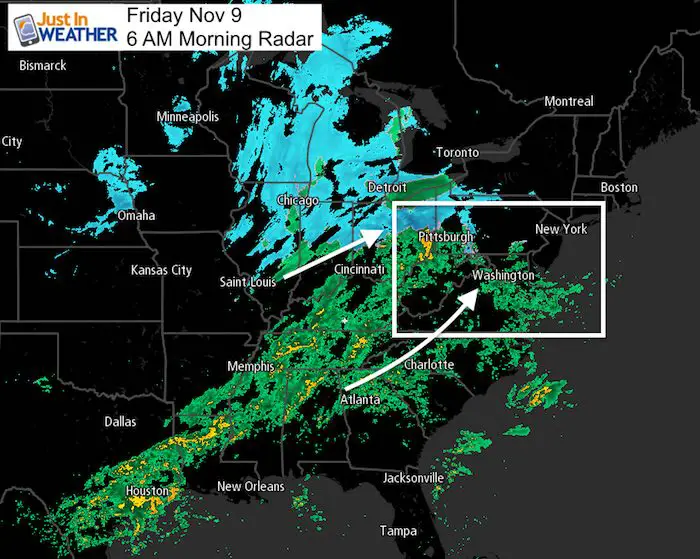
Today will be yet another wet Friday and we already have showers this morning. The start did produce some sleet in northern Maryland, but it will be just wet today. Widespread snow and a look of winter is dominating the national radar this morning. That will stay well to our west, but the complex is going to make the second have of our day ore active.
After a late morning break, there will be heavier rain moving in this afternoon between 3 and 8 PM. Strong storms with heavy downpours might be hard hitting across southern Maryland and Delmarva between 5 PM and 9 PM. Then very cold air will move in and you will definitely get the feel of winter this weekend. The next storm will bring rain Tuesday with another coastal storm that could bring wet snow across central Maryland as it ends.
Local Weather Stats For November 9 in Baltimore
Average High: 59ºF
Record High: 78ºF in 1994
Average Low: 38ºF
Record Low: 25ºF in 2003
Sunrise: 6:43 AM
Sunset 4:56 PM
*Daylight = 2:05 shorter than yesterday
*Bay Water Temperature = 56ºF at Thomas Pt. Light House
Rainfall 2018 Total: Rank 3rd Wettest Year
We could get the 2nd spot by next week

Morning Snapshot
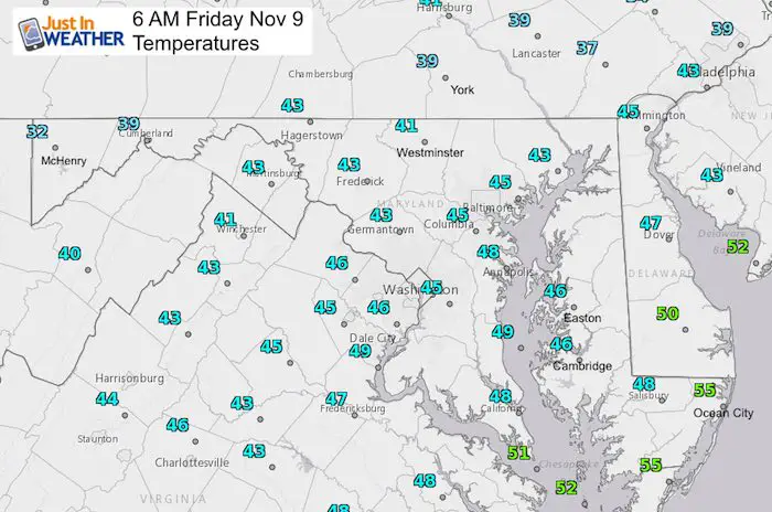
Temperatures
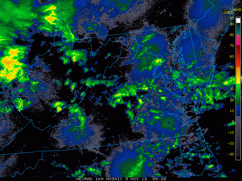
Radar
Radar Simulation—> slider
A few hours of showers then a break until around noon. Heavier rain will spread in mid afternoon until evening. Hard hitting storms across southern Maryland and Delmarva just after sunset.
[metaslider id=68080]
High Temperatures
Temperatures
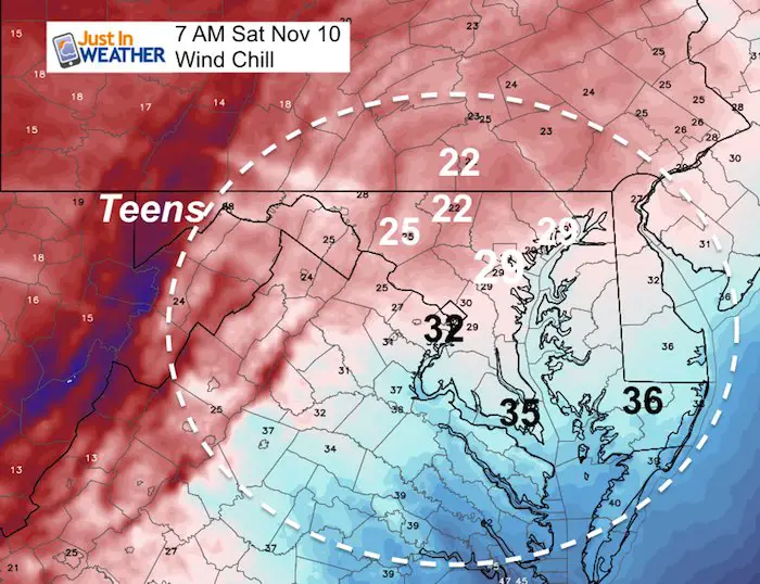
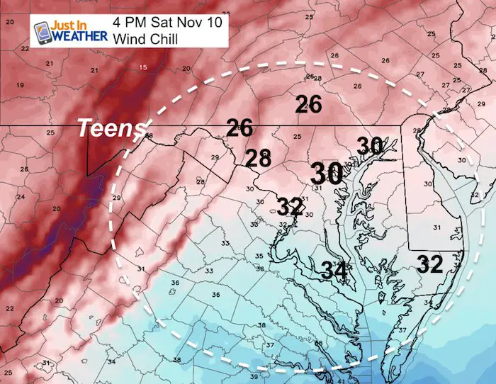
It is going to get cold! But the wind with that cold is going to really make it feel like winter
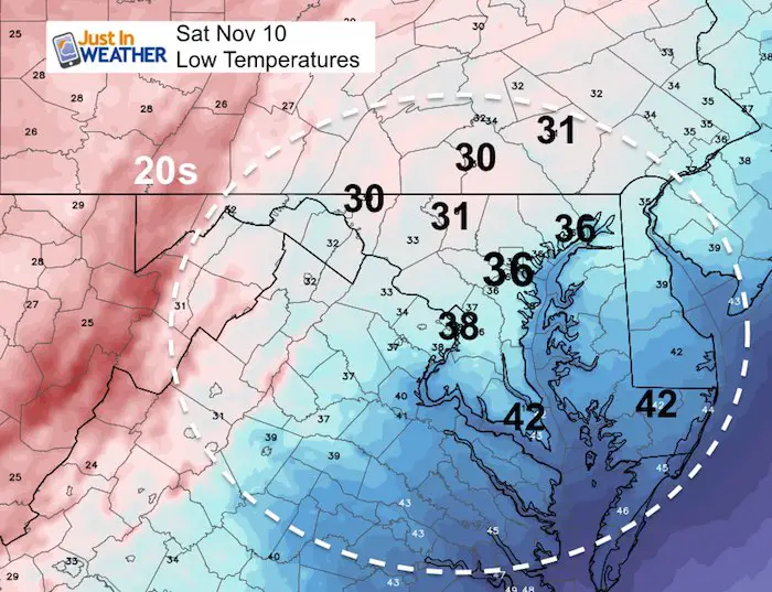
Saturday Morning Actual Temperatures
Saturday Morning Wind Chill
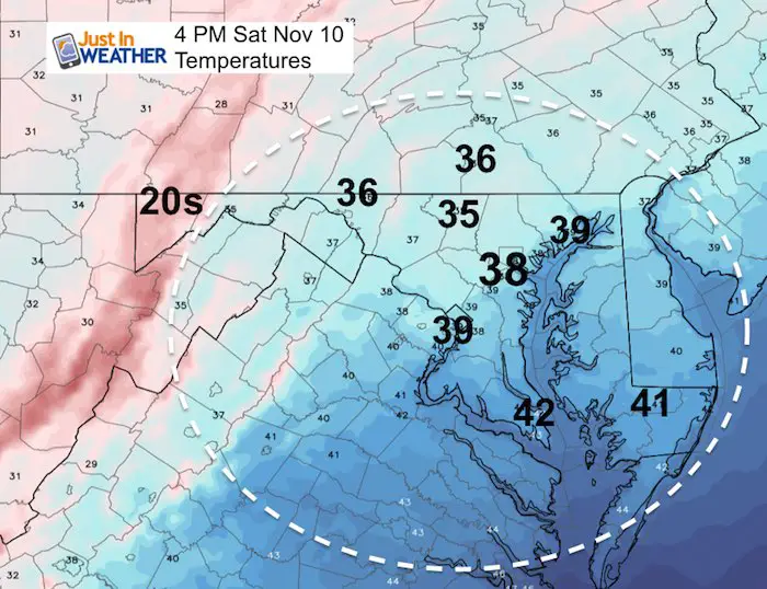
Saturday Afternoon Temperatures
Saturday Afternoon Wind Chill
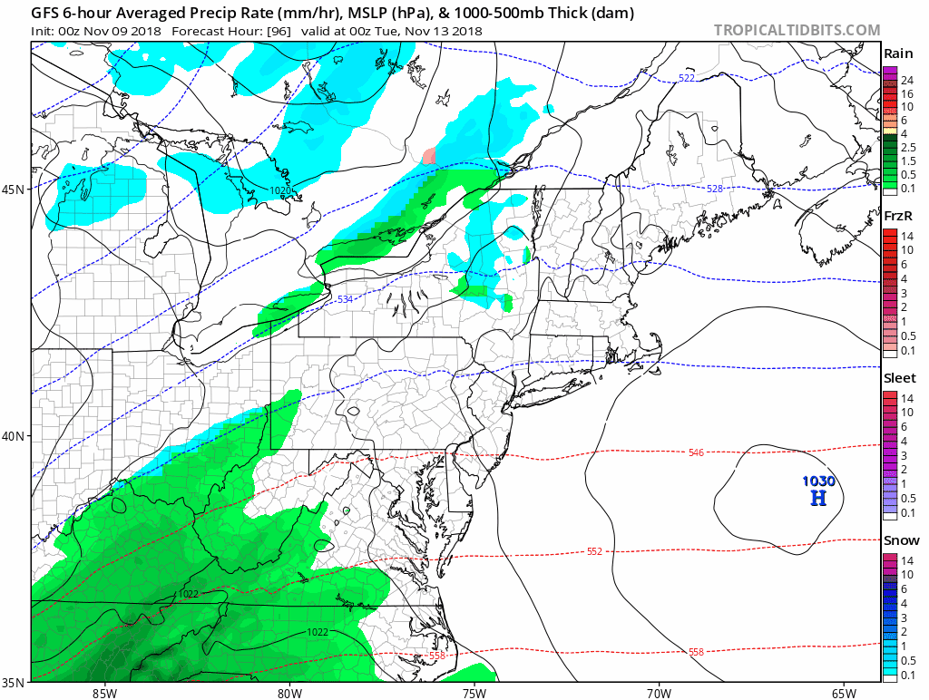
Next Storm…Tuesday
This will be yet another coastal storm/Nor’easter with the Low near VA Beach and Ocean City into New England. Check out the progression of the rain, then the snow in blue to follow.
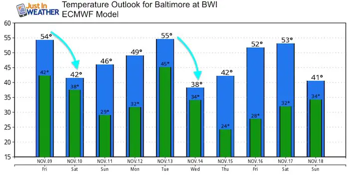
Temperature Outlook
Winter Outlook
My Winter Outlook 2018-19: Multiple Nor’Easters and more snow

Related Winter Outlooks
Solar Cycle: When Sun Spots Are Low We Get More Snow
El Nino Modoki May Enhance Snow Chances
Sweet Spot: Hitting 70ºF on Halloween is followed by more winter snow
Will A Wet Summer Bring A Snowy Winter?
NOAA Winter 2018-2019 Outlook Explained: This Actually Supports Snow
Winter Outlook From Two Different Farmers Almanacs
Cold Stuff
Normal First Frost/Freeze Dates
FITF and SnowStix Stores are now OPEN

Snowstix- We Need You To Measure Snow Too
We are giving 10% of each sale to Just In Power Kids: Providing FREE holistic care for pediatric oncology patients.

Keep In Touch Every Day
Click here to sign up for email alerts…. Just in case you don’t get the post on your social media feed
Please share your thoughts, best weather pics/video, or just keep in touch via social media
-
Facebook: Justin Berk, Meteorologist
-
Twitter: @JustinWeather
-
Instagram: justinweather