 Sunday November 11 2018
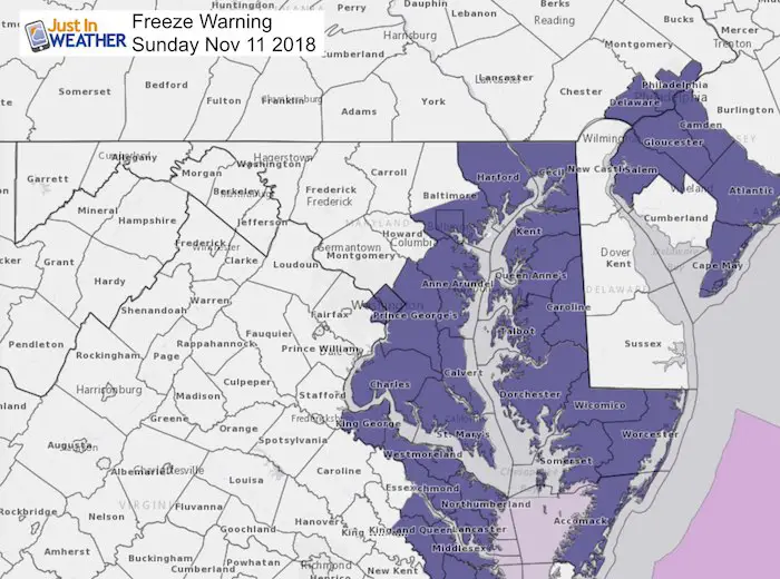
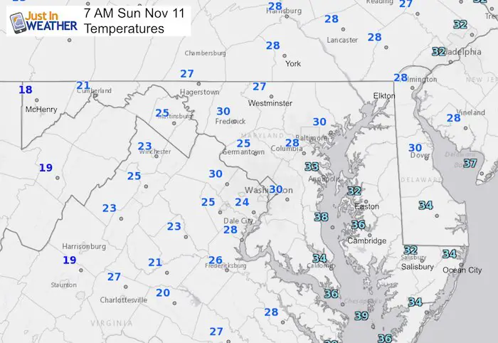
Veterans Day is a day starts of in the freeze for most areas. The Freeze Warning Expires this morning. The Eastern Shore of Maryland does not have a lot of weather stations reporting, but likely the borderline freeze near the water is contrasted with colder areas inland.
This day that adds something more special to my family as it is my younger son’s birthday. The good news is that there will be less wind, but it will remain colder and average outside all day.
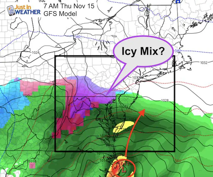
Next up is anther coastal storm. This one appears to be on the trend of arriving sooner, so rain will move in from the south later on Monday. The heaviest will be overnight, but we will have showers lingering on Tuesday. This timing is likely to not allow the colder air to bring in the first flakes to central Maryland. But, another storm right behind it could bring in some wintery icy mic on Thursday. Once again, we will be faced with a timing issue to determine if it matters.
Note Last year in this date we tied the record Low Temperature in Baltimore.
Local Weather Stats For November 11 in Baltimore
Average High: 58ºF
Record High: 77ºF in 2006
Average Low: 38ºF
Record Low: 21ºF in 2017
Sunrise: 6:45 AM
Sunset 4:55 PM
*Daylight = 2:02 shorter than yesterday
*Bay Water Temperature = 55ºF at Thomas Pt. Light House
Rainfall 2018 Total: Rank 3rd Wettest Year
We could get the 2nd spot by next week

Afternoon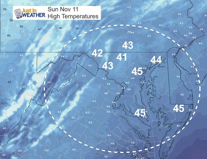
Monday Radar Simulation —> slider
[metaslider id=68140]
Storm Animation
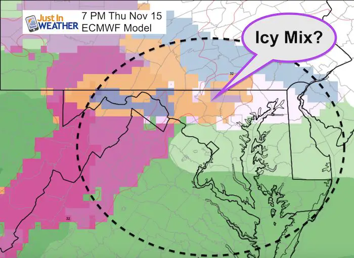
The first event will be Monday into Tuesday. The another storm arrives Thursday. Please see the comparison below. The timing on Thursday could make all the difference if we get any wintry precipitation in the area.

Thursday Ice?
I am only presenting the chance, but do not change any plans or go shopping for extra food yet. The timing is critical and a big difference shown here. If we get it in the morning then there may be a better chance for a pre dawn problem. But waiting until the end of the day will need it to be after sunset, and even then iffy at best to be an issue. GFS and European Model are 12 hours apart here…
GFS Model – Morning ‘Stuff’
European Model – Morning ‘Stuff’
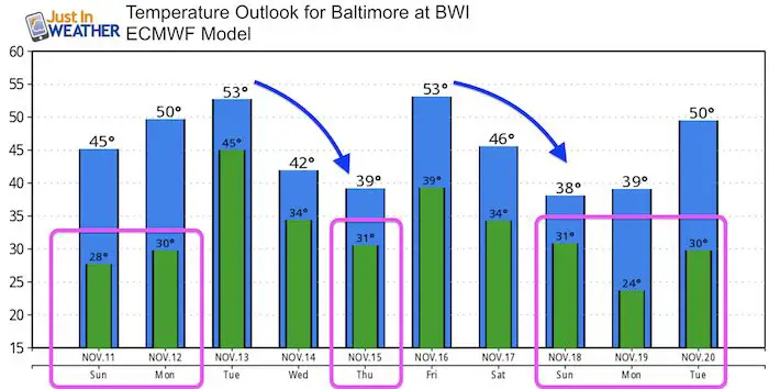
Temperature Outlook
Cold Stuff
Normal First Frost/Freeze Dates
Winter Outlook
My Winter Outlook 2018-19: Multiple Nor’Easters and more snow

Related Winter Outlooks
Solar Cycle: When Sun Spots Are Low We Get More Snow
El Nino Modoki May Enhance Snow Chances
Sweet Spot: Hitting 70ºF on Halloween is followed by more winter snow
Will A Wet Summer Bring A Snowy Winter?
NOAA Winter 2018-2019 Outlook Explained: This Actually Supports Snow
Winter Outlook From Two Different Farmers Almanacs
FITF and SnowStix Stores are now OPEN

Snowstix- We Need You To Measure Snow Too
We are giving 10% of each sale to Just In Power Kids: Providing FREE holistic care for pediatric oncology patients.

Keep In Touch Every Day
Click here to sign up for email alerts…. Just in case you don’t get the post on your social media feed
Please share your thoughts, best weather pics/video, or just keep in touch via social media
-
Facebook: Justin Berk, Meteorologist
-
Twitter: @JustinWeather
-
Instagram: justinweather