Monday October 8 2018
No rest for the weary. We have fog problems and Tropical Storm Micheal is expected to become a hurricane today. Hurricane Watches have been issue for the northern Florida Gulf Coast. That storm will reach us with rain later in the week. A full report on that storm below include the latest satellite loop and forecast tracks.
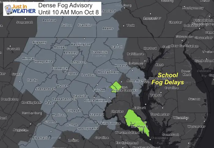
We start of this Monday morning with a muggy feel to the air and low visibility. The hint of leftover summer air and long nights has allowed the moisture in the air to condense and the result is a Dense Fog Advisory for many counties west of the Chesapeake Bay in Maryland. This is one of those confusing times when the National Weather Service local offices don’t seem to communicate. Fog is thick on the Eastern Shore as well and has resulted in school delays for Kent, Queen Annes, Caroline, and Dorchester Counties. But there has not been an advisory issued by their local office in Mount Holly NJ.
Local Weather Stats For October 8 in Baltimore
Average High: 69ºF
Record High: 91ºF in 12007
Average Low: 48ºF
Record Low: 31ºF in 2001
Sunrise: 7:09 AM
Sunset 6:38 PM
*Daylight = 2:31 shorter than yesterday
*Bay Water Temperature = 73ºF at Thomas Pt. Light House
Also see:
Will A Wet Summer Bring A Snowy Winter?
Winter Outlook From Two Different Farmers Almanacs
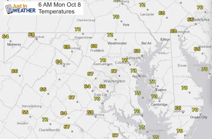
Morning Weather
Temperatures
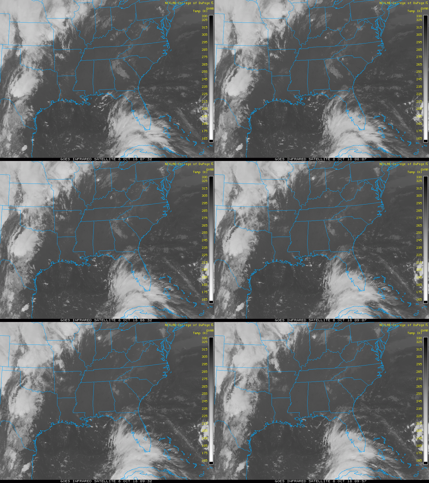
Satellite Loop
Morning fog will burn off and give way to hazy sun and a warm afternoon. The clouds of from Tropical Storm Michael are now reaching Florida at the bottom of the screen.
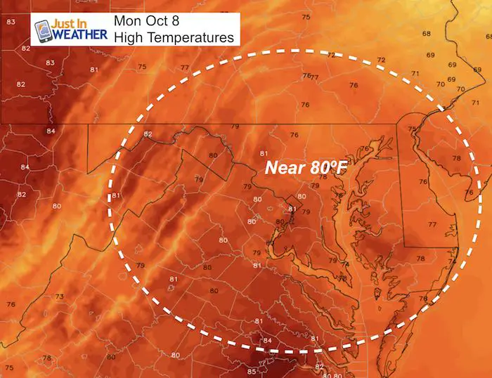
Afternoon Highs
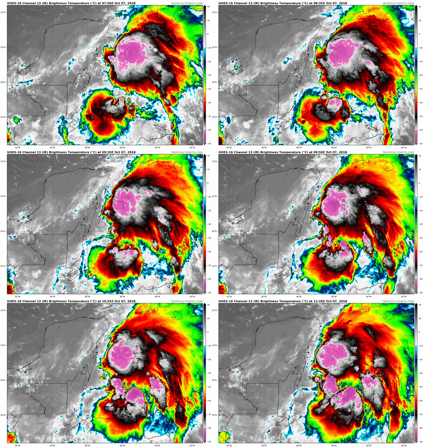
Tropical Storm Michael
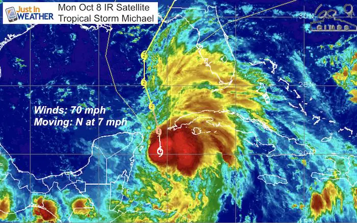
National Hurricane Center Morning Update
----------------------------------------------
LOCATION...20.6N 85.5W
ABOUT 90 MI...145 KM E OF COZUMEL MEXICO
ABOUT 100 MI...155 KM SSW OF THE WESTERN TIP OF CUBA
MAXIMUM SUSTAINED WINDS...70 MPH...110 KM/H
PRESENT MOVEMENT...N OR 360 DEGREES AT 7 MPH...11 KM/H
MINIMUM CENTRAL PRESSURE...983 MB...29.03 INCHES
Satellite Loop
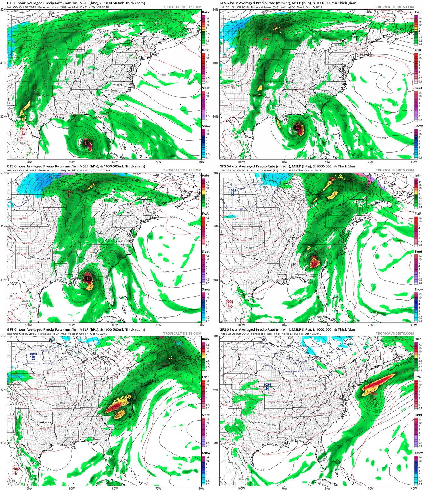
Forecast Models
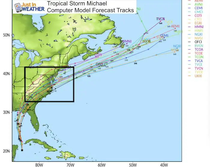
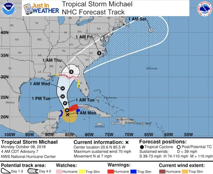
Hurricane Michale is expected to become a hurricane today but may reach Category 2 or 3 intensity Tuesday before making landfall.
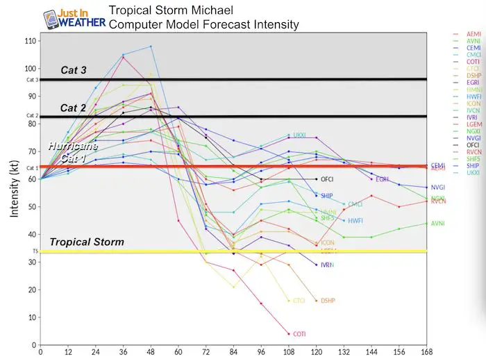
Micheal is expected to be a hurricane when it makes landfall on the Florida Panhandle late Tuesday or Wednesday morning. Then the track brings it north and curves across southeast Virginia Thursday. Heavy rain will spread into central Maryland.
Forecast Animation
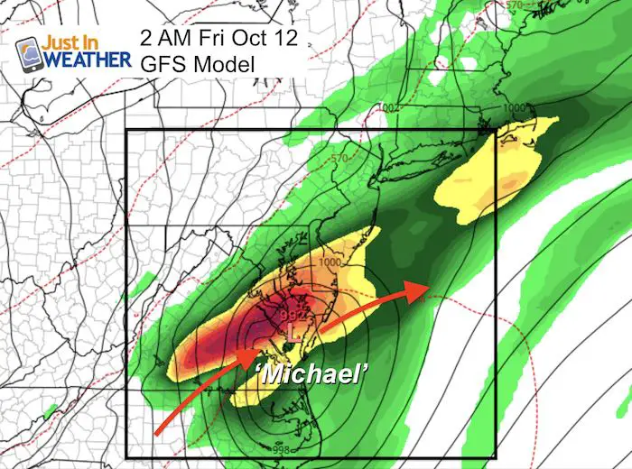
The bulk of the rain from Michael will reach us Thursday into Friday morning. Then clear out for the weekend. It appears the heaviest rain will fall south of Baltimore, but our area will get moderate to heavy rain and possible severe storms.
Snapshot of the closest pass Friday morning
Rainfall
It appears the heaviest rain will fall south of Baltimore, but our area will get moderate to heavy rain and possible severe storms.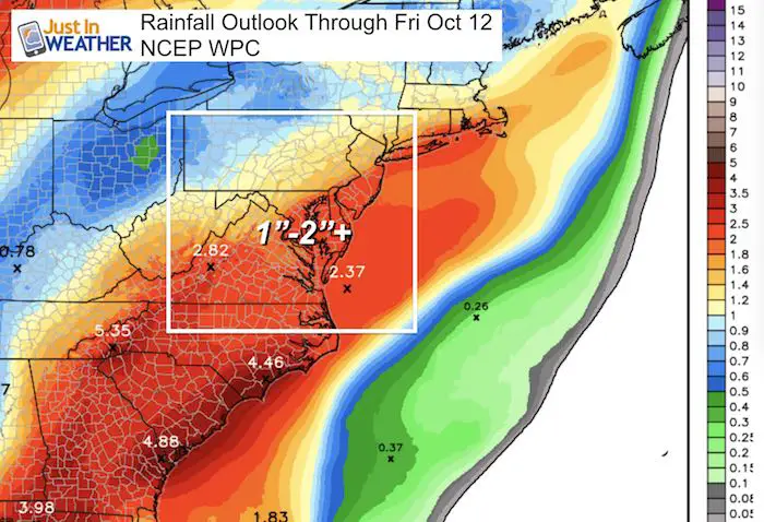
National Hurricane Center Forecast Track
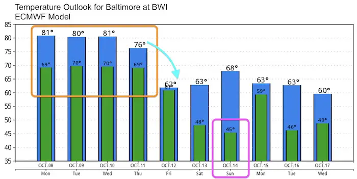
Temperature Outlook
After Micheal passes, chilly autumn air will move in for next weekend. Highs in the lower 60s with 50s inland. Lows in the mid 40s with inland areas possibly reaching the 30s and the first frost.
Keep In Touch Every Day
Click here to sign up for email alerts…. Just in case you don’t get the post on your social media feed
Please share your thoughts, best weather pics/video, or just keep in touch via social media
-
Facebook: Justin Berk, Meteorologist
-
Twitter: @JustinWeather
-
Instagram: justinweather
Love Maryland Shirt Designed By Jaiden

 Get the award winning Kid Weather App I made with my oldest son and support our love for science, weather, and technology. Our 3 year anniversary of the release and our contribution to STEM education is this November. It has been downloaded in 60 countries, and works in both temperature scales. With your support we can expand on the fun introduction to science and real weather.

