October 6 2018
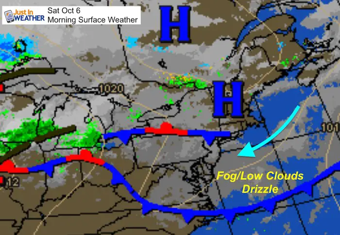
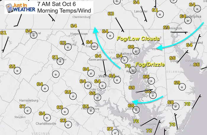
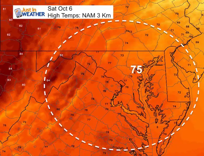
This weekend starts off with low clouds, fog, and some drizzle. This does not show up well on radar, but a few showers have moved in from the Atlantic on coastal Delmarva. The flow off of the Bay has helped with some fog and drizzle in central Maryland and the northern hills into PA as well. Below is a look at the expected cloud cover that will try to thin out this afternoon, but repeat the clouds overnight and Sunday morning. Temps will be moderate but warm back to the 80s and stay there all week.
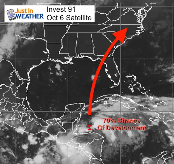
The other item to watch this morning is a possible Tropical Storm developing in the Gulf of Mexico. This is expected to move north and bring some heavy rain into our region at the end of the week. See more below.
Local Weather Stats For Friday October 6 in Baltimore
Average High: 70ºF
Record High: 95ºF in 1941 *Part of a 3-Day record heat wave in 1941
Average Low: 49ºF
Record Low: 33ºF in 1965
Sunrise: 7:07 AM
Sunset 6:41 PM
*Daylight = 2:32 shorter than yesterday
*Bay Water Temperature = 72ºF at Thomas Pt. Light House
Also see:
Will A Wet Summer Bring A Snowy Winter?
Winter Outlook From Two Different Farmers Almanacs
Morning Set Up
Temperatures
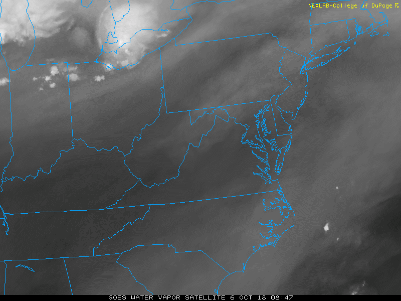
Satellite Loop
This does not look like much as low clouds don’t show up well.
Hourly Cloud Cover —> slider
We may get some breaks in the clouds during the afternoon. There is a better chance for sun farther inland.
[metaslider id=66454]
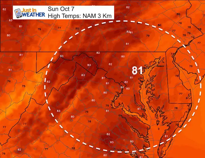
High Temperatures
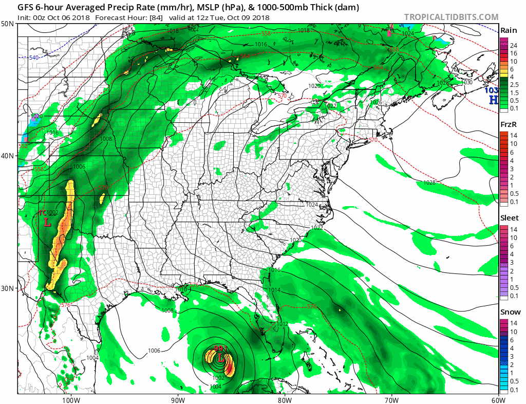
Tropical Outlook
Invest 91 – The technical name for an organizing system entering into the southern Gulf of Mexico. This has a 70% chance for developing to a Tropical Storm in the next 5 days. If so, this would be named Michael. Often there is a second surge of activity in the tropical Atlantic during the month of October.
The reason this is important to us is that it has already changed the long range computer model outlooks. The development and track should pass to our south, but send heavy rain up our way. However, this could pull a cold front through before next weekend, when without this storm it was expected to remain stalled.
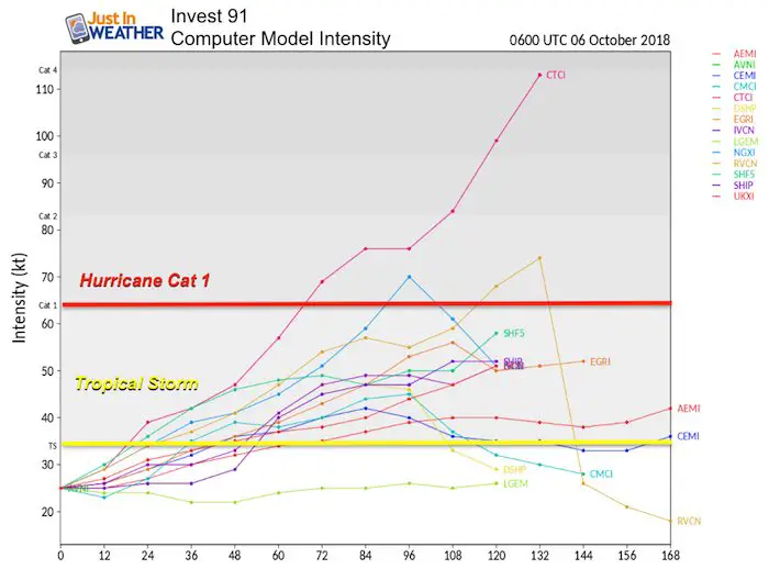
Forecast Intensity
The consensus shows intensity reaching tropical storm intensity between Sunday and Tuesday.
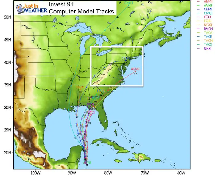
Forecast Tracks
The movement to the north, staying just east of Cancun. Then the interaction with a cold front will determine if ion curves to our south or hits us directly.
Forecast Animation (one possibility)
Should this storm develop, we get a change in our forecast to bring in more rain Wednesday and Thursday. The GFS model here shows a track over flood stricken South and North Carolina. But the organized system would help to pull the front through and drag in cooler air for next weekend.
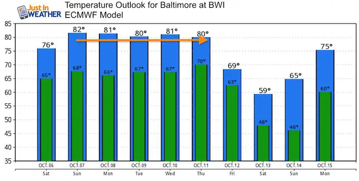
Temperature Outlook
We are still in for a warm week ahead. But the drop in temps appears to arrive abruptly. That would be behind ‘Michael. Yes, the result of a tropical storm could bring in lows in the 40s behind it. Stay tuned. I expect some adjustment of the track and timing.
Keep In Touch Every Day
Click here to sign up for email alerts…. Just in case you don’t get the post on your social media feed
Please share your thoughts, best weather pics/video, or just keep in touch via social media
-
Facebook: Justin Berk, Meteorologist
-
Twitter: @JustinWeather
-
Instagram: justinweather
Love Maryland Shirt Designed By Jaiden
 |
|
This shirt was designed by my ‘bonus’ daughter Jaiden. All proceeds will go to Just In Power Kids and free holistic therapy for kids in and post cancer treatment.
Show your love for Maryland and make this 14 year old artist extra proud
|
![]()
 Get the award winning Kid Weather App I made with my oldest son and support our love for science, weather, and technology. Our 3 year anniversary of the release and our contribution to STEM education is this November. It has been downloaded in 60 countries, and works in both temperature scales. With your support we can expand on the fun introduction to science and real weather.