Friday October 5
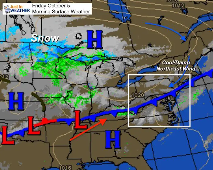
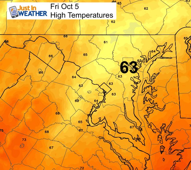
You should notice a difference in the weather this morning as reality has returned. Temps are dropping into the 60s with a shift in the wind and we won’t warm much today. A cold front is draped across our area, but the down side is that it will get stuck and keep some showers around today. As it tried to move back north and warm us up again, Saturday morning will start with fog and drizzle.
Confession: One of my clients is Johns Hopkins and they have family weekend with a lot of events. Initially it looked like an easy call for the cold front to pass and give us a nice weekend. Now that the front is stalling, that changes everything. The eruption of storms last night in metro Baltimore and central Maryland is the same area with the atmospheric weakness fro two days. We will improve Saturday afternoon and get back to the warm spell Sunday.
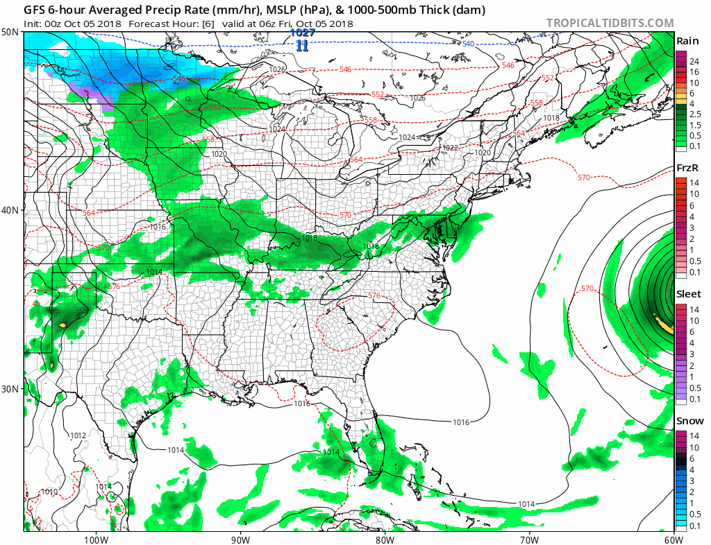
Contrast that with the first snow in the northern US. A Winter Weather Advisory is in place for much of North Dakota and Northern Minnesota. They are expecting 1 to 3 inches of snow. That may not sound like much, but in early October, it is a big deal. As we warm back up next week, this area plus the Rockies could get another larger snow event. FITF
Local Weather Stats For Friday October 5 in Baltimore
Average High: 70ºF
Record High: 97ºF in 1941 *Hottest for the month and first of 3-Day record heat wave in 1941
Average Low: 49ºF
Record Low: 35ºF in 1996
Sunrise: 7:06 AM
Sunset 6:42 PM
*Daylight = 2:32 shorter than yesterday
*Bay Water Temperature = 74ºF at Thomas Pt. Light House
Also see:
Will A Wet Summer Bring A Snowy Winter?
Winter Outlook From Two Different Farmers Almanacs
Morning Set Up
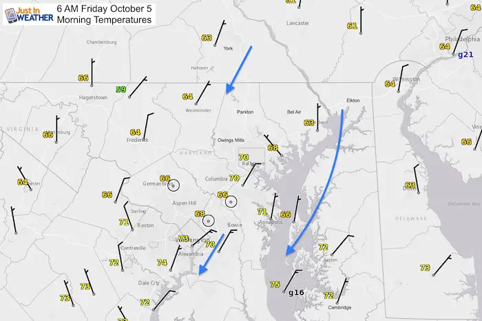
Temperatures
The wind direction is key. The shift to the north is why we expect it to remain cool today. A shift further to the northeast will help keep clouds around and showers develop mid day and early afternoon.
Radar Simulation —> slider
[metaslider id=66422]
High Temperatures
Rain and Snow Animation
Watching the snow across the northern US. We will be on the edge of rain, but on the warm side next week. The next big chance for rain or storms will be next Friday
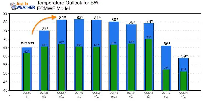
Temperature Outlook
Also See: Warm October Outlook (and why it could mean more winter snow)
Keep In Touch Every Day
Click here to sign up for email alerts…. Just in case you don’t get the post on your social media feed
Please share your thoughts, best weather pics/video, or just keep in touch via social media
-
Facebook: Justin Berk, Meteorologist
-
Twitter: @JustinWeather
-
Instagram: justinweather
Love Maryland Shirt Designed By Jaiden
 |
|
This shirt was designed by my ‘bonus’ daughter Jaiden. All proceeds will go to Just In Power Kids and free holistic therapy for kids in and post cancer treatment.
Show your love for Maryland and make this 14 year old artist extra proud
|
![]()
 Get the award winning Kid Weather App I made with my oldest son and support our love for science, weather, and technology. Our 3 year anniversary of the release and our contribution to STEM education is this November. It has been downloaded in 60 countries, and works in both temperature scales. With your support we can expand on the fun introduction to science and real weather.