 Monday July 9 2018
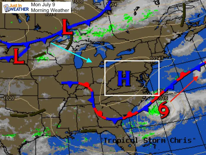
Our great weather weekend has been thanks to the strongest high pressure in 30 years. This morning was another morning with lows in the 50s, but that is about the change. Our weather system has kept Tropical Storm Chris from moving onshore, and now will do two things: 1) Push Chris into the Atlantic; 2) Allow the heat to return.
Below is an amazing look at a double circulation off of the coast, but first we have some local weather to pay tribute to. Bu the way, only a small chance of rain with a cold front passing Tuesday evening. Otherwise the action remains off of the coast.
Stats For July 9 in Baltimore
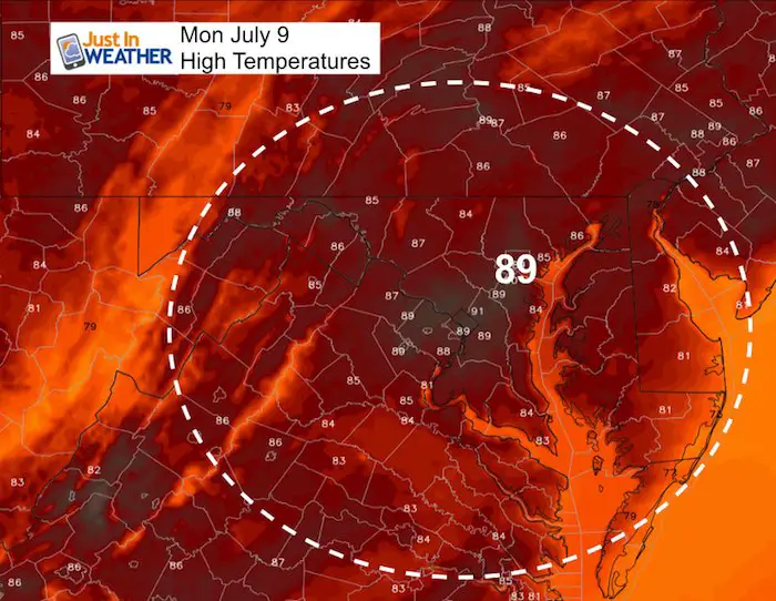
Average High: 88ºF
Record High: 103ºF in 1936
Average Low: 67ºF
Record Low: 55ºF in 2014
Sunrise: 5:48 AM
Sunset 8:34 PM
*Daylight = 1:00 shorter than yesterday
*Bay Water Temperature = 78ºF at Thomas Pt. Light House
Keep In Touch Every Day
Click here to sign up for email alerts…. Just in case you don’t get the post on your social media feed
Please Support Maryland Trek 5
329 miles hiking and biking in 7 days
To provide free integrated wellness programs for kids in and post cancer treatment
*If you want to join my team for a day, a few days, or the whole week, please ask me for more info.
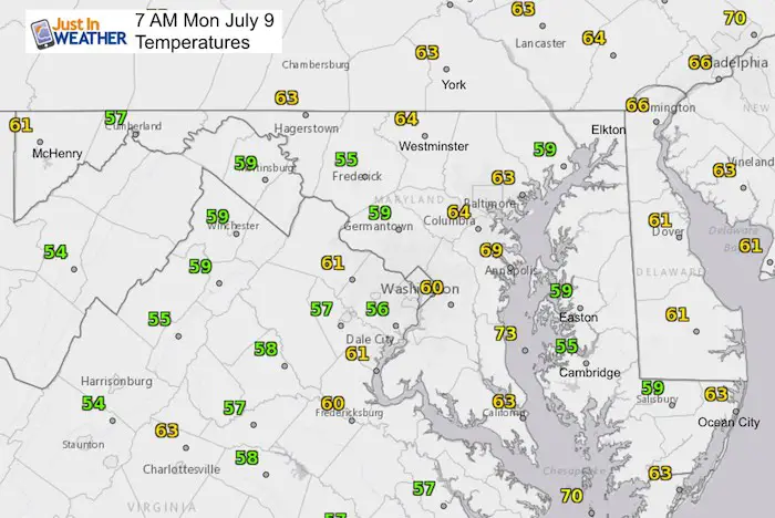
Morning Set Up
Afternoon High Temps
Today
Tuesday
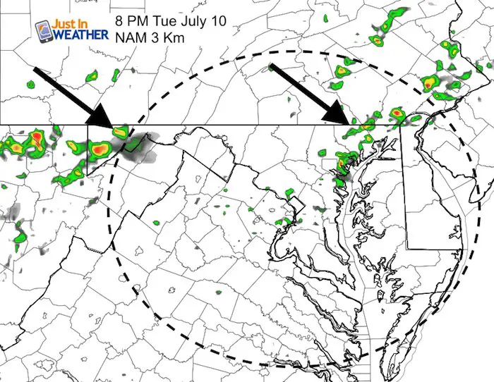
Tuesday Evening: Scattered Showers
This line of rain is not solid, so only hit or miss showers expected
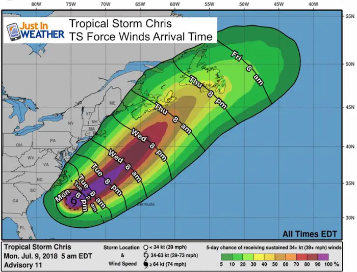
Tropical Storm Chris
Winds are up to 60 mph and there is plenty of warm water in the Gulf Stream to support intensification. But, our large High Pressure will keep it off shore and steer to the northeast.
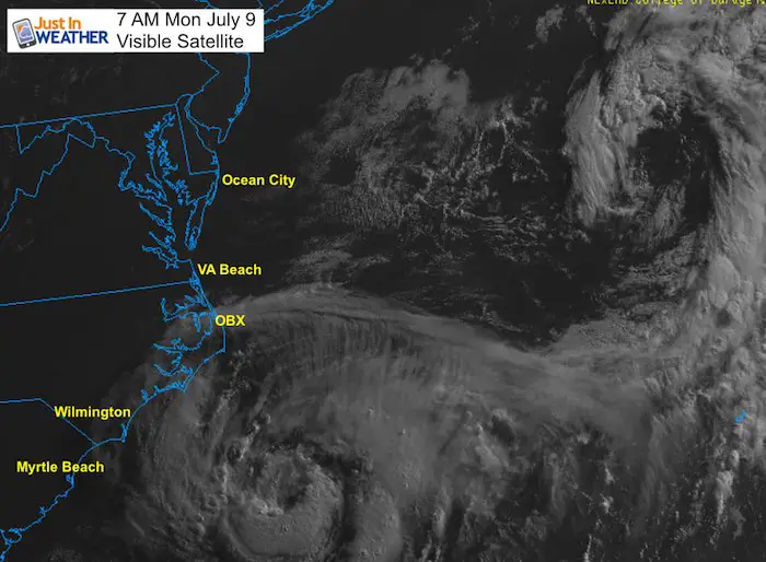
Tropical Storm Chris Satellite Loop
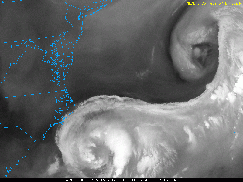
This water vapor imagery is amazing with a double vortex… That second circulation is remaining well offshore.
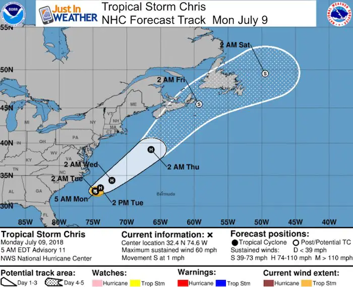
Tropical Storm Chris
This is expected to reach hurricane intensity by Tuesday. Rip Currents will be the biggest impact at the Delmarva Beaches.
SUMMARY OF 500 AM EDT...0900 UTC...INFORMATION
----------------------------------------------
LOCATION...32.4N 74.6W
ABOUT 200 MI...320 KM SSE OF CAPE HATTERAS NORTH CAROLINA
MAXIMUM SUSTAINED WINDS...60 MPH...95 KM/H
PRESENT MOVEMENT...S OR 180 DEGREES AT 1 MPH...2 KM/H
MINIMUM CENTRAL PRESSURE...999 MB...29.50 INCHES
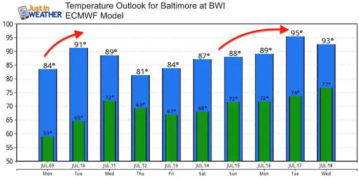
Temperature Outlook
Note: The ECMWF Model has been running cool. So the heat displayed next week might end up hotter. It looks like a nice weekend but another heat wave next week.
Please share your thoughts, best weather pics/video, or just keep in touch via social media
-
Facebook: Justin Berk, Meteorologist
-
Twitter: @JustinWeather
-
Instagram: justinweather
Keep In Touch Every Day
Click here to sign up for email alerts…. Just in case you don’t get the post on your social media feed
Shine On
Proceeds from all sales go to Just In Power Kids. Click the image to shop and show your support.

![]()
 Get the award winning Kid Weather App I made with my oldest son and support our love for science, weather, and technology. Our 3 year anniversary of the release and our contribution to STEM education is this November. It has been downloaded in 60 countries, and works in both temperature scales. With your support we can expand on the fun introduction to science and real weather.