 Saturday July 7
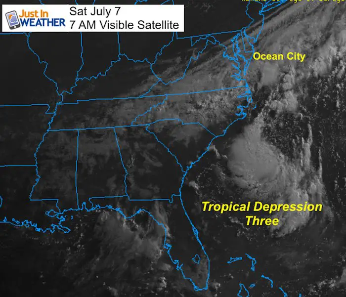
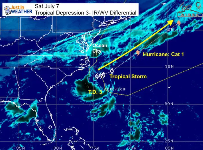
This morning the temperatures AND dew points have dropped. You will notice that as soon as you step outside, however there is one wrinkle in this beautiful weekend forecast. Clouds are lingering across central and southern Maryland through the Delmarva beaches. That is the back edge of the cold front that ended out heat wave and it is stalled because of tropical depression three off of the South Carolina Coast.
This storm is expected to develop into a tropical storm this weekend and hurricane early next week. It will be named Chris and it will move away from the coast. But as the sun returns, rip currents will be a beach issue for a few days early next week.
Stats For July 7 in Baltimore
Note: Remember the hot summer of 2012? The record high on this date was set that year at 104ºF. One of the top 10 hottest days on record.
Average High: 87ºF
Record High: 104ºF in 2012
Average Low: 67ºF
Record Low: 55ºF in 2014
Sunrise: 5:46 AM
Sunset 8:35 PM
*Daylight = 0:53 shorter than yesterday
*Bay Water Temperature = 80ºF at Thomas Pt. Light House
Keep In Touch Every Day
Click here to sign up for email alerts…. Just in case you don’t get the post on your social media feed
Please Support Maryland Trek 5
329 miles hiking and biking in 7 days
To provide free integrated wellness programs for kids in and post cancer treatment
*If you want to join my team for a day, a few days, or the whole week, please ask me for more info.
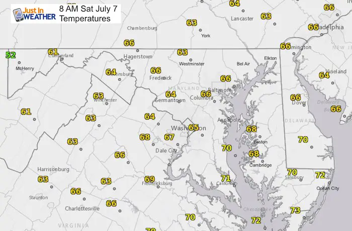
First Our Temperatures This Morning And All Weekend Look GREAT
Morning
Look at all of those 60s… Ahhhh
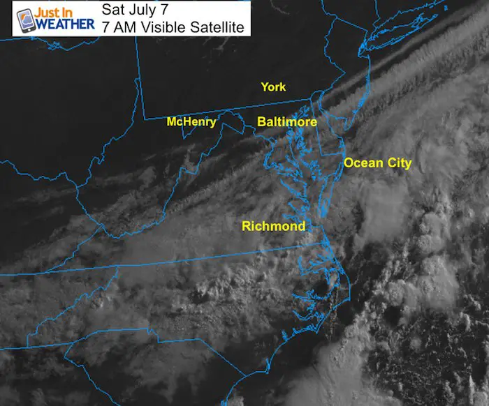
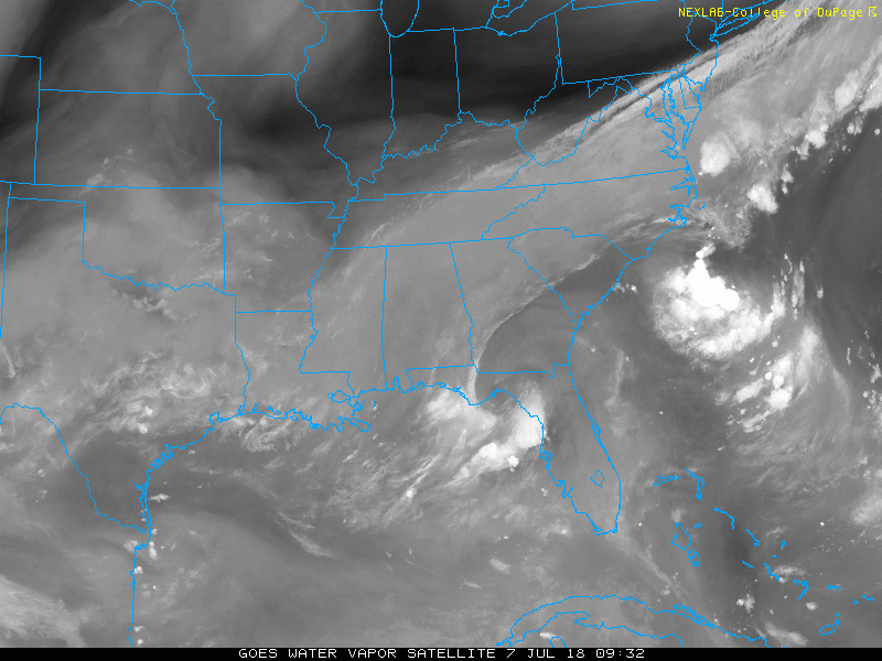
Clouds From Old Front And T.D. 3
This may dim the sun around the beaches and farther south. North and west of Baltimore the sky is blue.
Afternoon
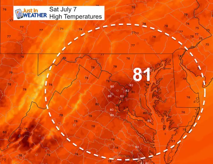
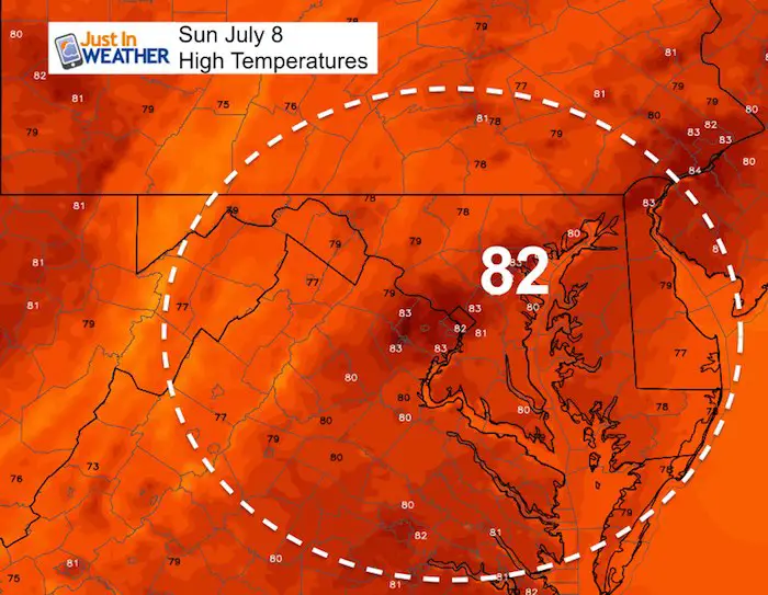
Lower 80s to upper 70s is below our average of 87ºF
Sunday Afternoon
Tropical Set Up
Tropical Depression Three has winds of 30 mph this morning. It is organizing and should be names Tropical Storm Chris this weekend. Then strengthen to a hurricane with winds over 75 mph as it moves farther away from the coat. This may result in rip currents early next week.
Satellite Loop
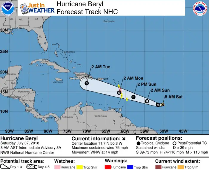
Hurricane Beryl
This is a tiny storm! Hurricane Force winds extend only 10 miles from the center. It is expected to be downgraded to a tropical storm by the end of the weekend. The track appears to remain to the south of Puerto Rico. But small storms are tough to forecast….
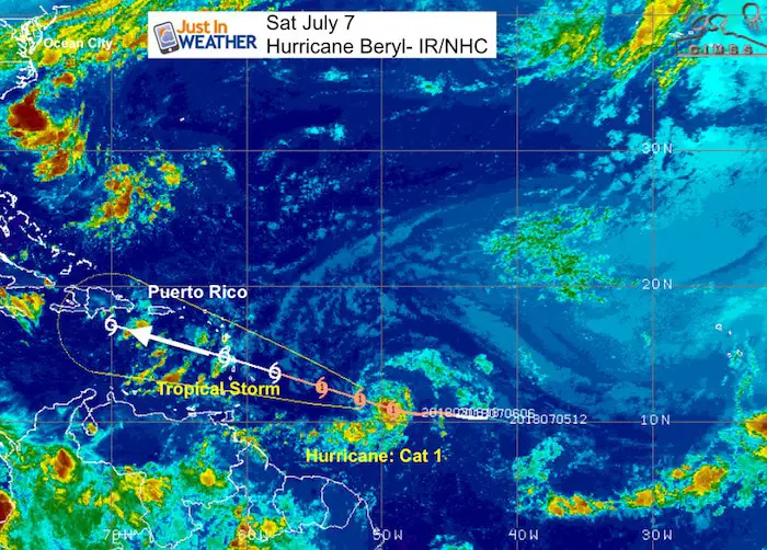
SUMMARY OF 800 AM AST...1200 UTC...INFORMATION
----------------------------------------------
LOCATION...11.7N 50.3W
ABOUT 780 MI...1260 KM ESE OF THE LESSER ANTILLES
MAXIMUM SUSTAINED WINDS...75 MPH...120 KM/H
PRESENT MOVEMENT...WNW OR 295 DEGREES AT 14 MPH...22 KM/H
MINIMUM CENTRAL PRESSURE...995 MB...29.39 INCHES
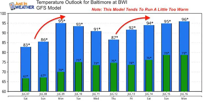
Outlook Back Home….
Temperatures will warm back up next week. The GFS Model tends to run warm, so the intensity of the heat next week is up for debate.
Please share your thoughts, best weather pics/video, or just keep in touch via social media
-
Facebook: Justin Berk, Meteorologist
-
Twitter: @JustinWeather
-
Instagram: justinweather
Keep In Touch Every Day
Click here to sign up for email alerts…. Just in case you don’t get the post on your social media feed
Shine On
Proceeds from all sales go to Just In Power Kids. Click the image to shop and show your support.

![]()
 Get the award winning Kid Weather App I made with my oldest son and support our love for science, weather, and technology. Our 3 year anniversary of the release and our contribution to STEM education is this November. It has been downloaded in 60 countries, and works in both temperature scales. With your support we can expand on the fun introduction to science and real weather.