 Saturday June 9 2018
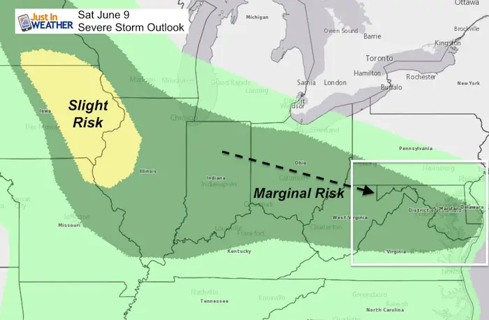
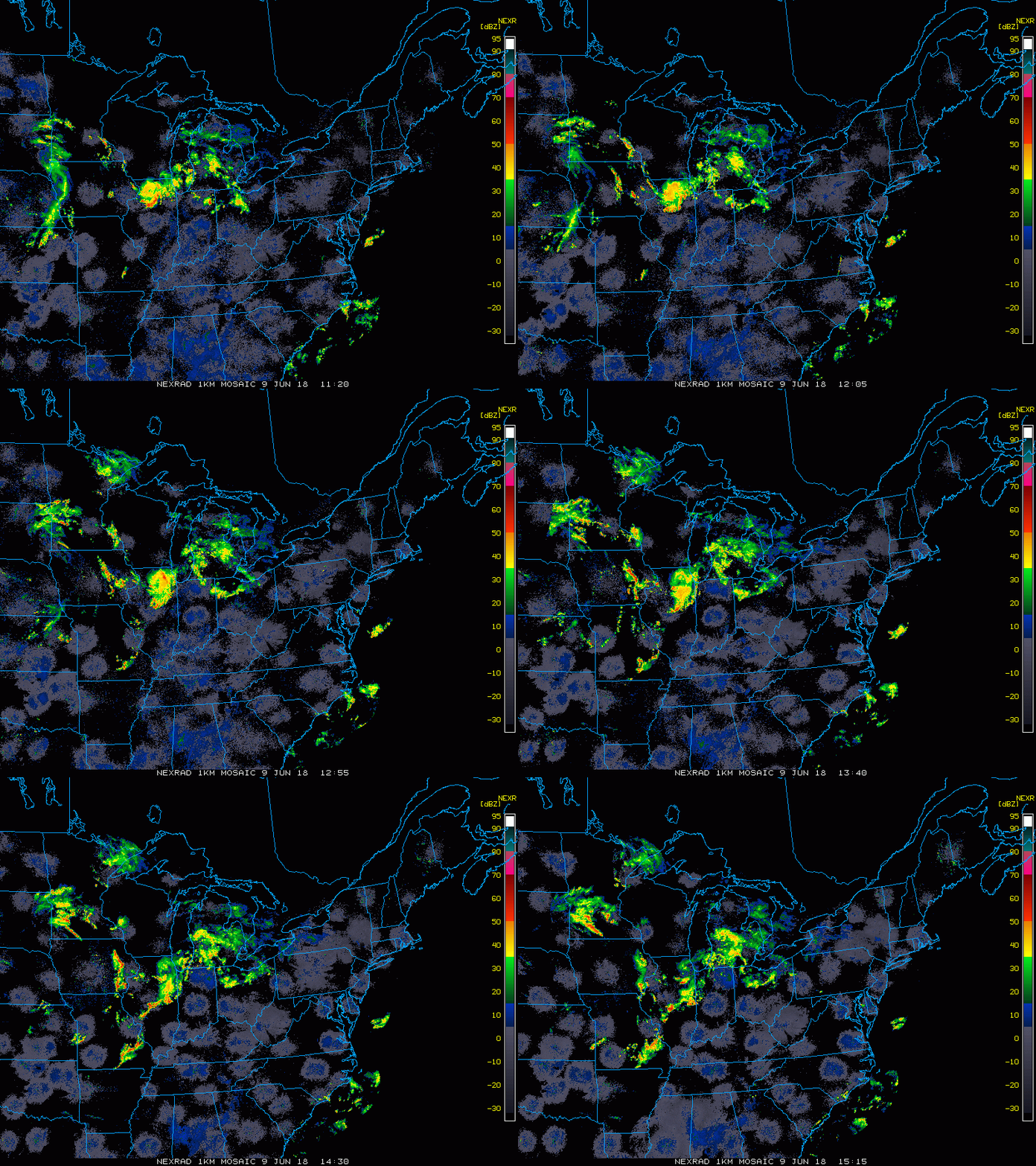
The energy for today’s weather is located in the southern Great Lakes and the upper level flow is pointing in our direction. Storms will be developing in the afternoon and evening, then another round expected overnight. We do get a few dry hours out of the deal, but when storms fire up, there is a marginal risk that one or two could turn severe. We will be watching the development to the north and west then dropping south across the area. Below is a look at the morning radar and the radar simulation for the rest of the day as we track the action.
Stats For June 9 in Baltimore
Note: June 5th was the earliest date on record that Baltimore has broken 100 degrees, back in 1925
Average High: 81ºF
Record High: 100ºF in 2011
Average Low: 60ºF
Record Low: 45ºF in 1997
Sunrise: 5:39 AM
Sunset 8:32 PM
*Daylight = 0:42 longer than yesterday
*Bay Water Temperature = 71ºF at Thomas Pt. Light House
Keep In Touch Every Day
Click here to sign up for email alerts…. Just in case you don’t get the post on your social media feed
Radar: 4 Hour loop ending at 11:10 AM
Radar Simulation —> slider
[metaslider id=63064]

Shine On
Proceeds from all sales go to Just In Power Kids. Click the image to shop and show your support.
Please share your thoughts, best weather pics/video, or just keep in touch via social media
-
Facebook: Justin Berk, Meteorologist
-
Twitter: @JustinWeather
-
Instagram: justinweather
Keep In Touch Every Day
Click here to sign up for email alerts…. Just in case you don’t get the post on your social media feed
 Get the award winning Kid Weather App I made with my oldest son and support our love for science, weather, and technology. Our 3 year anniversary of the release and our contribution to STEM education is this November. It has been downloaded in 60 countries, and works in both temperature scales. With your support we can expand on the fun introduction to science and real weather.


