 Monday March 5 2018
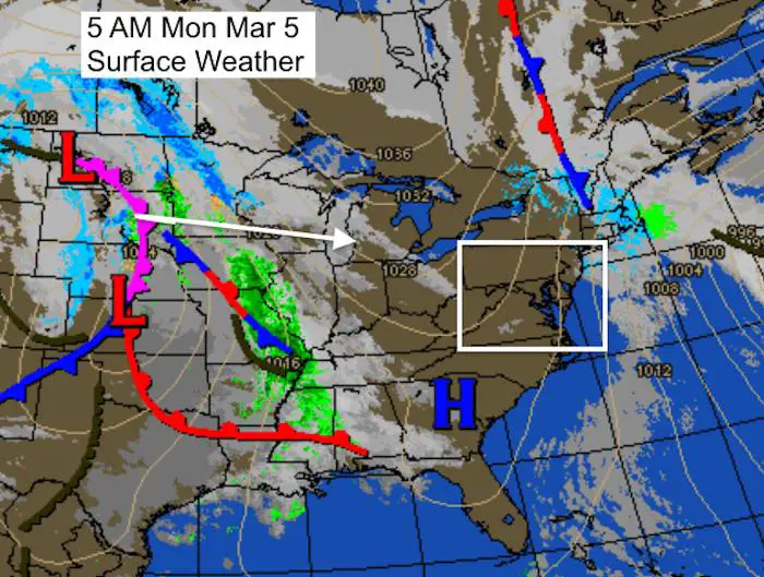
We have another strong Nor’easter about to develop nearby with wind and snow, but it won’t be a strong a the last one. That is the last thing you want to hear as nearly 30,000 people in Maryland are still with power from the last storm. The pattern we are in will keep us on the edge with marginal impacts, but there is more on the way. Three systems in the next 8 days. At his time, the focus is on the northern part of Maryland, with the highlights on Baltimore, Harford, and Cecil Counties. A chance for some snow this weekend and yet another strong storm next week. Before we get going and full on FITF, I just want to add the reminder that it is March. This time of the year we need heavy snow or it to fall overnight to have the best chance of stickage. Otherwise the higher sun angle will help keep the roads wet. But there is one other key factor. See more below.
Stats For March 5
Average High: 59ºF
Record High: 83ºF in 1976
Average Low: 30ºF
Record Low: 10ºF in 1873
Snow Record: 6.2″ in 2015
Seasonal Snow To Date (at BWI): 8.7″
Sunrise: 6:33 AM
Sunset 6:03 PM
*Daylight = 2:33 longer than yesterday
*Bay Water Temperature = 41ºF at Thomas Pt. Light House
Keep In Touch Every Day
Click here to sign up for email alerts…. Just in case you don’t get the post on your social media feed
Today
Morning
Afternoon
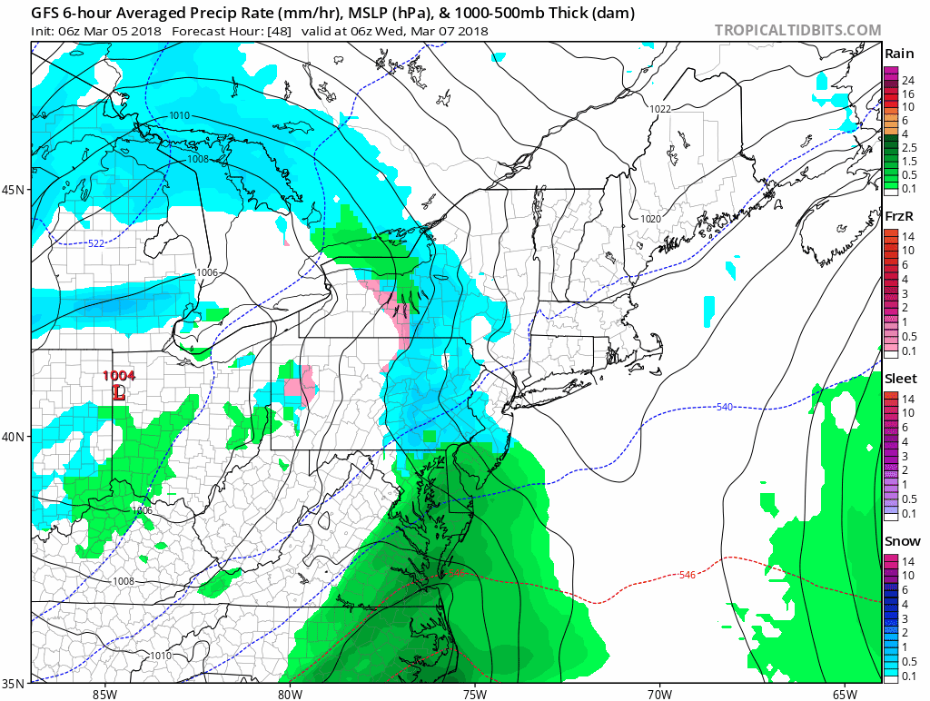
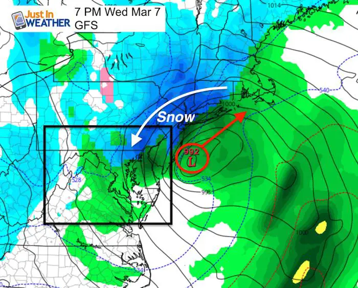
Storm Tuesday/Wednesday
The Low Pressure Will Develop just east of Maryland and explode with development as it pounds New England. This will send back colder wind and snow into northeastern Maryland Tuesday night and Wednesday. See the local hourly timeline slider below.
Snow Timeline —> slider
Notice the resurgence of steady, moderate snow (dark blue) at the end of the time period. This storm will be gaining intensity and try to backfill Wednesday.
[metaslider id=59473]
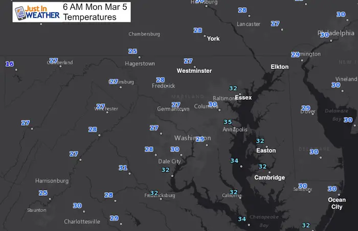
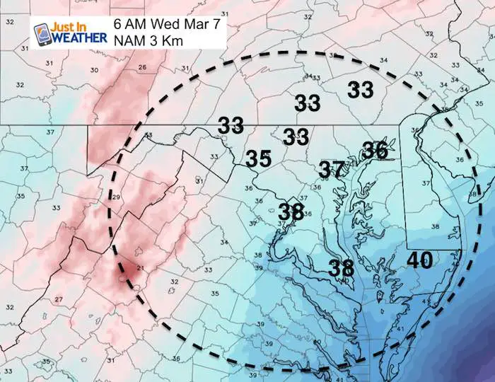
Wednesday Morning Temperatures
This is important! We are hard pressed to find any freezing air with the snow Wednesday morning. Stickage will be limited to grassy areas and perhaps some slush on roads where heavier bursts fall before sunrise.
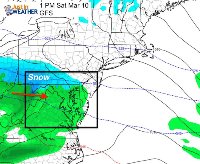
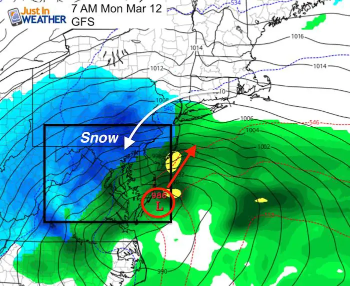
Three Chances of Snow
After this storm Tuesday/Wednesday, we will have a weekend clipper, then a stronger storm with colder air Sunday night into Monday. That might be the best chance for stickage and impact.
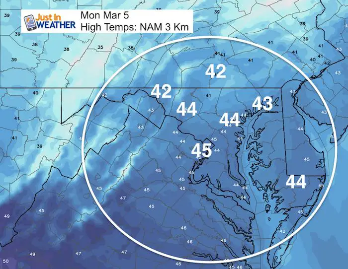
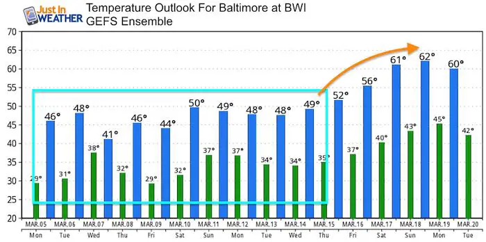
Temperature Outlook
Please share your thoughts, best weather pics/video, or just keep in touch via social media
-
Facebook: Justin Berk, Meteorologist
-
Twitter: @JustinWeather
-
Instagram: justinweather
Keep In Touch Every Day
Click here to sign up for email alerts…. Just in case you don’t get the post on your social media feed
FITF Gear

Snowstix- We Need You To Measure Snow Too
We are giving 10% of each sale to programs that benefit pediatric oncology patients.

 Get the award winning Kid Weather App I made with my oldest son and support our love for science, weather, and technology. Our 3 year anniversary of the release and our contribution to STEM education is this November. It has been downloaded in 60 countries, and works in both temperature scales. With your support we can expand on the fun introduction to science and real weather.
Keep In Touch All Winter
Click here to sign up for email alerts…. Just in case you don’t get the post on your social media feed
Also See:
My Winter Outlook 2017-2018 for more snow
La Nina Formed: What it could mean to our winter
NOAA Winter Outlook: Not The Best But Not The Worst For Snow
Two Farmers Almanacs Winter 2018 Outlooks
Winter Weather Folkore: Suggestions from Animals and Crops
First Frost and Freeze Dates For Maryland (southern PA and northern VA)
My Preliminary Winter Outlook Notes
Low Snow Winters In Baltimore: To Repeat Or Not Repeat
NOAA Ranks Blizzard 2016 4th Worst Snowstorm On Record