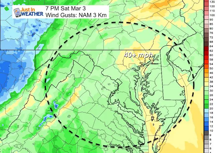
Saturday March 3 2018
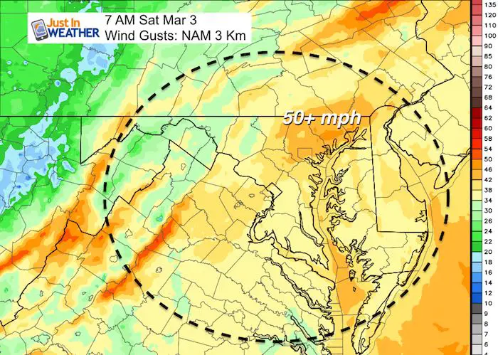
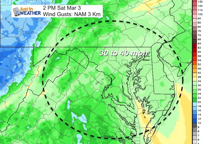
Governor Hogan has declared a State of Emergency in Maryland and as the storm moves away we will only get a slow and gradual improvement. The winds have already been gusting over 30 mph this morning and there will be two peaks of wind speeds today, but not nearly as strong as yesterday. So instead of near hurricane force (70 mph), we just get solid tropical storm force winds (up to 50 mph) today. We swap the wind warning for an advisory due to less intense push of air. The long duration event has already weakened trees to the point that more stress will cause more to fall. Basically, we are not done with this thing yet!
Note: Baltimore reported a peak wind gust of 61 mph. Patuxent River hit 69 mph in the morning. Many locations across the Mid Atlantic were close to 70 mph.
Below is a look at the timeline for the winds. It will be a cool day with highs in the 40s. And while we escaped the 3+ Feet of snow part of this storm, there will be another chance for some snow as the next strong storm arrives next week.
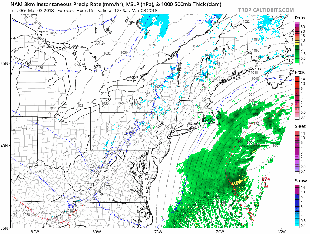
Storm Pulling Away
This animation shows the lines (isobars) of equal pressure spread out as the storm moves away. The tightly packed lines translates to more wind, so wider parts represents our slight improvement. See the local hourly wind breakdown slider below.
Trivia for today:
- We set two record low temperatures in Baltimore in 2014 including the all tie coldest reading for March on the 4th
- Today is the first day of the year with sunset after 6 PM
Stats For March 3
Average High: 49ºF
Record High: 78ºF in 1923
Average Low: 30ºF
Record Low: 5ºF in 2014
Snow Record: 10.0″ in 1960
Seasonal Snow To Date (at BWI): 8.7″
Sunrise: 6:36 AM
Sunset 6:01 PM
*Daylight = 2:33 longer than yesterday
*Bay Water Temperature = 42ºF at Thomas Pt. Light House
Keep In Touch Every Day
Click here to sign up for email alerts…. Just in case you don’t get the post on your social media feed
This Morning
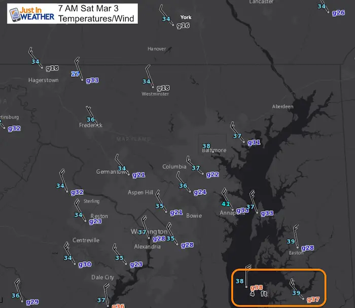
About The Wind
Let’s begin with the peak gusts
Hourly Wind Timeline —> slider
LEGEND:
- Yellow: 34 knots= 39 mph *Tropical Storm Force
- Orange: 42 knots = 48 mph
- Red: 50 knots = 58 mph
[metaslider id=59313]
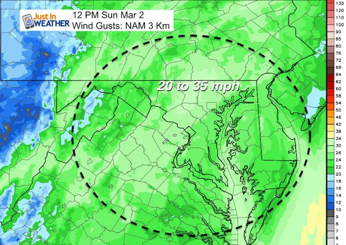
Sunday Peak Winds Easing
Outlook:
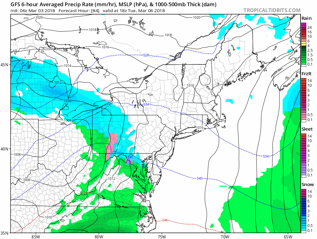
Tuesday will make the arrival and development of the next strong Nor’easter. This may arrive with some snow or windy mix on Tuesday an could have some snow on the back end Thursday morning. I still think there is more development to adjust here. I will have more details on this in my Sunday report.
Please share your thoughts, best weather pics/video, or just keep in touch via social media
-
Facebook: Justin Berk, Meteorologist
-
Twitter: @JustinWeather
-
Instagram: justinweather
Keep In Touch Every Day
Click here to sign up for email alerts…. Just in case you don’t get the post on your social media feed
FITF Gear

Snowstix- We Need You To Measure Snow Too
We are giving 10% of each sale to programs that benefit pediatric oncology patients.

 Get the award winning Kid Weather App I made with my oldest son and support our love for science, weather, and technology. Our 3 year anniversary of the release and our contribution to STEM education is this November. It has been downloaded in 60 countries, and works in both temperature scales. With your support we can expand on the fun introduction to science and real weather.
Keep In Touch All Winter
Click here to sign up for email alerts…. Just in case you don’t get the post on your social media feed
Also See:
My Winter Outlook 2017-2018 for more snow
La Nina Formed: What it could mean to our winter
NOAA Winter Outlook: Not The Best But Not The Worst For Snow
Two Farmers Almanacs Winter 2018 Outlooks
Winter Weather Folkore: Suggestions from Animals and Crops
First Frost and Freeze Dates For Maryland (southern PA and northern VA)
My Preliminary Winter Outlook Notes
Low Snow Winters In Baltimore: To Repeat Or Not Repeat
NOAA Ranks Blizzard 2016 4th Worst Snowstorm On Record