 Tuesday February 27 2018
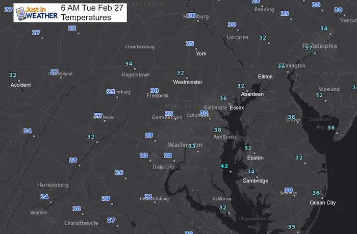
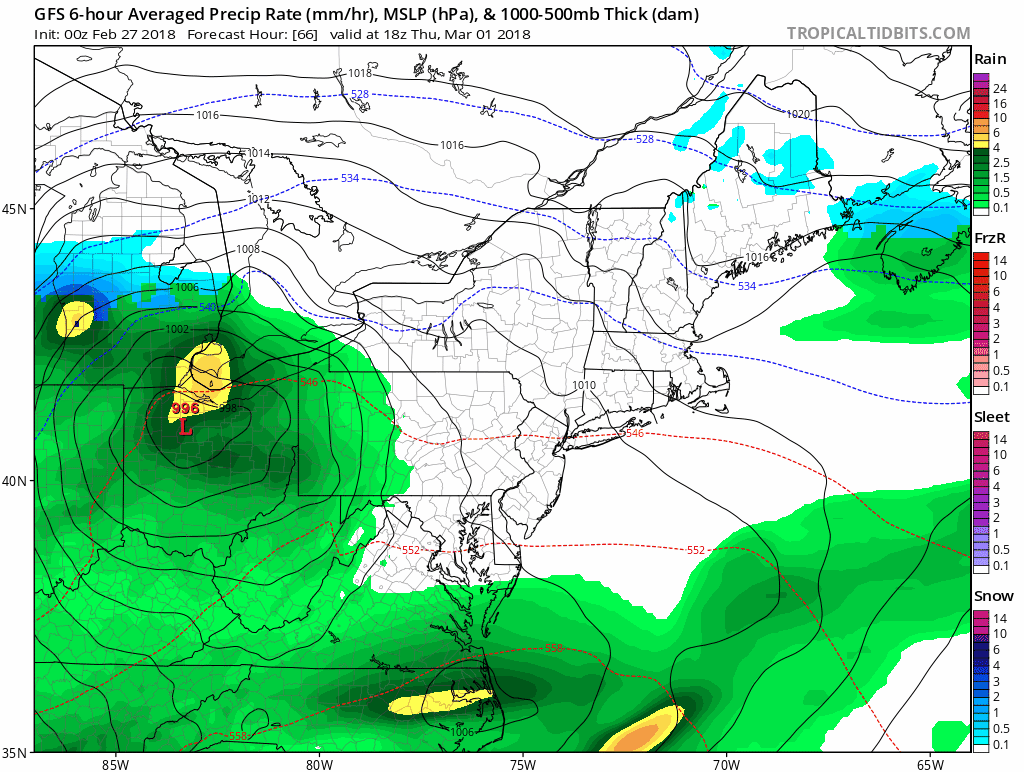
The clouds finally moved away overnight and allowed colder air to spread through the area. This is the first time in s while we have frost to scrape, but it is still February. However, the sun will allow temperatures back into the 50s this afternoon and even warmer tomorrow. The next storm will spread rain showers between Thursday and Friday, followed by a shift in the jet stream. The maps below show the pattern change, but I stand by the belief that the models can not handle it well. So while I can show you a cool down and trough in the jet stream, plotting a specific storm track and location is not their forte. But I do believe we are in for a strong east coast storm in the first two weeks of March.
Stats For February 26
Average High: 48ºF
Record High: 76ºF in 1997
Average Low: 29ºF
*Former Record Low: 9ºF in 1934
Snow Record: 3.5″ in 1940
Seasonal Snow To Date (at BWI): 8.7″
Sunrise: 6:42 AM
Sunset 5:56 PM
*Daylight = 2:31 longer than yesterday
*Bay Water Temperature = 42ºF at Thomas Pt. Light House
Keep In Touch Every Day
Click here to sign up for email alerts…. Just in case you don’t get the post on your social media feed
How Warm This Afternoon?

Rain Returns Thursday and Friday
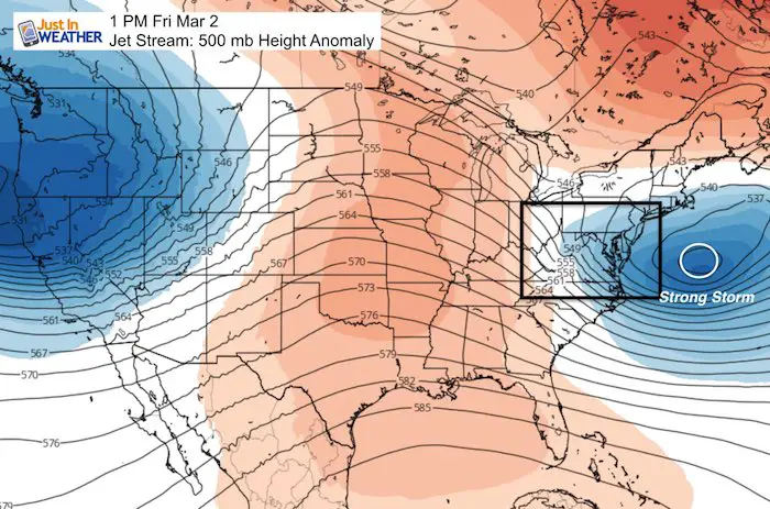
Jet Stream Flip
The trough (blue) in the jet stream on Friday represents a strong storm and adjustment of the flow from the north. While there is a pronounced ridge in the middle of the nation, there will be a stronger trough and possibly more impactful storm a week later.
The following Friday shows a stronger closed Low over the Mid Atlantic. This is reflected on the surface with a coastal snow storm but I refuse to show it at this time since I do not trust the modeling beyond 7 days. I will elaborate in my next report. But keep the notion of an active storm pattern with cold air for the first two weeks of March.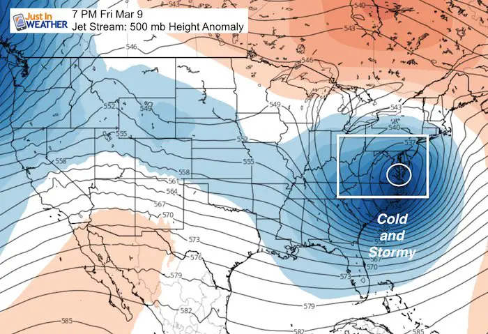
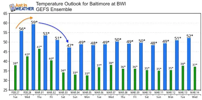
Temperature Outlook
I think think the modeling is having a hard time identifying how cold we will get with the pattern change. So the default is close to average.
Please share your thoughts, best weather pics/video, or just keep in touch via social media
-
Facebook: Justin Berk, Meteorologist
-
Twitter: @JustinWeather
-
Instagram: justinweather
Keep In Touch Every Day
Click here to sign up for email alerts…. Just in case you don’t get the post on your social media feed
FITF Gear

Snowstix- We Need You To Measure Snow Too
We are giving 10% of each sale to programs that benefit pediatric oncology patients.

 Get the award winning Kid Weather App I made with my oldest son and support our love for science, weather, and technology. Our 3 year anniversary of the release and our contribution to STEM education is this November. It has been downloaded in 60 countries, and works in both temperature scales. With your support we can expand on the fun introduction to science and real weather.
Keep In Touch All Winter
Click here to sign up for email alerts…. Just in case you don’t get the post on your social media feed
Also See:
My Winter Outlook 2017-2018 for more snow
La Nina Formed: What it could mean to our winter
NOAA Winter Outlook: Not The Best But Not The Worst For Snow
Two Farmers Almanacs Winter 2018 Outlooks
Winter Weather Folkore: Suggestions from Animals and Crops
First Frost and Freeze Dates For Maryland (southern PA and northern VA)
My Preliminary Winter Outlook Notes
Low Snow Winters In Baltimore: To Repeat Or Not Repeat
NOAA Ranks Blizzard 2016 4th Worst Snowstorm On Record
Blizzard 2016 Record Top Snowstorm: Area Totals
Extreme Weather of 2015 balanced out on both ends