 Thursday February 15 2018
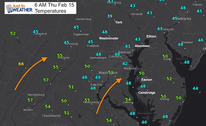
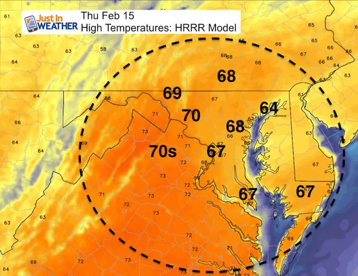
Warm air is already building in this morning and it will be the warmest we have felt in months. Some of the region is starting off with showers and fog, but we will get many dry hours and sun to boost the day ahead. Computer modeling has a hard time adjusting the such an anomaly as temperatures will be about 25 degrees above normal. So it is possible that while we show upper 60s to near 70ºF, many end up on the top end of that… except if you are near the chilly Chesapeake Bay. Note, this is not even close to the record high today.
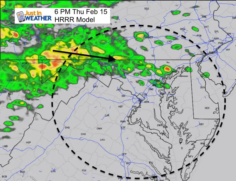
Rain begins to arrive tonight and temperatures will tank tomorrow, so highs will be in the morning. Then we set up a unique situation where the arctic front drops south, then returns Saturday with just enough cold air in place to produce a wet snow. That means snow from colder clouds with high water content, but the warm ground and surface temperatures will inhibit stickage until overnight. That will eat into potential snow totals. See more below.
Stats For February 15
Trivia: The record high today was set in 1949 and will be safe from this afternoon’s warmth.
Normal High: 45ºF
Record High: 77ºF in 1949
Normal Low: 26ºF
*Former Record Low: +6ºF in 2015
Snow Record: 11.5″ in 1958
Seasonal Snow To Date (at BWI): 6.5″
Sunrise: 6:58 AM
Sunset 5:43 PM
*Daylight = 2:21 longer than yesterday
*Bay Water Temperature = 37ºF at Thomas Pt. Light House
Keep In Touch All Winter
Click here to sign up for email alerts…. Just in case you don’t get the post on your social media feed
This Afternoon
Rain Returns The Evening From The North
Forecast Highlights
See the animation below…
Friday
- Rain builds in the morning with the cold front
- High temperatures in the morning: Mid 50s to near 60ºF
- Faling temperatures by afternoon: Mid 30s to near 40ºF
Saturday
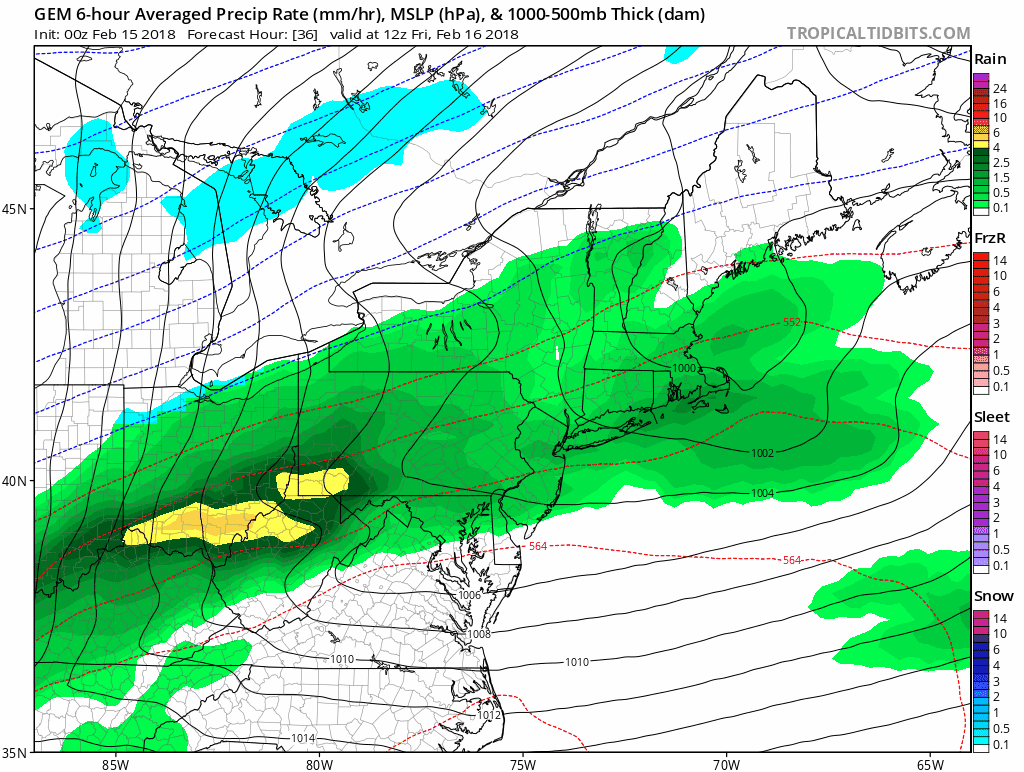
- Snow, sleet develop mid to late afternoon. Best chance along and northwest of I-95 *NW suburbs of Washington and Baltimore
- Rain by the Bay and Eastern Shore
- Temperatures will remain above freezing for most of the event. Stickage may be limited
- Falling temperatures towards Sunday morning will allow for some icy roads in the normally colder inland locations (northwest of the cities)
- The storm will be gone by Sunday morning.
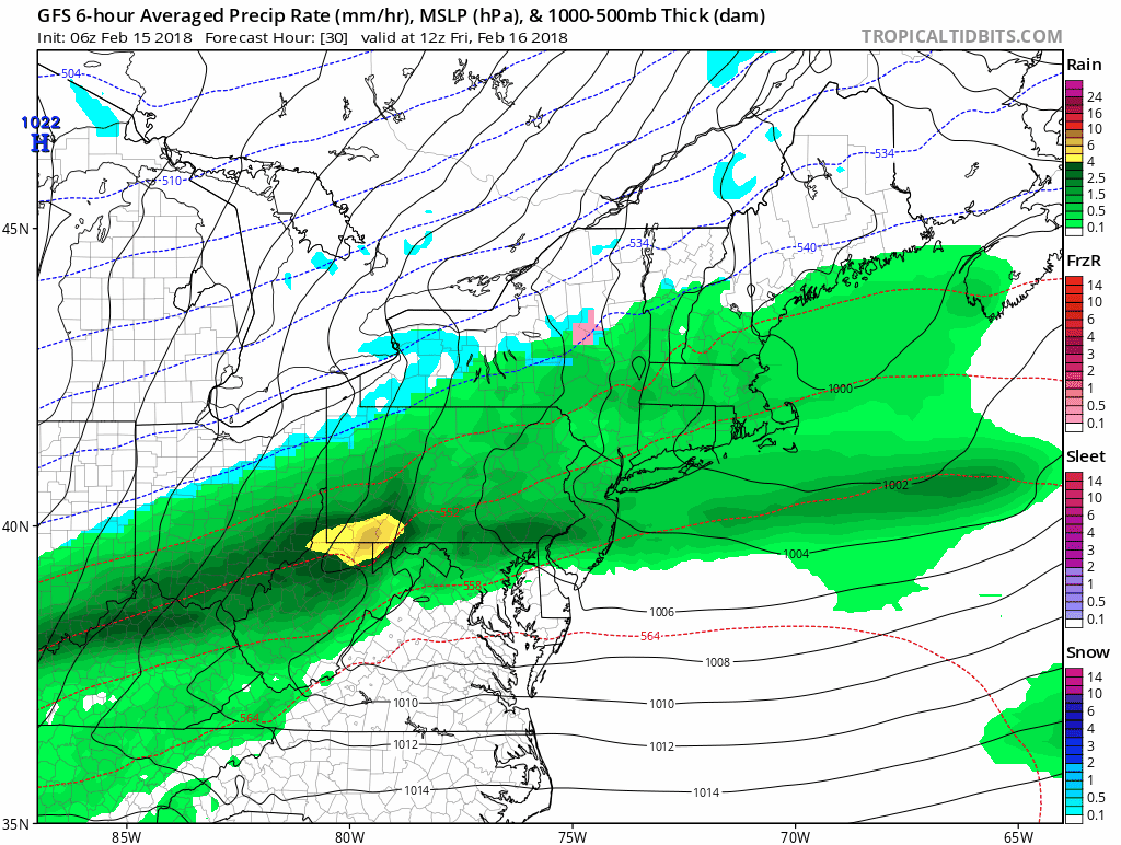
GFS Model
Canadian Model
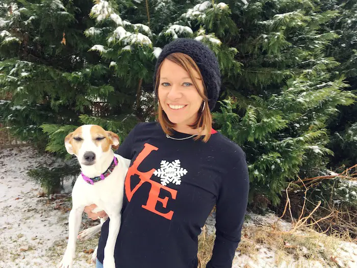
L❄️VE Snow ❤️
Over $5,000 has already been raised. THANK YOU! This campaign is still going on…
My Fiancée Shannon is showing off her design for our L❄️VE Shirt. Proceeds help the start-up of our new wellness program for Pediatric Oncology Patients. The big announcement is just two weeks away. Click here or on the photo to see more…
Multiple Styles: Ladies Performance, Unisex, Kids, and two types of Hoodies
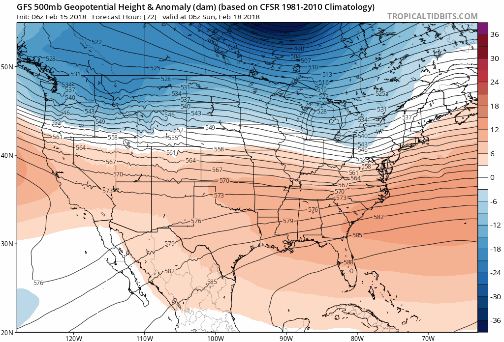
Jet Stream Animation
There is barely enough cold air for this weekend’s storm, then another warm up next week. However the pattern breaks down before the end of February
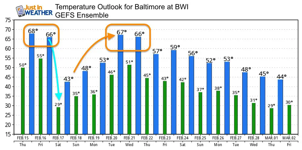
Temperature Outlook
Please share your thoughts, best weather pics/video, or just keep in touch via social media
-
Facebook: Justin Berk, Meteorologist
-
Twitter: @JustinWeather
-
Instagram: justinweather
Keep In Touch All Winter
Click here to sign up for email alerts…. Just in case you don’t get the post on your social media feed
 Get the award winning Kid Weather App I made with my oldest son and support our love for science, weather, and technology. Our 3 year anniversary of the release and our contribution to STEM education is this November. It has been downloaded in 60 countries, and works in both temperature scales. With your support we can expand on the fun introduction to science and real weather.
Snowstix- We Need You To Measure Snow Too
We are giving 10% of each sale to programs that benefit pediatric oncology patients.

FITF Gear

Keep In Touch All Winter
Click here to sign up for email alerts…. Just in case you don’t get the post on your social media feed
Also See:
My Winter Outlook 2017-2018 for more snow
La Nina Formed: What it could mean to our winter
NOAA Winter Outlook: Not The Best But Not The Worst For Snow
Two Farmers Almanacs Winter 2018 Outlooks
Winter Weather Folkore: Suggestions from Animals and Crops
First Frost and Freeze Dates For Maryland (southern PA and northern VA)
My Preliminary Winter Outlook Notes
Low Snow Winters In Baltimore: To Repeat Or Not Repeat
NOAA Ranks Blizzard 2016 4th Worst Snowstorm On Record
Blizzard 2016 Record Top Snowstorm: Area Totals
Extreme Weather of 2015 balanced out on both ends