 Friday February 2 2018
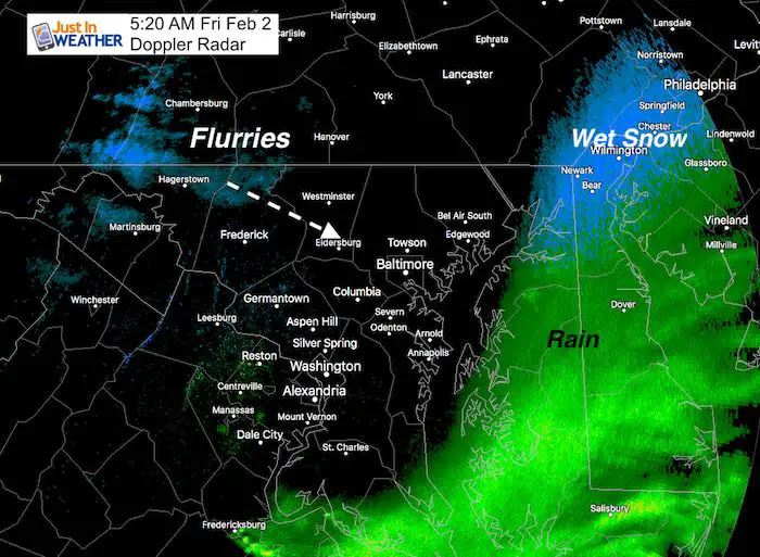
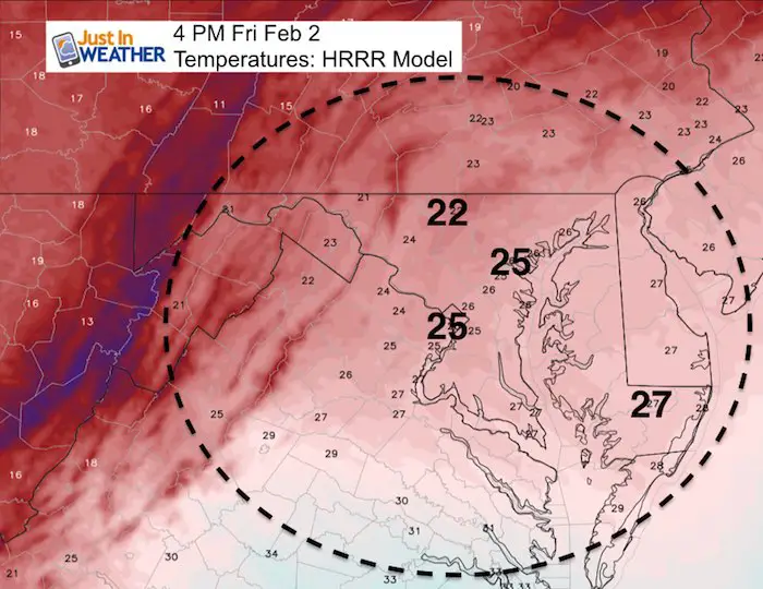
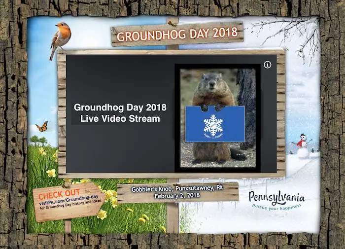
Rain overnight ended with a brief period of sleet and snow as expected. The cold air lagged just a two hours behind and it will mean business as many drop into the 20s. My concern for a flash freeze all depends on how fast some roads can dry out, because what is wet will ice up in a hurry. The temperature timeline is below. We may have some snow showers or flurries this morning and a storm to watch for Super Bowl Sunday, but this has nothing to do with Punxsutawney Phil in western Pennsylvania. A live video stream of Gobbler’s Knob and the Groundhog’s call can be found below. The official call from Phil will be around 7:25 AM this morning.
Stats For February 2
Normal High: 42ºF
Record High: 71ºF in 1967
Normal Low: 25ºF
*Former Record Low: +1ºF in 1961
Snow Record: 4.4″ in 1996
Seasonal Snow To Date (at BWI): 6.5″
Sunrise: 7:12 AM
Sunset 5:28 PM
*Daylight = 2:06 longer than yesterday
*Bay Water Temperature = 35ºF at Thomas Pt. Light House
Keep In Touch All Winter
Click here to sign up for email alerts…. Just in case you don’t get the post on your social media feed
This Morning:
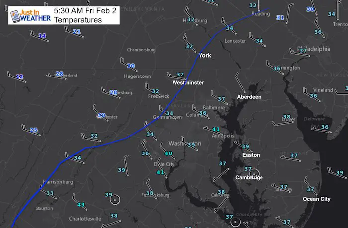
As of 5:30 AM the freezing line reached Frederic, Westminster and York PA. This will reach metro Baltimore during the 6 AM hour. Then pass quickly south and east. The race is on for pavement to dry or ice up. Sidewalks and some overpasses might get slick.
Temperature Timeline
[metaslider id=57502]
Afternoon
Wind chills will be in the teens with strong gusts to 30 mph
Groundhog Video Stream
Note: In 130 years, Phil has only called for an early spring 18 times…
Click image for streaming video
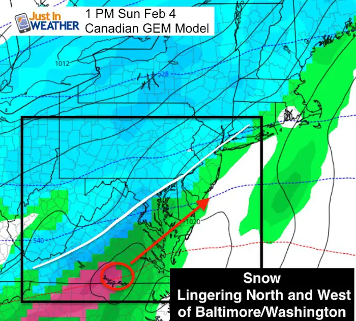
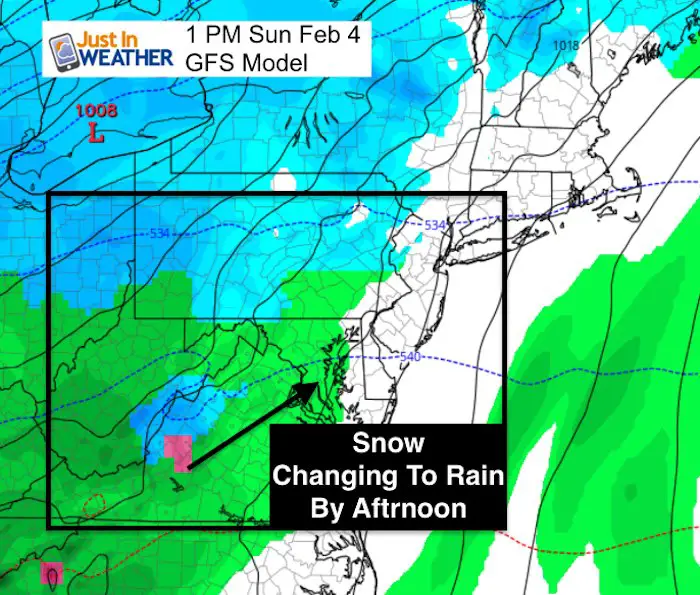
Looking Ahead To Sunday
The Canadian GEM Model is still hanging on to the notion of snow lingering north and west Sunday afternoon and evening. The GFS Model shows snow developing in the morning and changing to rain in the afternoon. I will have more details on this later today.
Outlook
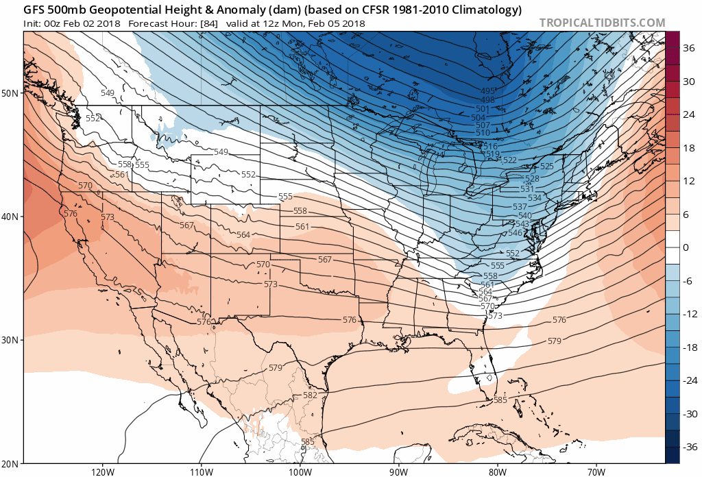
There are a few shots of colder air in the next two weeks (blue). This will be an active pattern and I don’t think the modeling is handling the surface features well. So there will be a few chances at snow coming up. FITF
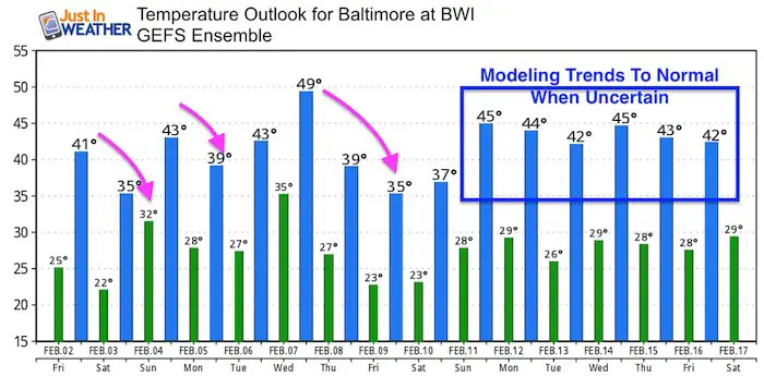
Temperature Outlook
Please share your thoughts, best weather pics/video, or just keep in touch via social media
-
Facebook: Justin Berk, Meteorologist
-
Twitter: @JustinWeather
-
Instagram: justinweather
Keep In Touch All Winter
Click here to sign up for email alerts…. Just in case you don’t get the post on your social media feed
 Get the award winning Kid Weather App I made with my oldest son and support our love for science, weather, and technology. Our 3 year anniversary of the release and our contribution to STEM education is this November. It has been downloaded in 60 countries, and works in both temperature scales. With your support we can expand on the fun introduction to science and real weather.
May The Flakes Be With You- Limited Edition Shirt
A Portion of the proceeds will go to Integrated Wellness programs for Pediatric Oncology Patients

Snowstix- We Need You To Measure Snow Too
We are giving 10% of each sale to programs that benefit pediatric oncology patients.

FITF Gear

Keep In Touch All Winter
Click here to sign up for email alerts…. Just in case you don’t get the post on your social media feed
Also See:
My Winter Outlook 2017-2018 for more snow
La Nina Formed: What it could mean to our winter
NOAA Winter Outlook: Not The Best But Not The Worst For Snow
Two Farmers Almanacs Winter 2018 Outlooks
Winter Weather Folkore: Suggestions from Animals and Crops
First Frost and Freeze Dates For Maryland (southern PA and northern VA)
My Preliminary Winter Outlook Notes
Low Snow Winters In Baltimore: To Repeat Or Not Repeat
NOAA Ranks Blizzard 2016 4th Worst Snowstorm On Record
Blizzard 2016 Record Top Snowstorm: Area Totals
Extreme Weather of 2015 balanced out on both ends