 Tuesday January 30 2018
The brief bought of snow this morning is pretty much on schedule, perhaps an hour early. This will be ending quickly but the freezing temperatures will be trying to catch up and make for an icing problem on the western side of the cities as wet roads may freeze up. So the warmer ground that melted the snow will have to deal with temps dropping into the upper 20s to near 30ºF just as we get daylight. Many schools that delayed will need to reevaluate. This is a tough call since a dusting to 2 inches of snow is done. See the temperature plot timeline slider below.

Note: Today is the first day our accelerated daylight increases more than 2 minutes each day.
Stats For January 30
Normal High: 42ºF
Record High: 72ºF in 191`4
Normal Low: 25ºF
*Former Record Low: -4ºF in 1873
Snow Record: 9.1″ in 1966
Seasonal Snow To Date (at BWI): 6.5″
Sunrise: 7:15 AM
Sunset 5:25 PM
*Daylight = 2:01 longer than yesterday
*Bay Water Temperature = 36ºF at Thomas Pt. Light House
Keep In Touch All Winter
Click here to sign up for email alerts…. Just in case you don’t get the post on your social media feed
This Morning
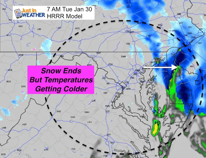
Temperature Timeline —> slider
[metaslider id=57406]
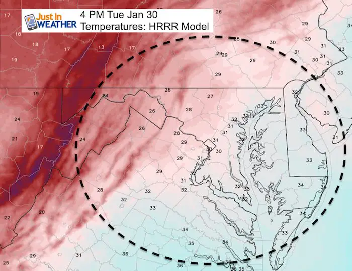
Afternoon Temperatures
Many stay near freezing all day…
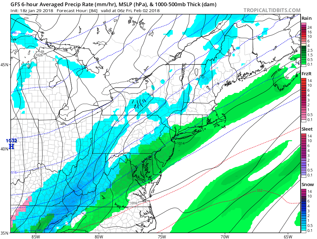
Snow Outlook
February will bring a colder pattern with more chances of snow for the first half of the month.
The Friday system will not be heavy, but another rain to snow and icing event…. The energy for a stronger storm seems to be reorganizing for possibly another try early next week.
Snowstix- We Need You To Measure Snow Too
We are giving 10% of each sale to programs that benefit pediatric oncology patients.

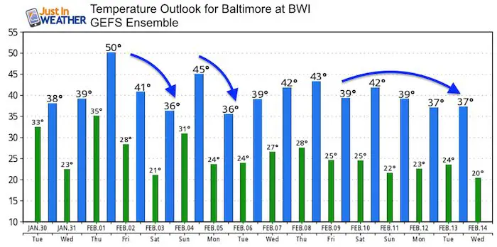
Temperature Outlook
This is just a trend, not a promise of actual numbers next week. The trend is for more days below average…
May The Flakes Be With You- Limited Edition Shirt
A Portion of the proceeds will go to Integrated Wellness programs for Pediatric Oncology Patients

FITF Gear

Please share your thoughts, best weather pics/video, or just keep in touch via social media
-
Facebook: Justin Berk, Meteorologist
-
Twitter: @JustinWeather
-
Instagram: justinweather
Snowstix- We Need You To Measure Snow Too
We are giving 10% of each sale to programs that benefit pediatric oncology patients.
 Get the award winning Kid Weather App I made with my oldest son and support our love for science, weather, and technology. Our 3 year anniversary of the release and our contribution to STEM education is this November. It has been downloaded in 60 countries, and works in both temperature scales. With your support we can expand on the fun introduction to science and real weather.
Keep In Touch All Winter
Click here to sign up for email alerts…. Just in case you don’t get the post on your social media feed
Also See:
My Winter Outlook 2017-2018 for more snow
La Nina Formed: What it could mean to our winter
NOAA Winter Outlook: Not The Best But Not The Worst For Snow
Two Farmers Almanacs Winter 2018 Outlooks
Winter Weather Folkore: Suggestions from Animals and Crops
First Frost and Freeze Dates For Maryland (southern PA and northern VA)
My Preliminary Winter Outlook Notes
Low Snow Winters In Baltimore: To Repeat Or Not Repeat
NOAA Ranks Blizzard 2016 4th Worst Snowstorm On Record