Sunday January 28 2018
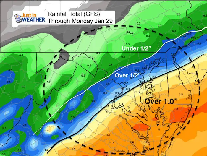
The rain this morning may try to last a little longer. The trend has shown a slower move of the front to the south, which will increase rainfall amounts a little. We can use it as we actually have a moderate drought in the area, despite the mud in your yard. Baltimore is -4.23 of normal precipitation since December 1st. While our snow is near normal, winter precipitation overall has been rather dry. Below is the latest rain simulation timeline today. Following this system, we have a quick moving hit of snow that should reach us Tuesday morning. This looks a little stronger but we need to consider two things for how it may impact our area.
Note: Today is the anniversary of Baltimore’s 4th largest snowstorm on record.
If you miss winter, it will be back. The entire pattern will be changing with a storm on Friday that will bring rain ending as snow. Regardless of what the groundhog says, we have a cold surge for the first half of February with multiple systems trying to dive our way. See it all below…
Stats For January 27
Normal High: 42ºF
Record High: 70ºF in 1949; 1944
Normal Low: 25ºF
*Former Record Low: -3ºF in 1987
Snow Record: 23.3″ in 1922- Total storm was 26.5″ snow ver 3 days…Ranking 4th largest snowstorm on record for Baltimore
Seasonal Snow To Date (at BWI): 6.5″
Sunrise: 7:16 AM
Sunset 5:22 PM
*Daylight = 1:57 longer than yesterday
*Bay Water Temperature = 34ºF at Thomas Pt. Light House
Keep In Touch All Winter
Click here to sign up for email alerts…. Just in case you don’t get the post on your social media feed
May The Flakes Be With You- Limited Edition Shirt
A Portion of the proceeds will go to Integrated Wellness programs for Pediatric Oncology Patients

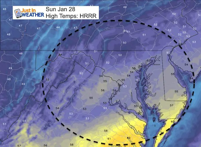
Today:
High Temperatures
Rain Simulation Timeline
[metaslider id=57205]
Rainfall Totals
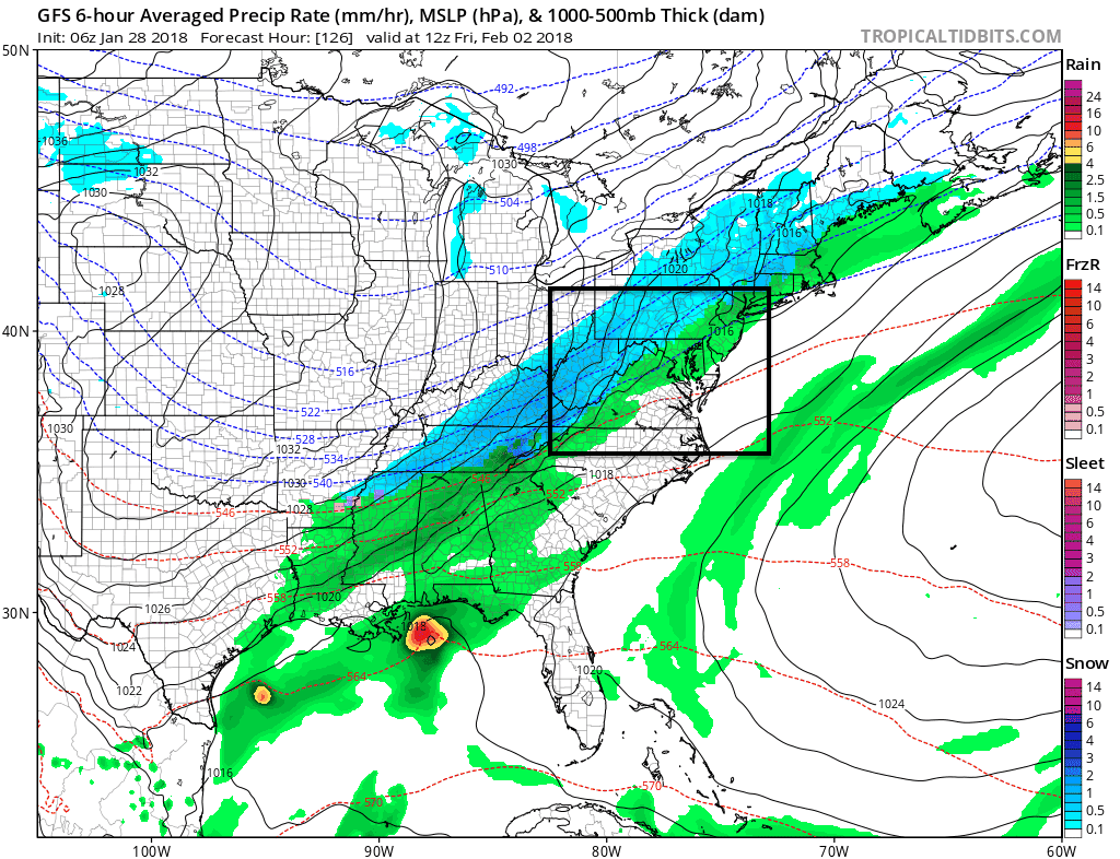
Tuesday Snow Simulation
—> slider
See the snow outlook animation below…
Note: The arrival will be before sunrise north/west of Baltimore but the ground is still warm. In fact here is the suggestion of where the freezing line may be which might arrive in the city by noon. But, the snow will battle solar radiational heating. So the roads could stay wet in urban areas, but might be slick in the normally colder spots.
[metaslider id=57233]
Snowstix- We Need You To Measure Snow Too
We are giving 10% of each sale to programs that benefit pediatric oncology patients.

Snow Outlook Animation
The rain to snow event on Friday will be followed by a pattern for a few more systems to follow. I DO NOT like specifics beyond 1 week, but I wanted to show you the trend does have more energy in the pipeline. So don’t lock on days and times for now, but that there are a few systems that will be cold enough for snow in the first 2 weeks of February.
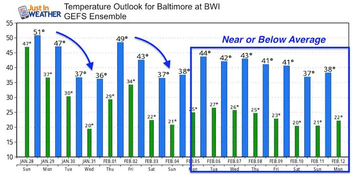
Temperature Outlook
FITF Gear

Please share your thoughts, best weather pics/video, or just keep in touch via social media
-
Facebook: Justin Berk, Meteorologist
-
Twitter: @JustinWeather
-
Instagram: justinweather
Snowstix- We Need You To Measure Snow Too
We are giving 10% of each sale to programs that benefit pediatric oncology patients.
 Get the award winning Kid Weather App I made with my oldest son and support our love for science, weather, and technology. Our 3 year anniversary of the release and our contribution to STEM education is this November. It has been downloaded in 60 countries, and works in both temperature scales. With your support we can expand on the fun introduction to science and real weather.
Keep In Touch All Winter
Click here to sign up for email alerts…. Just in case you don’t get the post on your social media feed
Also See:
My Winter Outlook 2017-2018 for more snow
La Nina Formed: What it could mean to our winter
NOAA Winter Outlook: Not The Best But Not The Worst For Snow
Two Farmers Almanacs Winter 2018 Outlooks
Winter Weather Folkore: Suggestions from Animals and Crops
First Frost and Freeze Dates For Maryland (southern PA and northern VA)
My Preliminary Winter Outlook Notes
Low Snow Winters In Baltimore: To Repeat Or Not Repeat
NOAA Ranks Blizzard 2016 4th Worst Snowstorm On Record