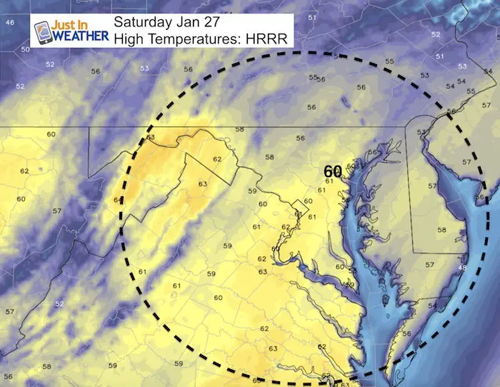
Saturday January 27 2018
Today is by far the pick of the weekend. With sunshine ahead of increasing clouds, the temperatures will rise into the upper 50s and near 60ºF. Polar Bear Plungers will have cooler temps right along the bay thanks to water temperature of 34ºF. Rain is on the way for Sunday and as the front appears to stall, it will linger near and south of Baltimore all day. But near and north of the PA line the rain may end in the morning.
Colder air is on the way and the first system to act on it might be a burst of snow Monday night into Tuesday morning. The second event will be a layer storm to arrive on Friday. There is more agreement among models that we will get snow after a start of rain on Groundhog Day. It is too early to say how much, or event eh specifics on timing. But I would hedge my bet now on the afternoon and evening impact on the weekend. See more below.
Stats For January 27
Normal High: 42ºF
Record High: 72ºF in 1974*
Normal Low: 25ºF
*Former Record Low: +3ºF in 1987
Snow Record: 4.3″ in 1925
Seasonal Snow To Date (at BWI): 6.5″
Sunrise: 7:17 AM
Sunset 5:21 PM
*Daylight = 1:55 longer than yesterday
*Bay Water Temperature = 34ºF at Thomas Pt. Light House
Keep In Touch All Winter
Click here to sign up for email alerts…. Just in case you don’t get the post on your social media feed
May The Flakes Be With You- Limited Edition Shirt
A Portion of the proceeds will go to Integrated Wellness programs for Pediatric Oncology Patients

Today
Clouds will begin to thicken up in the afternoon and towards evening.
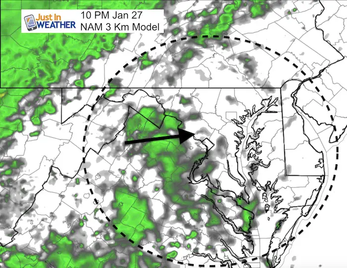
Rain Timeline
Saturday Night
The first showers will arrive tonight.
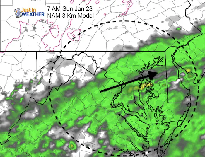
Sunday Morning
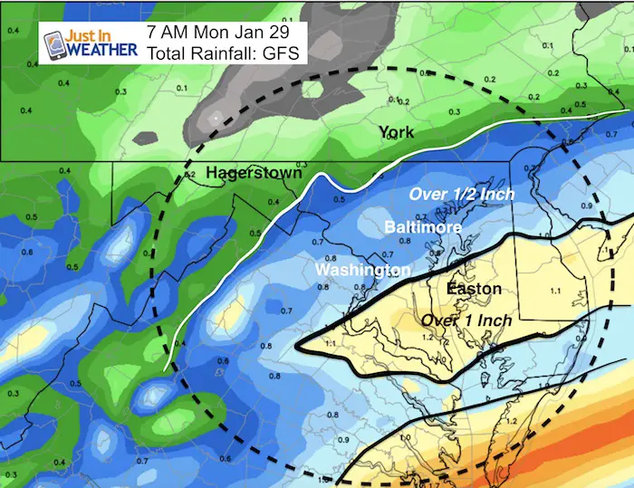
The system is showing signs of moving through Baltimore and stalling nearby. The rain may end in the morning north of Baltimore but linger all day near the city/I-95 and the rest of Maryland/Delmarva.
Sunday Night
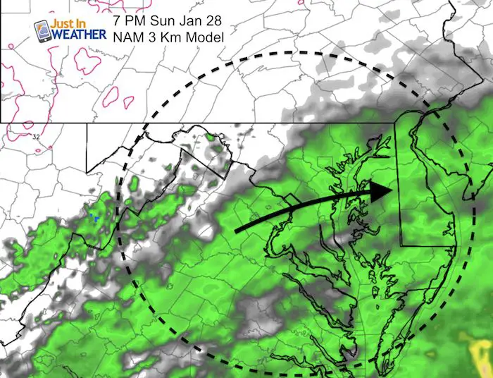
Rain Totals
This plot helps shows where the rain will likely last most of Sunday…
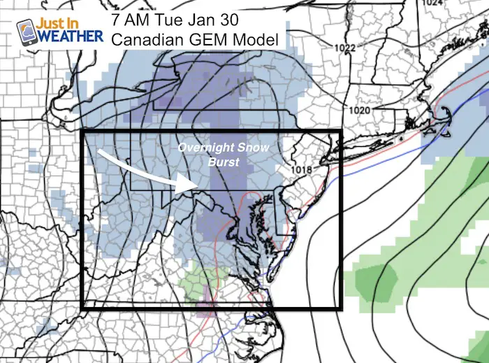
Snow Next Week?
Monday Night-Tuesday Morning
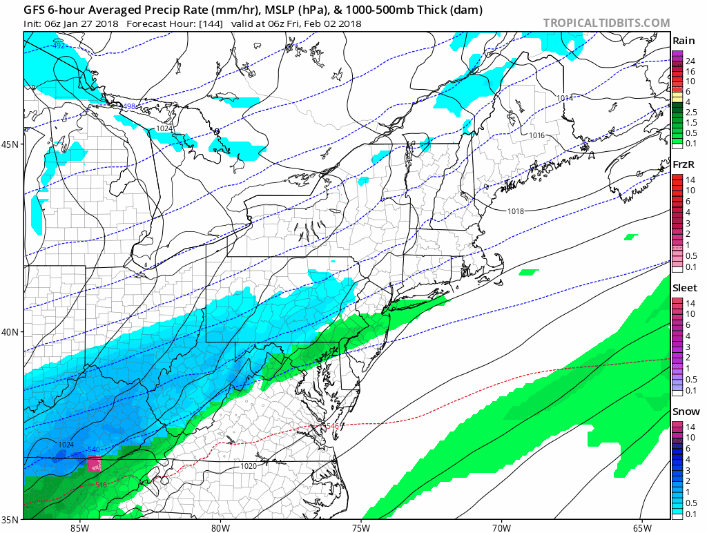
Groundhog Day Storm
GFS Model
This shows light rain to snow Friday morning… But the amounts will be light…
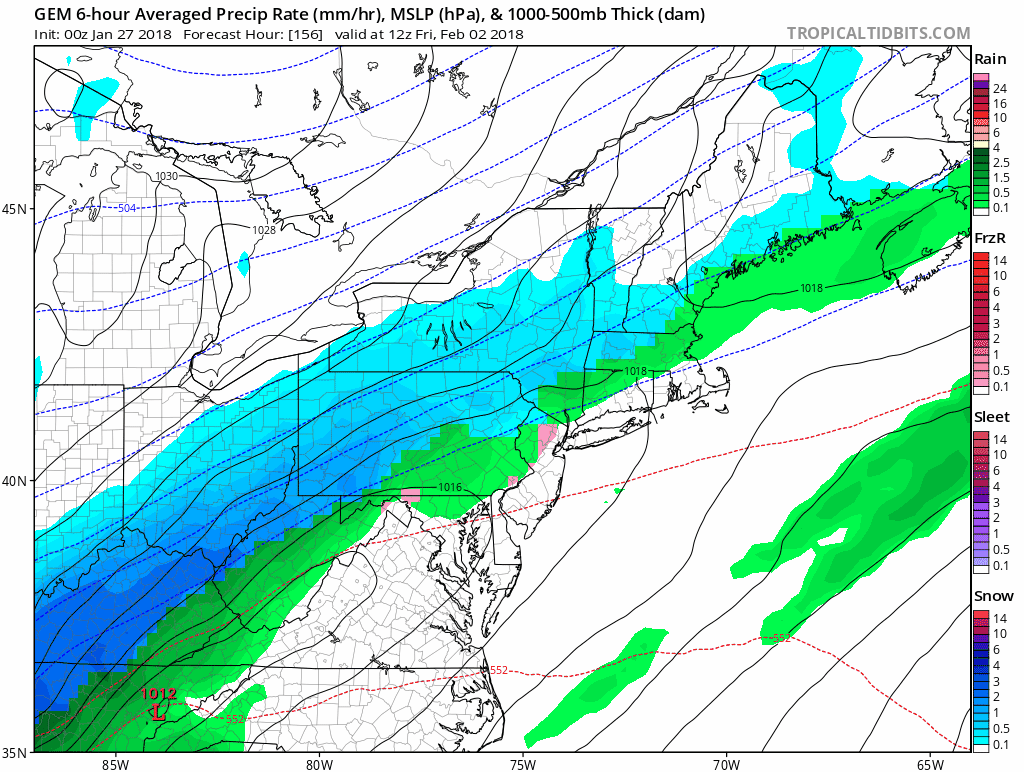
Canadian GEM Model
This shows a larger event with heavier snow amounts…. Still too early to pin down how much. But the timing supports rain turning to snow mid day and afternoon on Friday.
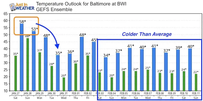
Temperature Trend
Please note:
- This weekend will be mild
- Monday and Friday will both has falling temperatures during the day
- February: When the model shows near normal conditions, it does not have a clear signal how cold the air mass wil be. I see a colder trend into Mid February .
FITF Gear

Please share your thoughts, best weather pics/video, or just keep in touch via social media
-
Facebook: Justin Berk, Meteorologist
-
Twitter: @JustinWeather
-
Instagram: justinweather
Snowstix- We Need You To Measure Snow Too
We are giving 10% of each sale to programs that benefit pediatric oncology patients.

 Get the award winning Kid Weather App I made with my oldest son and support our love for science, weather, and technology. Our 3 year anniversary of the release and our contribution to STEM education is this November. It has been downloaded in 60 countries, and works in both temperature scales. With your support we can expand on the fun introduction to science and real weather.
Keep In Touch All Winter
Click here to sign up for email alerts…. Just in case you don’t get the post on your social media feed
Also See:
My Winter Outlook 2017-2018 for more snow
La Nina Formed: What it could mean to our winter
NOAA Winter Outlook: Not The Best But Not The Worst For Snow
Two Farmers Almanacs Winter 2018 Outlooks
Winter Weather Folkore: Suggestions from Animals and Crops
First Frost and Freeze Dates For Maryland (southern PA and northern VA)
My Preliminary Winter Outlook Notes
Low Snow Winters In Baltimore: To Repeat Or Not Repeat
NOAA Ranks Blizzard 2016 4th Worst Snowstorm On Record