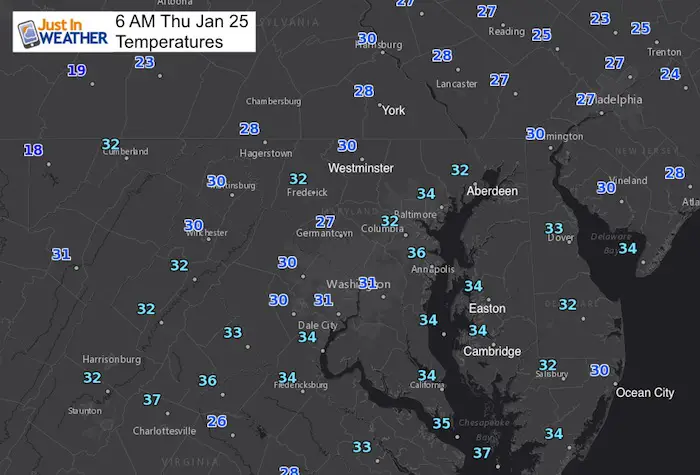
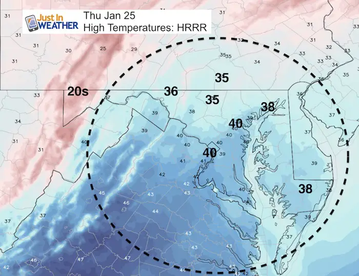
 Thursday January 25
A few flurries reached us overnight, but as the winds ease we will aim for more sun today. Temperatures will be cold and trend warming this weekend with the next storm brining us rain. The pivotal event will be next week with a storm on Groundhog Day (Friday) that may start with rain and end as snow. This will mark the pattern change back to below average temperatures into mid February. Here’s the quick breakdown.
Historical notes today
- The first day of the year we climatologically warm one degree.
- The 3rd day of a heat wave in 1967 all reaching the 70s in Baltimore
- The anniversary of the ‘surprise’ snowstorm in 2000 that brought 14 to 18 inches of snow across Baltimore. We only had 3 winer events that year all within a 10 day period.
Stats For January 25
Normal High: 42ºF
Record High: 75ºF in 1967
Normal Low: 24ºF
*Former Record Low: 0ºF in 1897
Snow Record: 14.9″ in 2000
Seasonal Snow To Date (at BWI): 6.5″
Sunrise: 7:19 AM
Sunset 5:17 PM
*Daylight = 1:50 longer than yesterday
*Bay Water Temperature = 34ºF at Thomas Pt. Light House
Keep In Touch All Winter
Click here to sign up for email alerts…. Just in case you don’t get the post on your social media feed
Today:
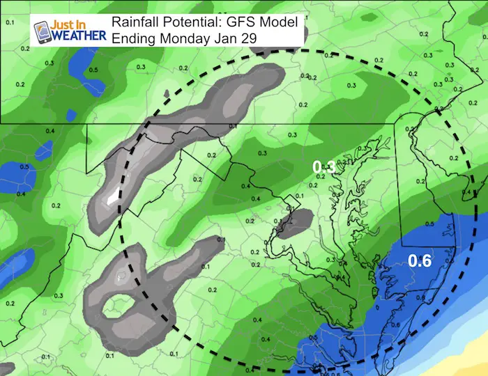
Sunday Rain
This is not s heavy event, but will be a wet day…
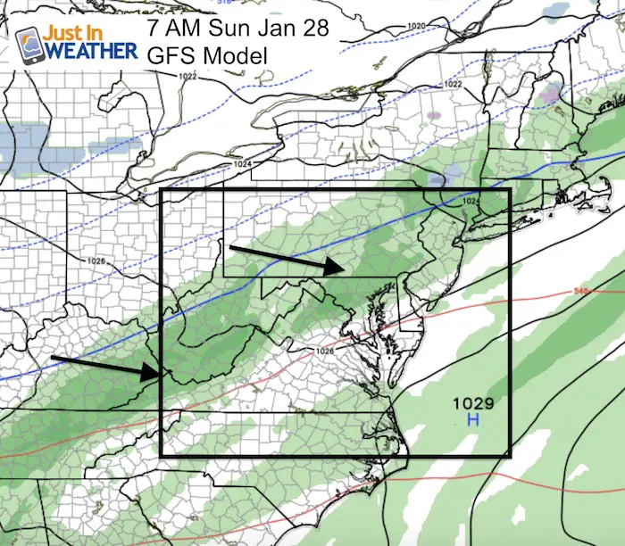
Rain Totals
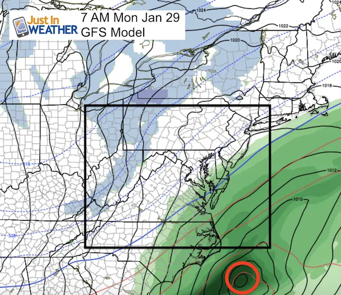
Monday Evening Flurries/Snow Showers
There will be a disturbance that follows with flurries or snow showers. This does not look like a travel issue.
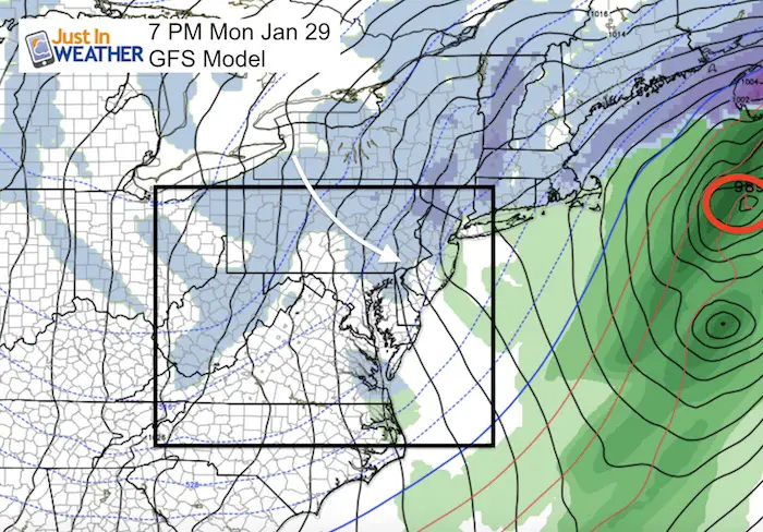
Outlook
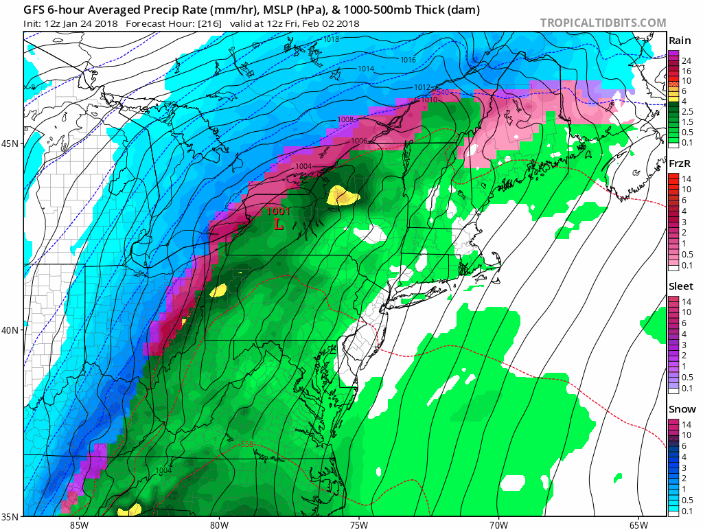
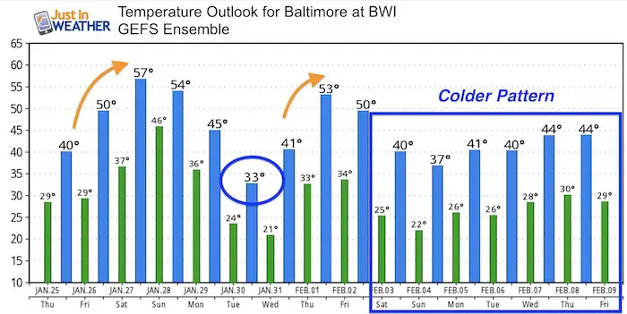
Groundhog Day Storm And Week That Follows
Regardless of what Phil days, early February looks more like winter. This event should start as rain and turn to snow next Friday. I would not put too much weight in specifics of systems that follow, just the trend there there are some other events that will try to swing our way with the cold air in place. It is WAY TOO EARLY to lock in on intensity air track of storms that have not formed yet. The pattern is trending in the snow favor though.
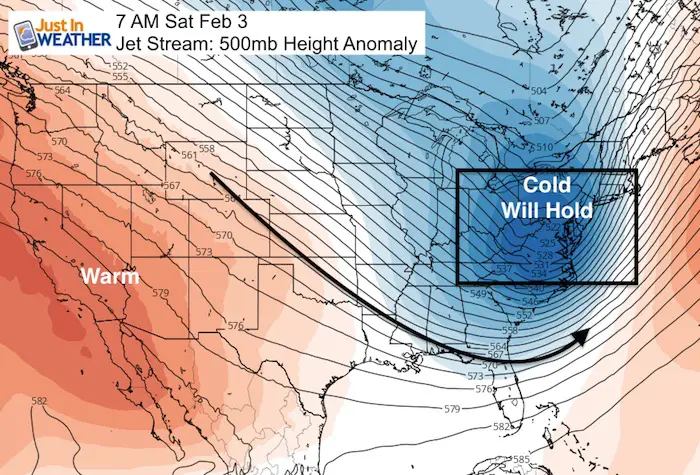
Jet Stream
The jet stream will be shifting back to the colder pattern for the first week (or longer) in to February)
Temperatures
May The Flakes Be With You- Limited Edition Shirt
A Portion of the proceeds will go to Integrated Wellness programs for Pediatric Oncology Patients

FITF Gear

Please share your thoughts, best weather pics/video, or just keep in touch via social media
-
Facebook: Justin Berk, Meteorologist
-
Twitter: @JustinWeather
-
Instagram: justinweather
Snowstix- We Need You To Measure Snow Too
We are giving 10% of each sale to programs that benefit pediatric oncology patients.

 Get the award winning Kid Weather App I made with my oldest son and support our love for science, weather, and technology. Our 3 year anniversary of the release and our contribution to STEM education is this November. It has been downloaded in 60 countries, and works in both temperature scales. With your support we can expand on the fun introduction to science and real weather.
Keep In Touch All Winter
Click here to sign up for email alerts…. Just in case you don’t get the post on your social media feed
Also See:
My Winter Outlook 2017-2018 for more snow
La Nina Formed: What it could mean to our winter
NOAA Winter Outlook: Not The Best But Not The Worst For Snow
Two Farmers Almanacs Winter 2018 Outlooks
Winter Weather Folkore: Suggestions from Animals and Crops
First Frost and Freeze Dates For Maryland (southern PA and northern VA)
My Preliminary Winter Outlook Notes
Low Snow Winters In Baltimore: To Repeat Or Not Repeat
NOAA Ranks Blizzard 2016 4th Worst Snowstorm On Record
Blizzard 2016 Record Top Snowstorm: Area Totals
Extreme Weather of 2015 balanced out on both ends